116 m away
Top of the World via Whyte Bowl
Enjoy some of the finest views at Sun Peaks and explore some wild-feeling terrain.
Difficult Hiking
- Distance
- 5.9 km
- Ascent
- 287 m
- Descent
- 287 m
The easiest hike from Sunburst Express - this is as straightforward and relaxing as it gets!
Hiking Moderate

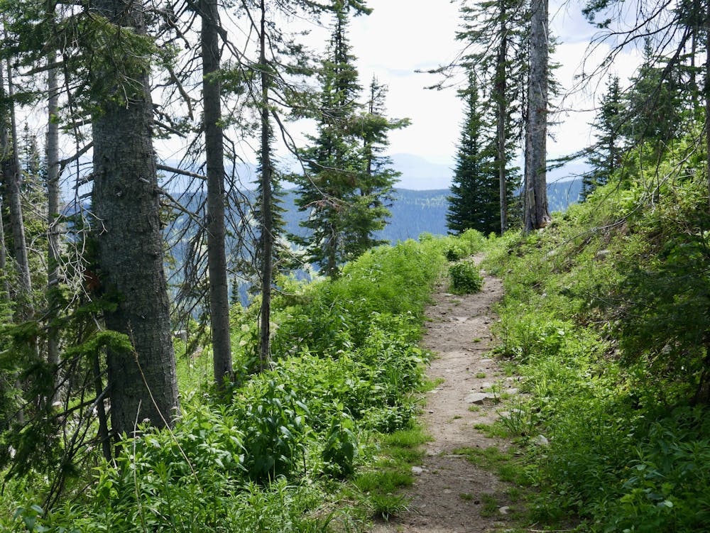
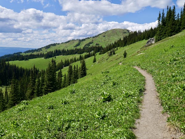
Given how scenic and remote this route feels, reaching it easily from a chairlift almost feels like cheating! As soon as you start hiking you'll find yourself in peaceful forests, seemingly a million miles from the buzz and chatter which surrounds the top of the Sunburst Express chairlift.
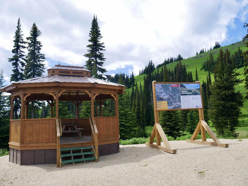
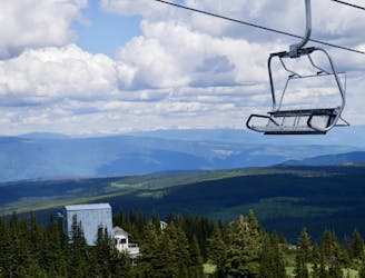
Having ridden the chairlift up, wander over to the small wooden hut and sign board explaining where the various hikes in these parts go. There's a maze of trails but most of them link together quite logically, so combining a few is easy enough. We'll describe this trail on its own here (as its such a popular easy hike) but combing it with Crystal Bowl Loop and Top of the World would be a simple and logical way of seeing some wonderful scenery.
Vista itself is low angled and easy underfoot - you should be able to hike this trail in sneakers, and no prior hiking experience is required. The trail isn't completely pancake smooth, but there's nothing that could even remotely be described as an obstacle! On the rare occasions that the trail crosses little creeks or hollows there are wooden bridges to enable safe and easy passage.
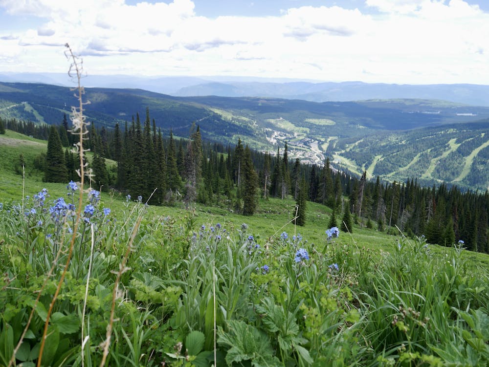
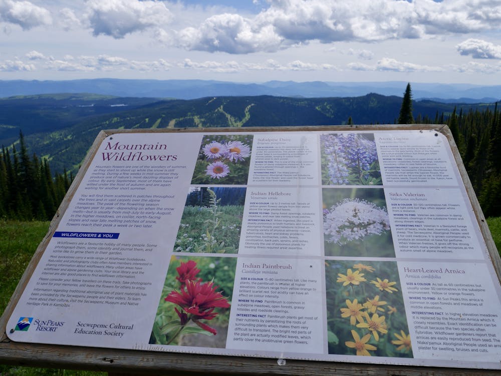
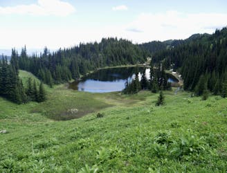
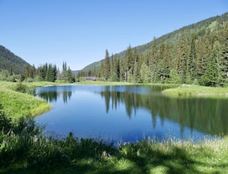
The key feature of the hike is the views it offers (hence the name). By hiking it you'll get vistas across Sun Peaks village and across to McGillivray and Morrissey Lakes, and you should (on a clear day) also be able to pick out the famous snowy summits of the Monashees in the distance. The wild flowers are spectacular too.
One thing to note is that this trail takes you into bear country, so be prepared with a bear spray and don't let the easy access fool you into thinking that you don't need to keep an eye out for unwanted company!
Moderate
Hiking along trails with some uneven terrain and small hills. Small rocks and roots may be present.

The path is on completely flat land and potential injury is limited to falling over.

Away from help but easily accessed.
116 m away
Enjoy some of the finest views at Sun Peaks and explore some wild-feeling terrain.
Difficult Hiking
121 m away
Climb the most famous summit in these parts and enjoy some wild terrain in the process!
Difficult Hiking
2.6 km away
A lovely stroll which is suitable for the whole family
Easy Hiking
4 routes · Hiking