1.3 km away
Pioneer -> Fizzy Pop -> Dog Beach Figure-8
This diverse group of trails offers a fun and easily-accessible Pemberton ride.
Severe Mountain Biking
- Distance
- 6.3 km
- Ascent
- 261 m
- Descent
- 261 m
This rugged ride is short but sweet!
Mountain Biking Severe

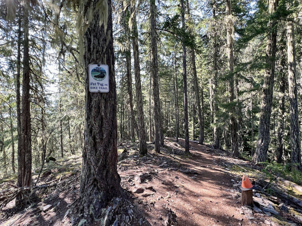
Fat Tug is a fantastic mountain bike trail that provides a much more entertaining ride than the short distance might imply. The ride begins directly from downtown Pemberton by climbing through neighborhoods before cutting through a park and then into the woods.
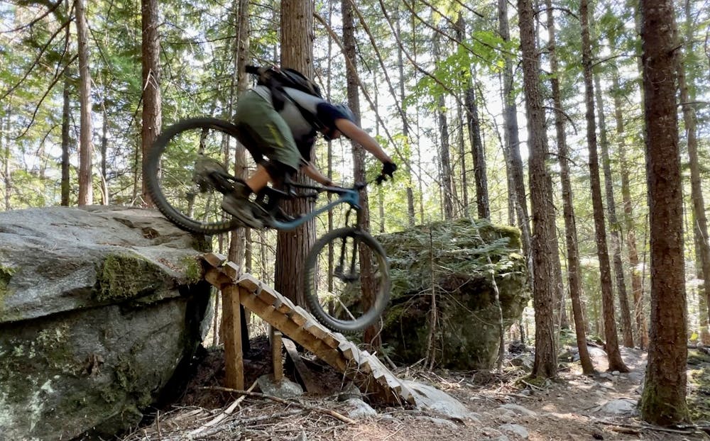
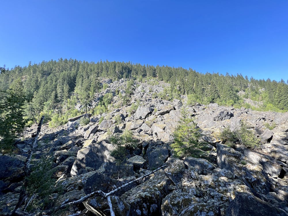
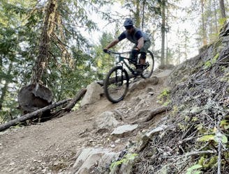
Once you enter the forest, the grade kicks up dramatically, and suddenly that short mileage begins to feel like a lot more work as you grind steeply up the mountainside. Soon, you'll leave the dirt road behind for a singletrack climbing trail that's a bit more manageable, but will force some riders to hike in spots. As you climb, you'll cross portions of the descent, and glimpses of entertaining wooden features will have you salivating for what's to come.
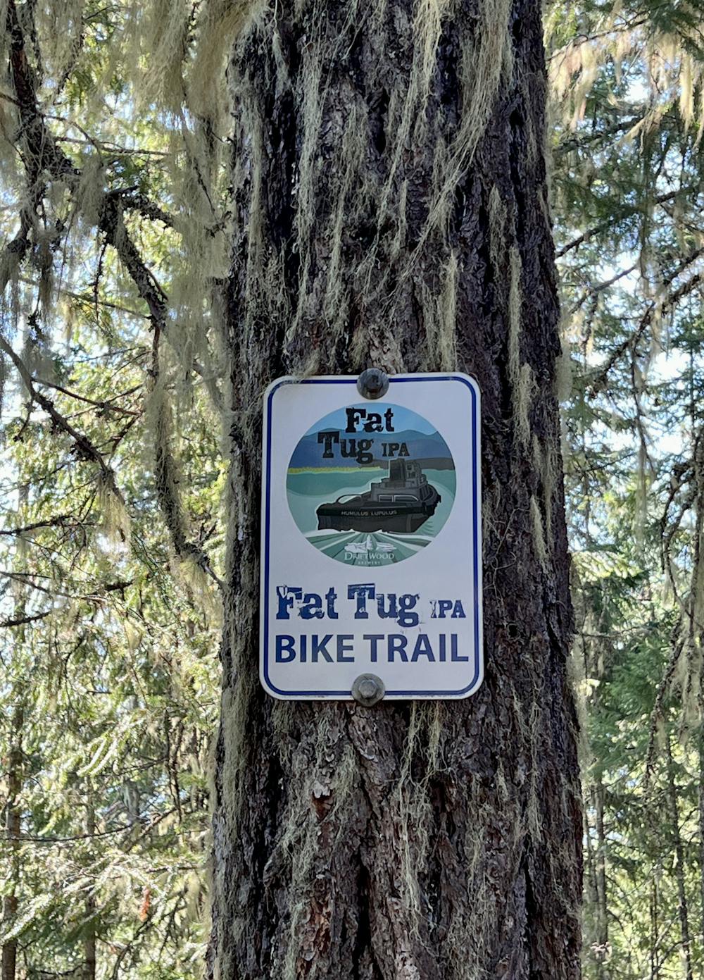
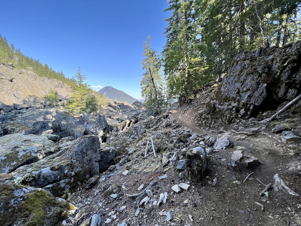
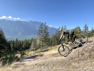
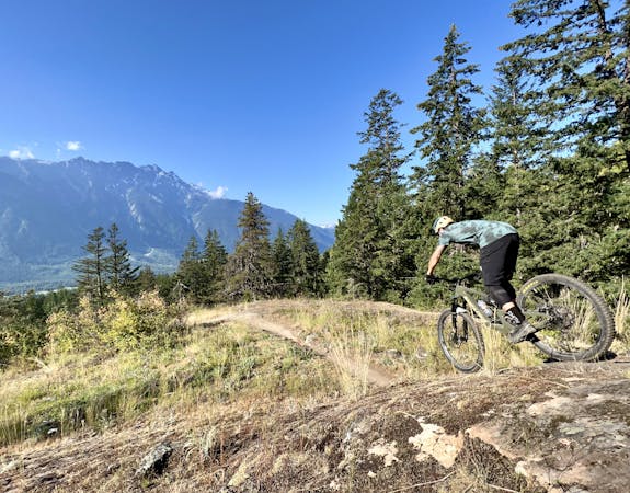
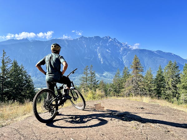
A break in the trees at the top provides glimpses of long-range views from a boulder field, but soon, it's time to descend! At a metal sign with the logo of the eponymous IPA from Driftwood Brewery in Victoria, BC, you'll drop in and begin to shred with a vengeance!
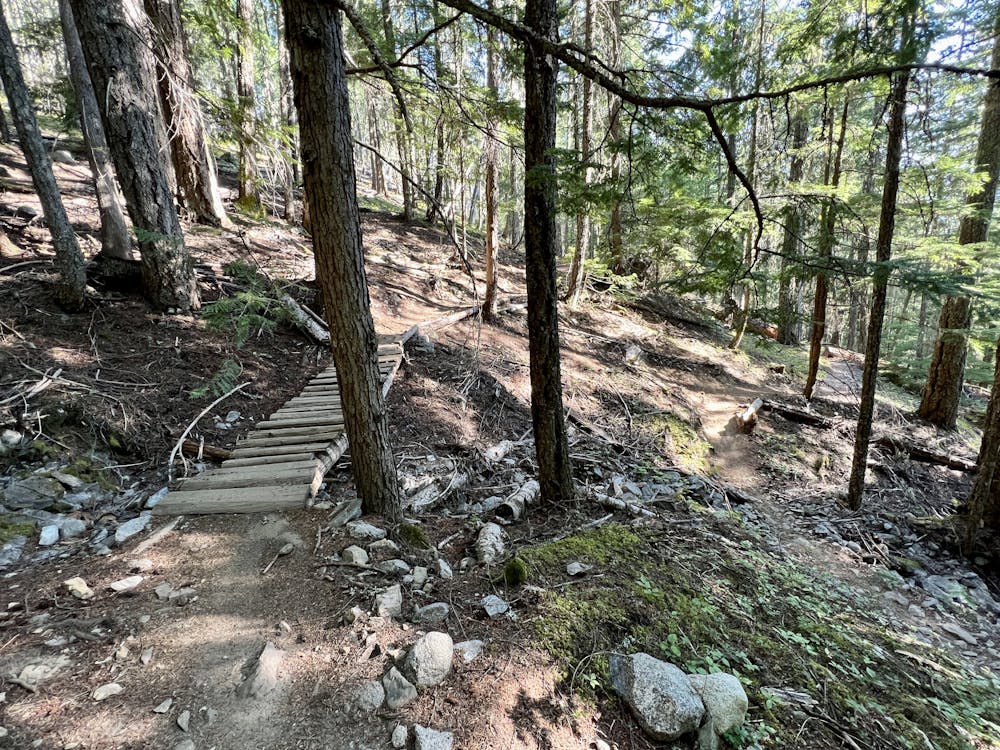
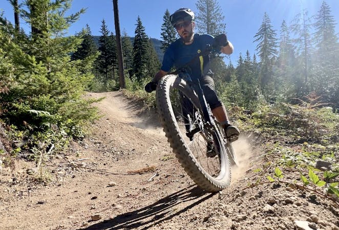
This incredibly diverse descent begins with some flowy bits that roll into smooth jumps and fast sections of trail. A few big fall-away turns provide moments of vertigo deep in the forest.
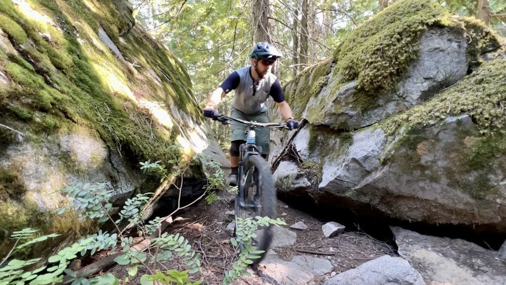
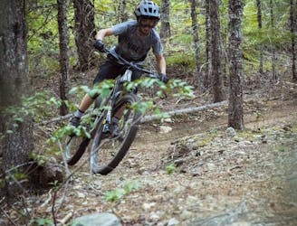
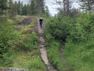
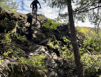
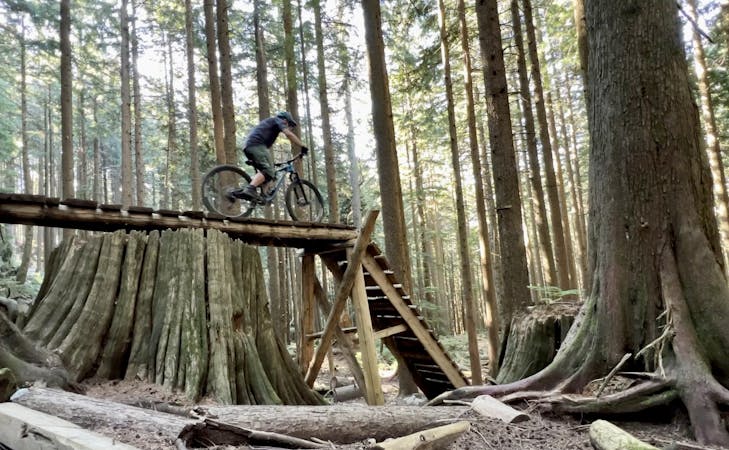
The track gets progressively rougher as you blast through rock gardens, rumble down root webs, launch off of rock drops, and hit optional technical trail features like skinnies and rollers. While there's plenty of challenge to be had here, it's all firmly in single black diamond territory.
As you descend, you'll notice many unmarked trails that cross Fat Tug. It can be easy to lose your way if you're not careful, so be sure to stick to the main track unless you feel like exploring.
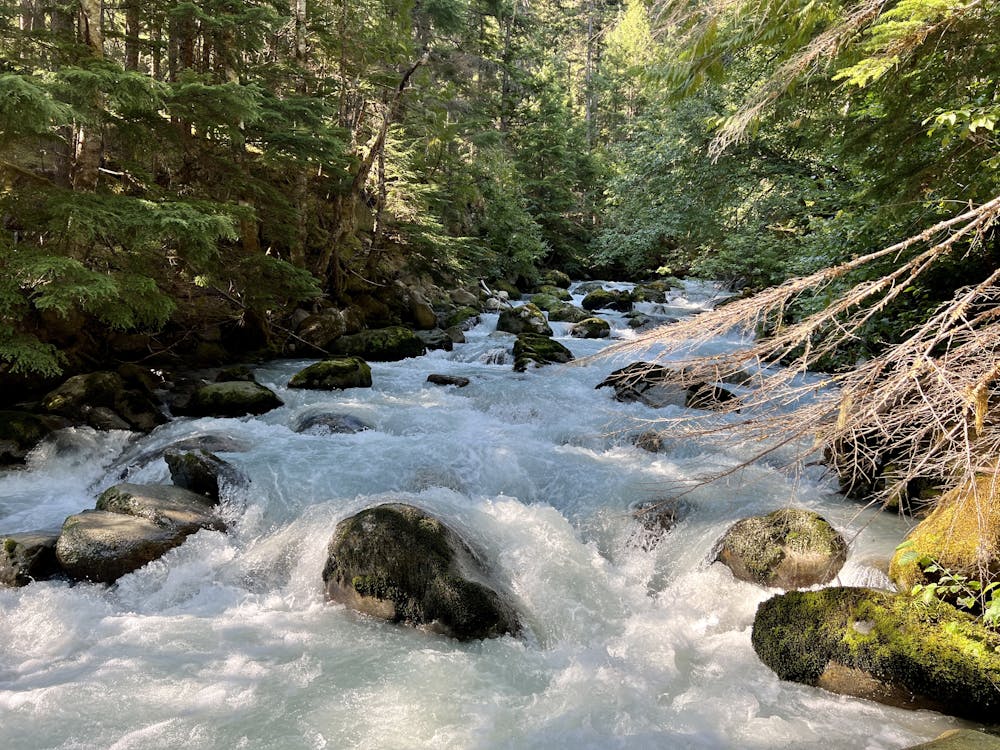
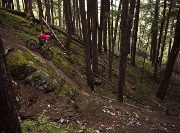
The deep, dark forest that Fat Tug flows through is uncharacteristic of the dry, rocky riding most often found in Pemberton. On this north-facing slope, you'll find beautiful black dirt, towering trees, and great traction. The descent also ends on the banks of a rushing mountain stream, with the cold air blowing off of the glacial water providing natural air conditioning on a hot day.
This is an absolute gem of a mountain bike ride and absolutely belongs on your hit list when you plan your next trip to Pemberton!
Severe
Widely variable, narrow trail tread with steeper grades and unavoidable obstacles of 15in/38cm tall or less. Obstacles may include unavoidable bridges 24in/61cm wide or less, large rocks, gravel, difficult root sections, and more. Ideal for advanced-level riders.

The trail contains some obstacles such as outcroppings and rock which could cause injury.
Away from help but easily accessed.
1.3 km away
This diverse group of trails offers a fun and easily-accessible Pemberton ride.
Severe Mountain Biking
3.4 km away
Pembys best blue trails.
Difficult Mountain Biking
3.4 km away
This remote trail almost feels like a backcountry ride!
Severe Mountain Biking
3.4 km away
A fast, flowy loop with some great jumps.
Difficult Mountain Biking
3.4 km away
A rad set of trails with some punchy climbs to access them!
Severe Mountain Biking
3.4 km away
This is a classic Pemberton trail that's absolutely filled with rock features!
Extreme Mountain Biking
3.4 km away
One of the best rock slab rips in British Columbia!
Severe Mountain Biking
3.5 km away

This remote trail in the Mackenzie network almost feels like a backcountry ride!
Severe Mountain Biking

25 routes · Mountain Biking
5 routes · Mountain Biking
7 routes · Mountain Biking
7 routes · Mountain Biking
14 routes · Mountain Biking
10 routes · Mountain Biking