Cream Puff Loop
One of the best rock slab rips in British Columbia!
Severe Mountain Biking
- Distance
- 9.1 km
- Ascent
- 368 m
- Descent
- 368 m
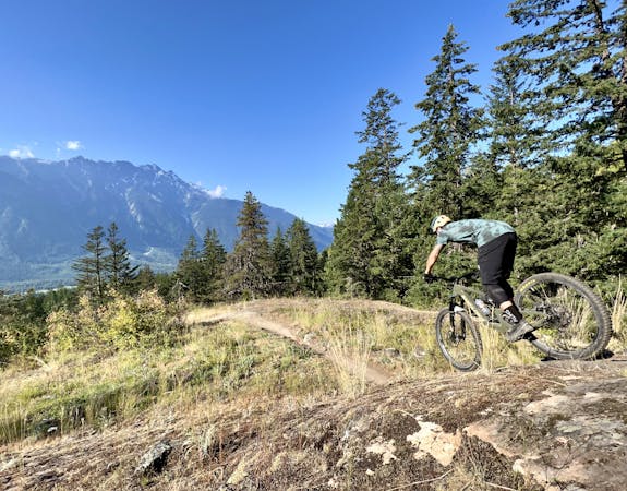
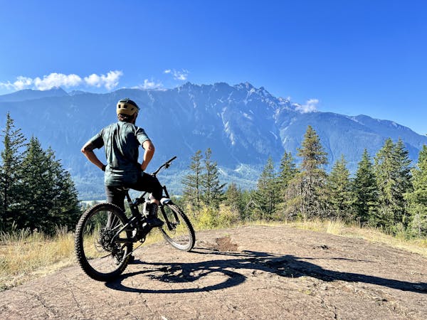
This is a classic Pemberton trail that's absolutely filled with rock features!
Mountain Biking Extreme

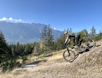
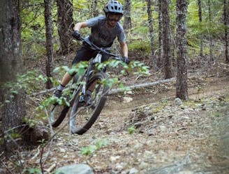
Rusty Trombone is a classic Pemberton trail that's absolutely filled with rock features! This trail can either be shuttled or pedaled as a loop—the loop option is shown here. However you get to the top of Rusty Trombone, it begins with a bit of a pedal before the descending really begins in earnest.
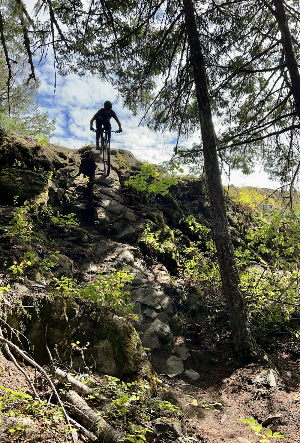
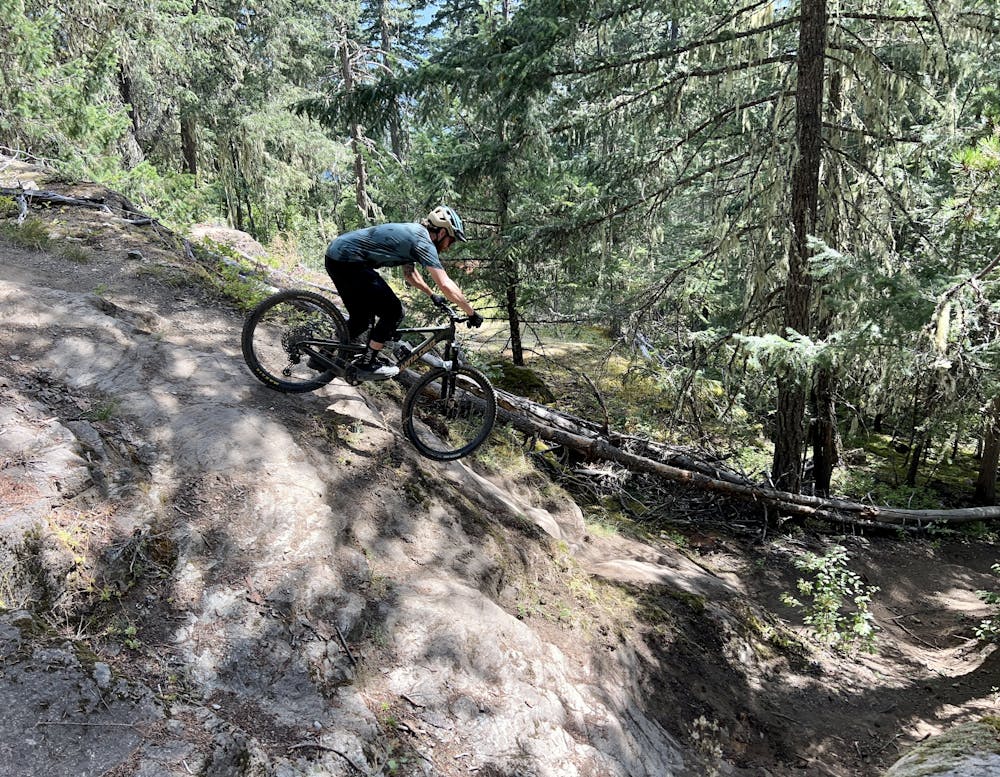
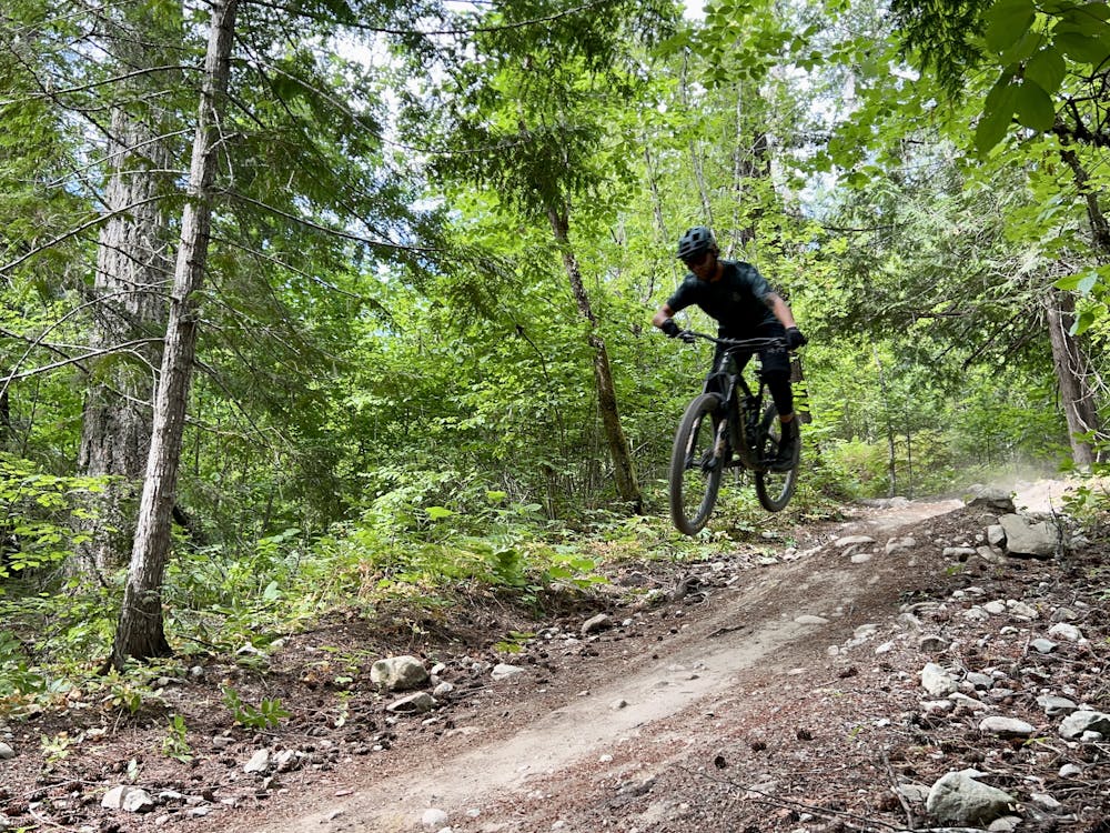
This downhill is an absolute ripper: you'll blast through a whole slew of rock features and rock gardens. Many of the rock features on this trail are either optional or offer A and B lines. Many of the A lines are easily in double black diamond territory, and the B lines are no joke, either. Be sure to scout the features before you hit them, as some of them are not clearly marked.
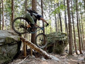
Lower down, Rusty Trombone funnels into some steep chutes that require absolute committment. During the dry summer season, these chutes fill with loose, sliding silt and are absurdly sketchy. When the trail's wet, this loose silt turns to a slick layer of mud coating the rocks and roots and is just as treacherous. You just can't win! These burly chutes combined with massive rock features earn Rusty Trombone a FATMAP Extreme rating, although most trail maps only assign it a single black diamond rating. Your mileage may vary.
It is possible to bypass the chutes on Rusty Trombone by kicking over to Overnight Sensation, but that doesn't set you up as well for the natural transition into Radio Tower.
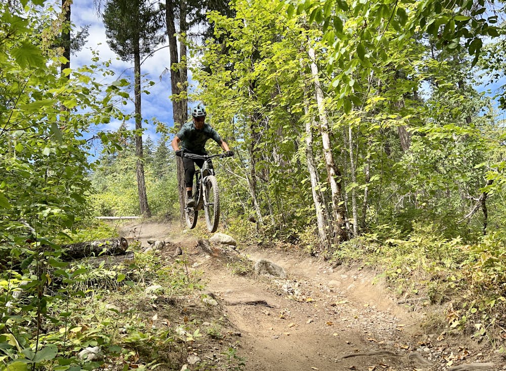
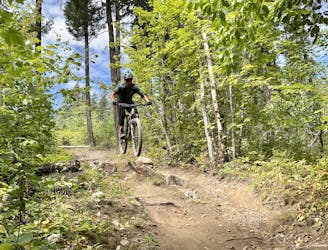
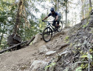
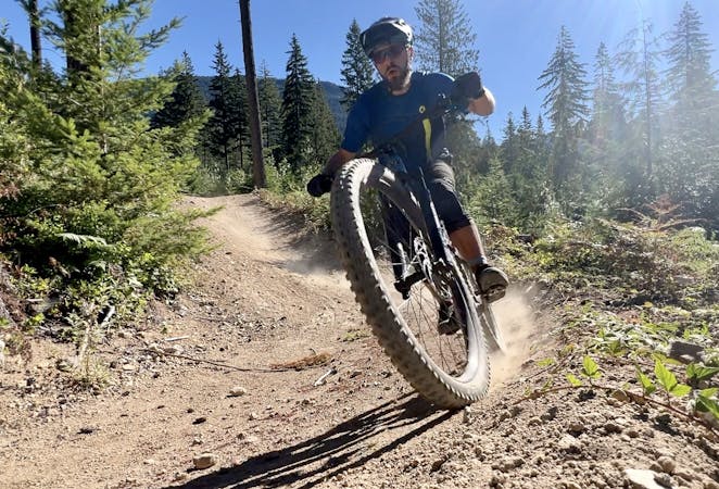
Radio Tower is a fairly fast, flowy trail with a couple of fun jumps and berms. Only in Pemberton does Radio Tower count as an easy flow trail—there are still plenty of rocks and chunk mixed into the trail tread!
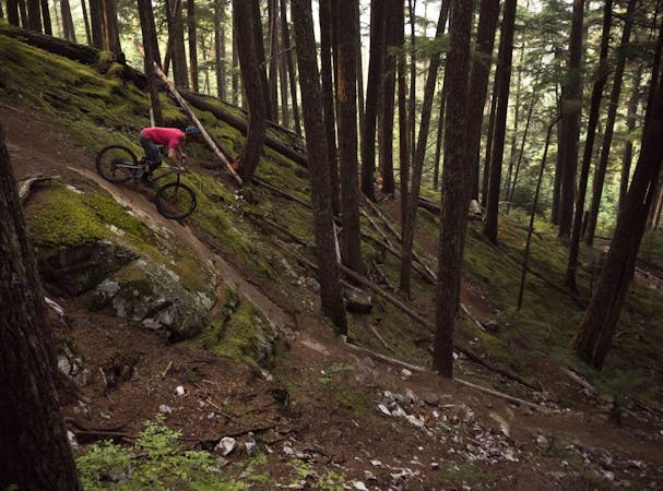
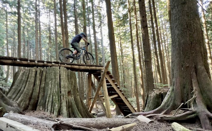
Connect into Crosstown Traffic, and then take the left turn to finish on Crosstown Jumps. Crosstown Jumps is a fun, flowy trail that, again, still has plenty of rocks, including some rock-armored berms. There are a couple of very flowy gap jumps that roll really, really well before you drop out of the trail via a steep chute to the trailhead.
Extreme
Very steep, difficult, narrow singletrack with widely variable and unpredictable trail conditions. Unavoidable obstacles could be 15in/38cm tall or greater, and unavoidable obstacles with serious consequences are likely to be present. Obstacles could include big rocks, difficult root sections, drops, jumps, sharp switchbacks, and more. Ideal for expert-level riders.

Some trail sections have exposed ledges or steep ascents/descents where falling could cause serious injury.

Away from help but easily accessed.
One of the best rock slab rips in British Columbia!
Severe Mountain Biking
1 m away
This remote trail almost feels like a backcountry ride!
Severe Mountain Biking
2 m away
A rad set of trails with some punchy climbs to access them!
Severe Mountain Biking
2 m away
A fast, flowy loop with some great jumps.
Difficult Mountain Biking
8 m away
Pembys best blue trails.
Difficult Mountain Biking
3.4 km away
This rugged ride is short but sweet!
Severe Mountain Biking
3.7 km away
This diverse group of trails offers a fun and easily-accessible Pemberton ride.
Severe Mountain Biking
4.2 km away

This remote trail in the Mackenzie network almost feels like a backcountry ride!
Severe Mountain Biking

25 routes · Mountain Biking
5 routes · Mountain Biking
7 routes · Mountain Biking
7 routes · Mountain Biking
14 routes · Mountain Biking
10 routes · Mountain Biking