7 m away
Balu Pass Ski Touring
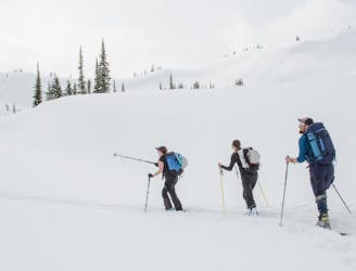
Simple Touring but Complex Terrain In Rogers Pass
Moderate Ski Touring
- Distance
- 13 km
- Ascent
- 1.1 km
- Descent
- 1.1 km
A 700-meter north-facing couloir from the Cheops West Ridge
Ski Touring Severe
For a deeper dive into the route and some detailed terrain photos, check out the post on Beyond Our Peak: https://beyondourpeak.com/sts-couloir-rogers-pass-an-absolute-beast/
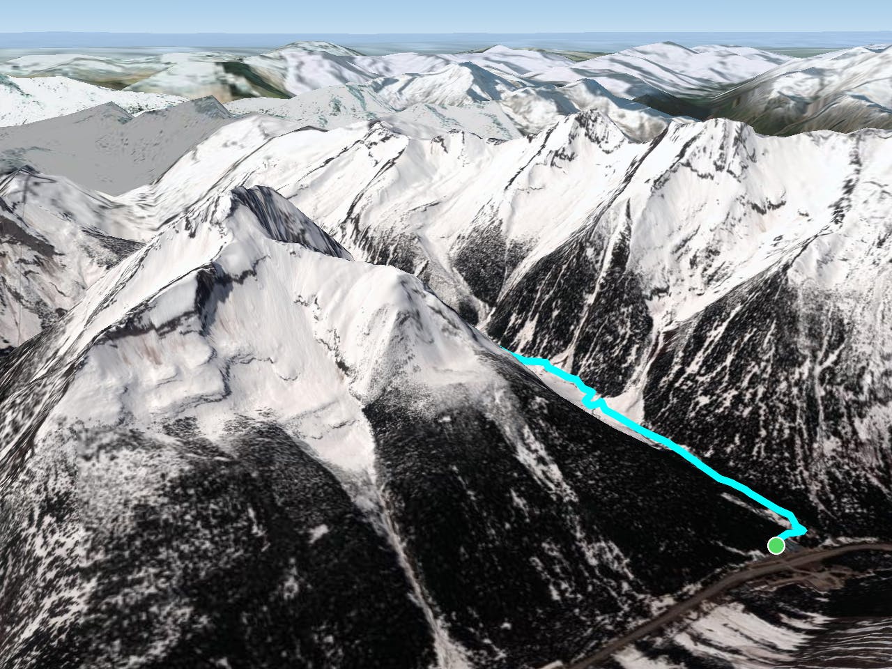
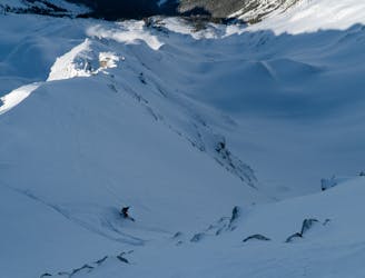
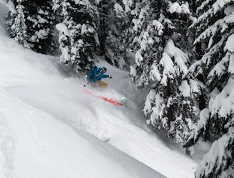
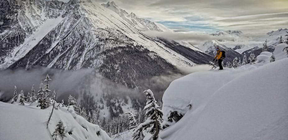
STS Couloir is an absolute beast of a run… and a notorious one at that. Nestled in the north face of Cheops Mountain (2581m) near the headwaters of Connaught Creek, the route offers 700 meters of epic north-facing couloir skiing with an average slope angle of 45 degrees. As a matter of fact, it’s one of Rogers Pass’ more popular ski-mountaineering routes, requiring a short rappel to get through the large overhanging cornices looming over the entrance. Even by the Pass’ standards, that’s a hell of a run. As for the name itself, STS couloir, originally Cheops North 4 avalanche path, was renamed after the Strathcona Tweedsmuir School avalanche incident – I’ll let you dig more into that subject on your own.
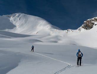
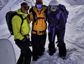
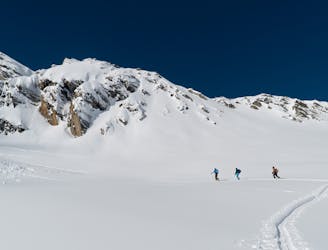
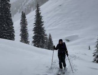
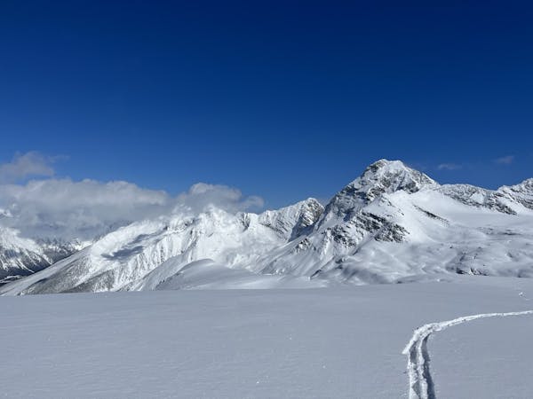
The route takes you through the imposing Connaught Valley all the way to Balu Pass, a popular ski touring area. As I’ve mentioned many times in previous articles, travelling through this valley exposes you to seriously hazardous avalanche paths that require careful consideration before crossing. Keep that in mind while you’re passing through. Once you've gained the mellow slopes of Balu Pass, first enjoy the wonderful views of the Ursus Major South Bowl and the Cougar Valley to the west, then veer to the south towards the Cheops West Ridge, a long-winding, rocky ridge to the top of Cheops Mountain. It's usually windswept and icy, requiring a carefully planned uptrack. You'll soon pass the entrance to the Cheops North Bowl. Continue onwards, up the ridge, to the entrance of STS Couloir. There you'll find a few trees with some old cordelette strung around them. Those are old rappel anchors. Looking ahead, you'll have a birds eye view of the solar aspects of the Connaught Valley, the popular Video Peak, 8812 Peak and Ursus Minor Mountain.
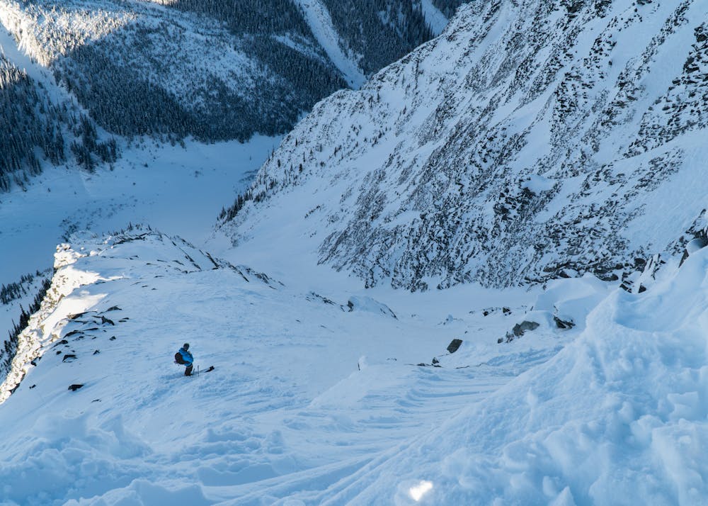
Earlier in the season when the cornices are still quite small, it’s possible to hop into the line without rappeling. However, as the cornices grow, a 5-10m rappel is absolutely necessary to enter the 45+ degree slope. Careful cornice assessment (while on belay ideally) is a must here as you’ll be exposed to them during your entire descent.
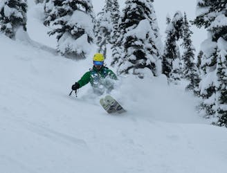
STS Couloir is steep, averaging 40-45 degrees the whole way down with two steep rocky walls on both sides. The left side tends to harbour some dangerous wind slabs while the right side exposes you to rockfall. Thankfully, it's pretty wide until the very end where it chokes up. Slow down at that point and you'll be fine.
Severe
Steep skiing at 38-45 degrees. This requires very good technique and the risk of falling has serious consequences.

As well as the slope itself, there are some obstacles (such as rock outcrops) which could aggravate injury.
Away from help but easily accessed.
7 m away
Simple Touring but Complex Terrain In Rogers Pass
Moderate Ski Touring
20 m away
Pillow-y tree skiing along the western shoulder of Grizzly Mountain
Moderate Ski Touring
21 m away
An absolutely massive face of sustained 40-50° skiing that lasts for more than 400m
Severe Ski Touring
22 m away
A mellow but exposed walk up the Connaught Valley
Moderate Ski Touring
22 m away
A steep descent into the lesser-known Ursus Valley and the Bruins Glacier
Difficult Ski Touring
22 m away
A pillowy goldmine of a run with more than 1000m of powdery falline descent
Difficult Ski Touring
22 m away
A naturally gladed, easily-accessible skier's paradise on the Grizzly Shoulder
Moderate Ski Touring
32 m away
Easy to moderate ski tour with a summit & 1500m ski descent.
Moderate Ski Touring
87 m away
A true Rogers Pass classic
Difficult Ski Touring
90 m away
Classic treeskiing in Connaught Creek
Moderate Ski Touring
7 routes · Ski Touring
28 routes · Freeride Skiing · Ski Touring