1.4 km away
Vormaine Gullies

A series of gullies offering great skiing with a lot of variety and options, all easily accessed from a lift.
Difficult Freeride Skiing
- Distance
- 2.3 km
- Ascent
- 5 m
- Descent
- 594 m
A superb, serious couloir that features a hazardous entrance and requires a comprehensive experience in the Vormaine area.
Also in Valais, Switzerland
Freeride Skiing Severe

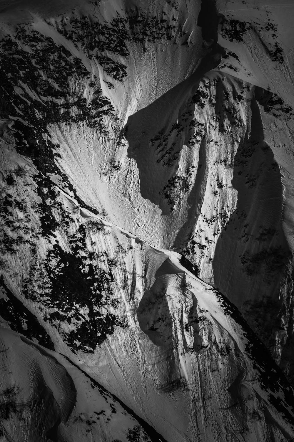
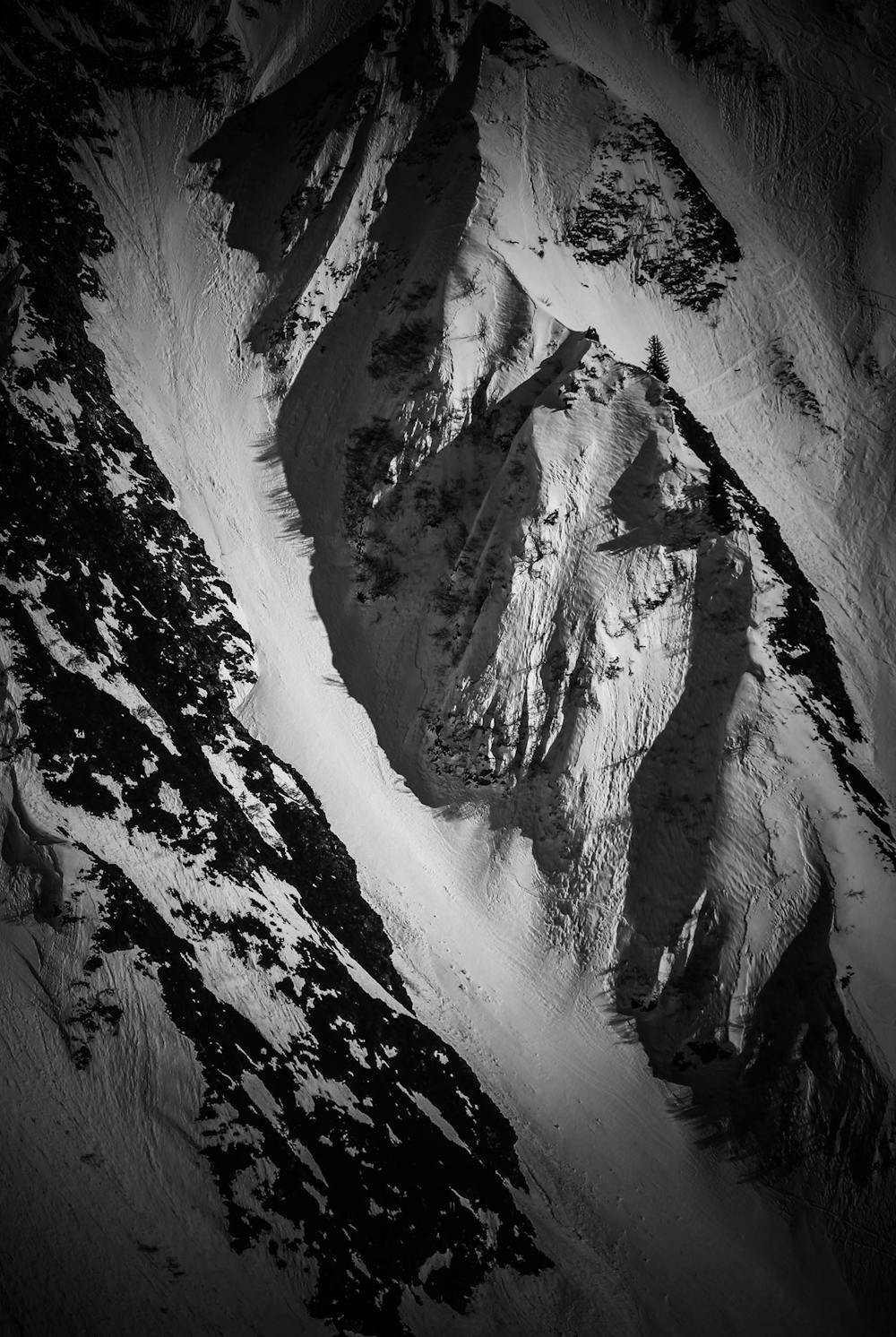
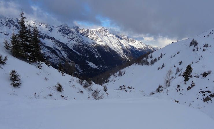
From the top station of Les Autannes chairlift ski in the direction of the Vormaine area, continue bootpacking or skinning up towards the obvious arch-shaped cornice. Keep reasonable distance away from the chutes. Entrance to the couloir is hazardous and committing. See the line at the top right corner of the photo. There are two focal points: First, you must find the right spot in the west to the couloir to drop into the slope before you reach the arch-shaped cornice. Approach the edge with the utmost care. Second, you have to do an exposed traverse. Bear in mind that it is uneasy to get back, depending on the conditions your retreat might require use of an ice axe and crampons. The upper part of the gully is a 45-degree avalanche prone slope with short sections of 50 degrees; it is necessary to know how to manage your sloughs. Lower section can be icy; your speed has to be kept in check. After you exit the couloir, descend Combe de Vormaine to the ski resort.
Severe
Steep skiing at 38-45 degrees. This requires very good technique and the risk of falling has serious consequences.

In case of a fall, death is highly likely.
Little chance of being seen or helped in case of an accident.
1.4 km away
A series of gullies offering great skiing with a lot of variety and options, all easily accessed from a lift.
Difficult Freeride Skiing
1.9 km away

A real treat with easy access, varied terrain and descent options.
Difficult Freeride Skiing
2.1 km away

A real adventure as you traverse and ski fantastic terrain all the way to the valley floor.
Difficult Freeride Skiing
2.1 km away
Long consistent, but serious couloirs offer amazing skiing.
Severe Freeride Skiing
2.4 km away

A wide open face offering good skiing far from the crowds.
Difficult Freeride Skiing
2.5 km away

This run offers great off piste skiing in relatively gentle undulating terrain.
Difficult Freeride Skiing
2.7 km away
Giving 600 meters of fantastic skiing, this is worth the hike.
Severe Freeride Skiing
3.3 km away

A real adventure linking bowls and steep faces all the way to the town of Châtelard.
Difficult Freeride Skiing
3.4 km away

Steep, very serious and sustained skiing leads you to the village of Trient.
Severe Freeride Skiing
3.6 km away

A wild, steep and serious descent for experts only.
Extreme Freeride Skiing

10 routes · Freeride Skiing
10 routes · Freeride Skiing