148 m away
Mont grange la chapelle line

A long access line into an isolated area with really steep skiing skills needed.
Extreme Freeride Skiing
- Distance
- 1.6 km
- Ascent
- 2 m
- Descent
- 665 m
A half day line with a lot of hiking and some really good skiing skills required.
Freeride Skiing Extreme
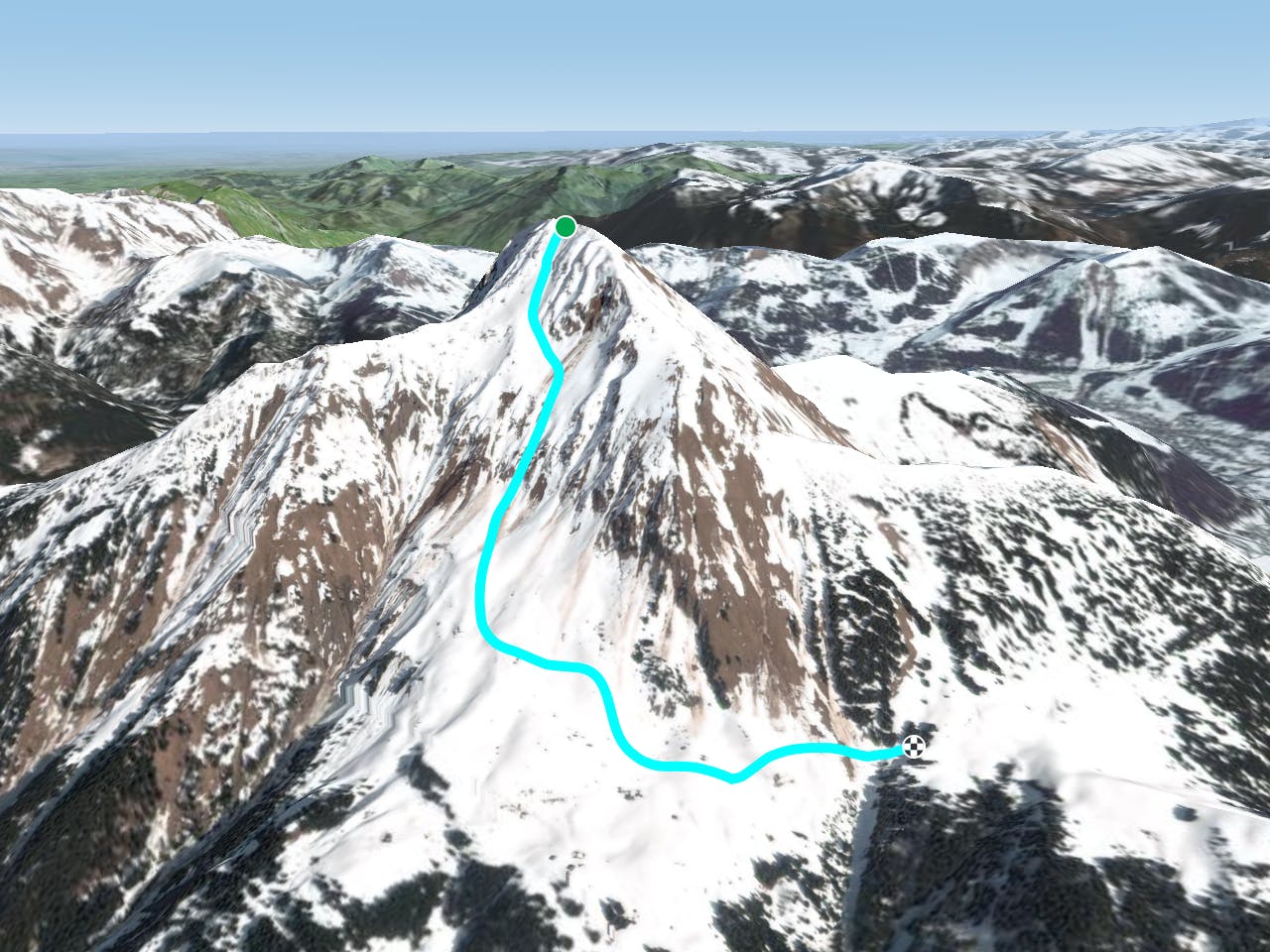
This is a long access line where a full day is needed starting from one resort to finish in another resort. From "Les Combes" ski lift follow the "Mont Grange Sunny Line" which takes about a half day to a full day where skins are great time and energy saver. The line gets a lot of sun so make sure a good weather window is present and good there's good snow conditions before heading in. Avalanche risk is really high around here due the high attitude and the face exposure taking a lot of sun. The main hazard present in this line is the isolated nature of the mountain. The line finishes at "Plagne to Plaine Dranse line." which leads back to Pré-la-Joux area in Chatel after some more tree skiing. Only totally expert and autonomous skiers need apply for this line.
Extreme
Extreme skiing terrain above 45 degrees. These routes are reserved for experienced experts.

In case of a fall, death is highly likely.

In the high mountains or remote conditions, all individuals must be completely autonomous in every situation.
148 m away
A long access line into an isolated area with really steep skiing skills needed.
Extreme Freeride Skiing
918 m away

A long hike access line until the summit where a really steep hike is present including a steep line into little part into an isolated area.
Extreme Freeride Skiing
1 km away

Expert line mixing hiking, steepness, trees and rocks.
Extreme Freeride Skiing
1.4 km away

From top of "Fontaines" chairlift follow "Cerf's gully line" hike until the top of the gully in your right side for about 45 minutes, to the higher peak in front of you.
Extreme Freeride Skiing
1.5 km away

A really steep and engaged line area into a short line only for expert skiers.
Extreme Freeride Skiing
1.6 km away

Easy access line and steep line close the trees.
Extreme Freeride Skiing
1.8 km away

Long walk into a steep area including a really steep line into an isolated area.
Extreme Freeride Skiing
1.8 km away

A full exploring line with steepness some hiking and climbing skills needed.
Extreme Freeride Skiing
2.1 km away
A nice shortcut below the chairlift "TS Fontaines, giving access back the to plateau of the "Crét beni".
Difficult Freeride Skiing
2.1 km away

Steep line in some forest area for only autonomous skiers.
Extreme Freeride Skiing