7.7 km away
Roc et Lac de Tavaneuse
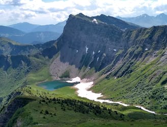
An accessible summit and lake combination.
Difficult Hiking
- Distance
- 8 km
- Ascent
- 1 km
- Descent
- 999 m
J3- Balade dans Avoriaz 07/01/2024
Hiking Easy

This is a popular hiking route which is generally considered to be easy. It's not remote, it features low exposure and is typically done in undefined. From a low point of 1.2 km to the maximum altitude of 1.9 km, the route covers 13 km, 636 vertical metres of ascent and 1289 vertical metres of descent.
Aujourd'hui c'et journée chill. Petit brunch le matin puis ballade dans al station d'Avoriaz en forêt et piste. Aucun trajet précis en tête
Easy
Walking along a well-kept trail that’s mostly flat. No obstacles are present.

The path is on completely flat land and potential injury is limited to falling over.
Close to help in case of emergency.
7.7 km away
An accessible summit and lake combination.
Difficult Hiking
7.8 km away
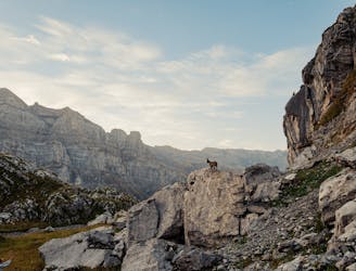
A steep and exposed hike. Beatifull panaromas
Severe Hiking
9.7 km away
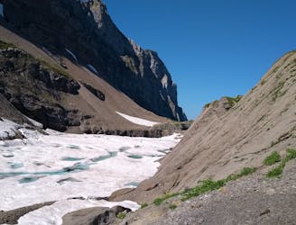
A hike beginning with easy trails and ending by scrambling to a summit.
Extreme Hiking