177 m away
Tour du Mont Blanc: Day 4 Variant
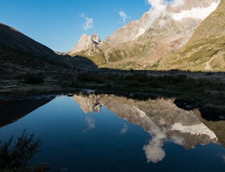
A significant addition to the day but one which rewards your efforts
Difficult Hiking
- Distance
- 13 km
- Ascent
- 552 m
- Descent
- 1.3 km
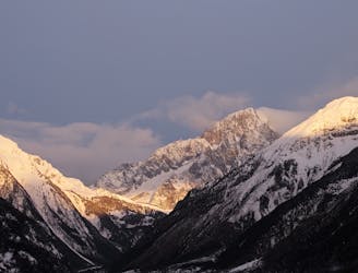
Ascesa Monte Bianco via normale dal Ghiacchiaio del Miage
Also in Aoste, Italy
Hiking Extreme

This is a popular hiking route which is generally considered to be extreme. It's very remote, it features extreme exposure and is typically done between June and September. From a low point of 2 km to the maximum altitude of 4.8 km, the route covers 13 km, 2959 vertical metres of ascent and 114 vertical metres of descent.
n
Extreme
Scrambling up mountains and along technical trails with moderate fall exposure. Handholds are necessary to navigate the trail in its entirety, although they are not necessary at all times. Some obstacles can be very large and difficult to navigate, and the grades can often be near-vertical. The challenge of the trail and the steepness of the grade results in very strenuous hiking. Hikes of this difficulty blur the lines between "hiking" and "climbing".

Some trail sections are extremely exposed where falling will almost certainly result in serious injury or death.

Little chance of being seen or helped in case of an accident.
177 m away
A significant addition to the day but one which rewards your efforts
Difficult Hiking
8.3 km away
Day 5: Although this day is more of a detour than anything, it is a wonderful one in good weather. If the weather is bad or you're pushed for time, get the bus from Courmayeur to Arp Nouva to join stage 6 and skip out this stage.
Difficult Hiking

14 routes · Hiking