1.3 km away
Tour du Mont Blanc: Les Contamines to Les Chapieux
Day 3: A long and wild day which leads to one of the most peaceful little settlements in the French Alps.
Difficult Hiking
- Distance
- 19 km
- Ascent
- 1.4 km
- Descent
- 975 m
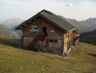
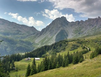
A serene glacier hike to a beautiful high mountain hut
Hiking Severe

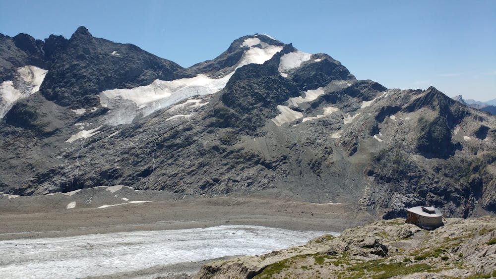
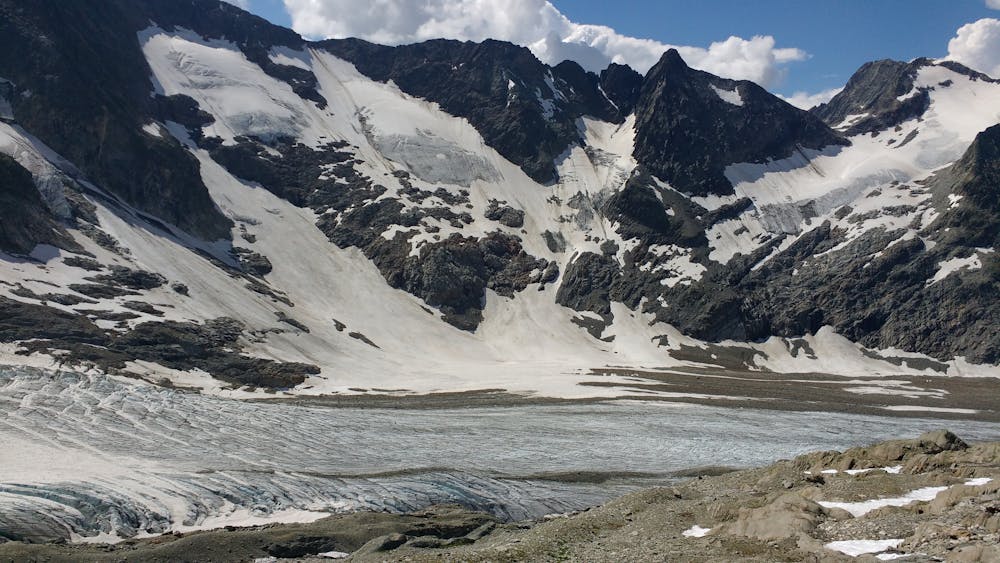
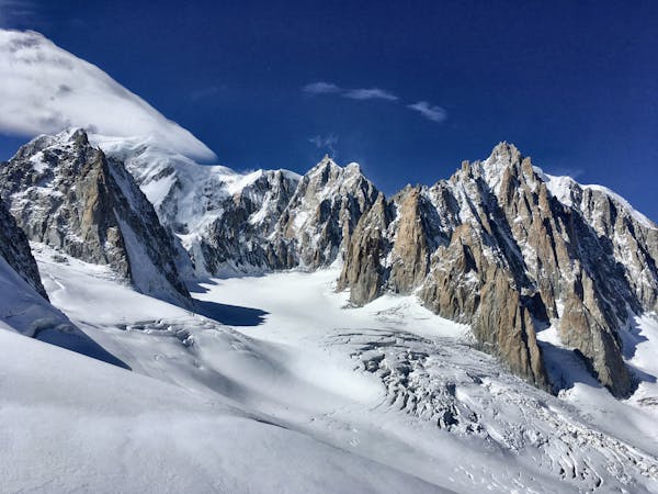
If glaciers appeal to you, but you are a bit put off by the busy climb to refuge Albert 1er, you might consider a visit to refuge des Conscrits and the Tré la Tête Glacier instead. The length of this hike keeps the crowds away, at least once you’re past refuge de Tré la Tête.
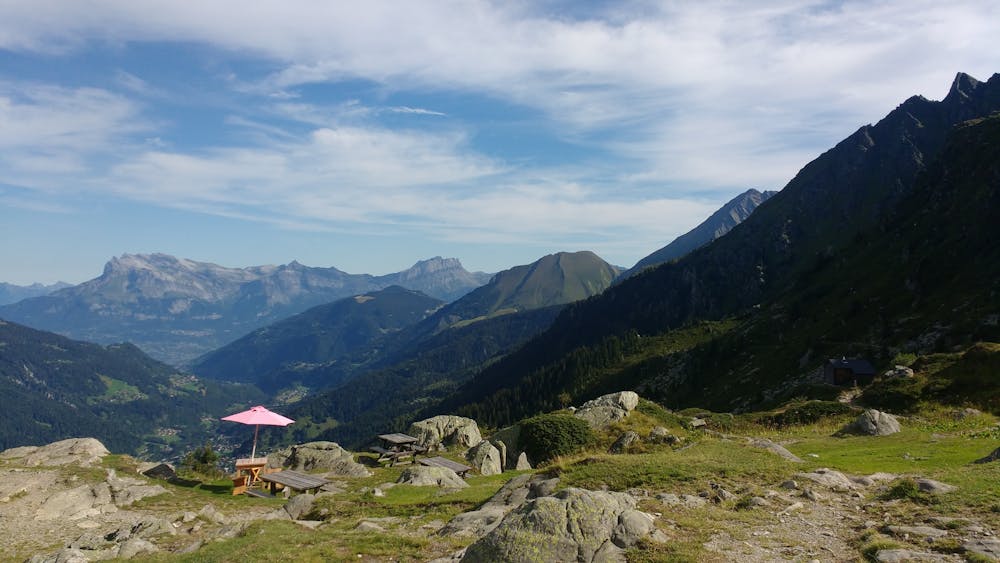
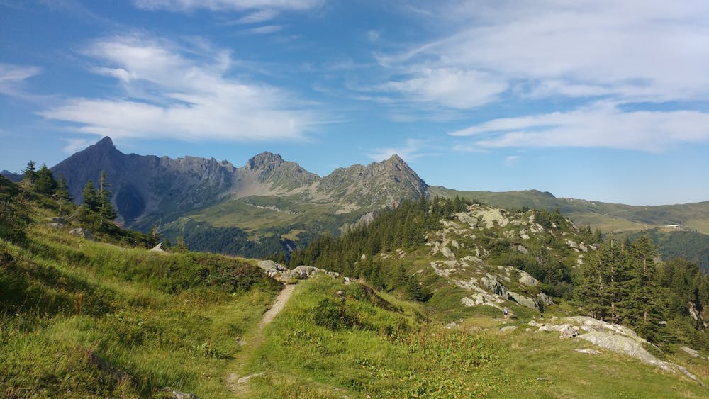
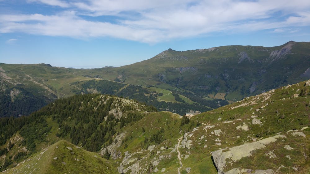
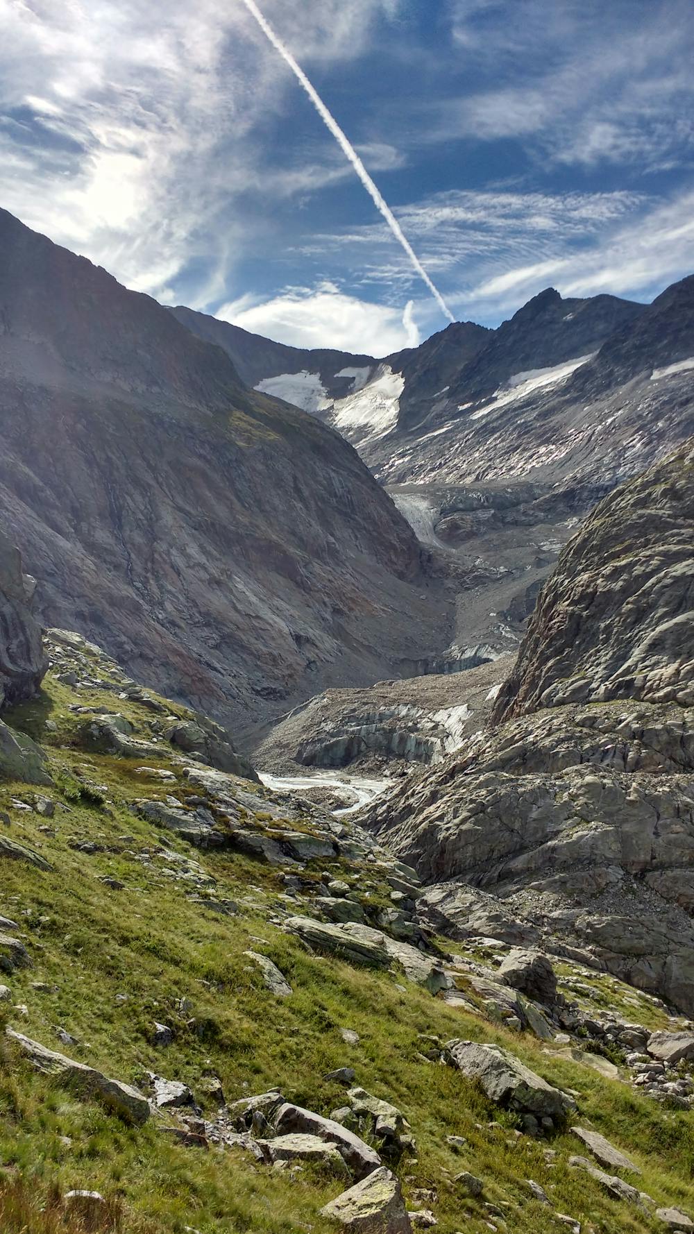
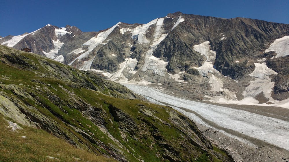
The first part of the climb is along a well-marked trail in the forest. The path forks a number of times on the way to the refuge, giving a few options to reach it. Consider choosing one route on the way up and a different route on the way down. Just before arriving at the refuge you’ll leave the tree cover, which will offer you an obstructed view of the valley and Mont Joly to the west. Most hikers stop there, making the second part of the climb much quieter.
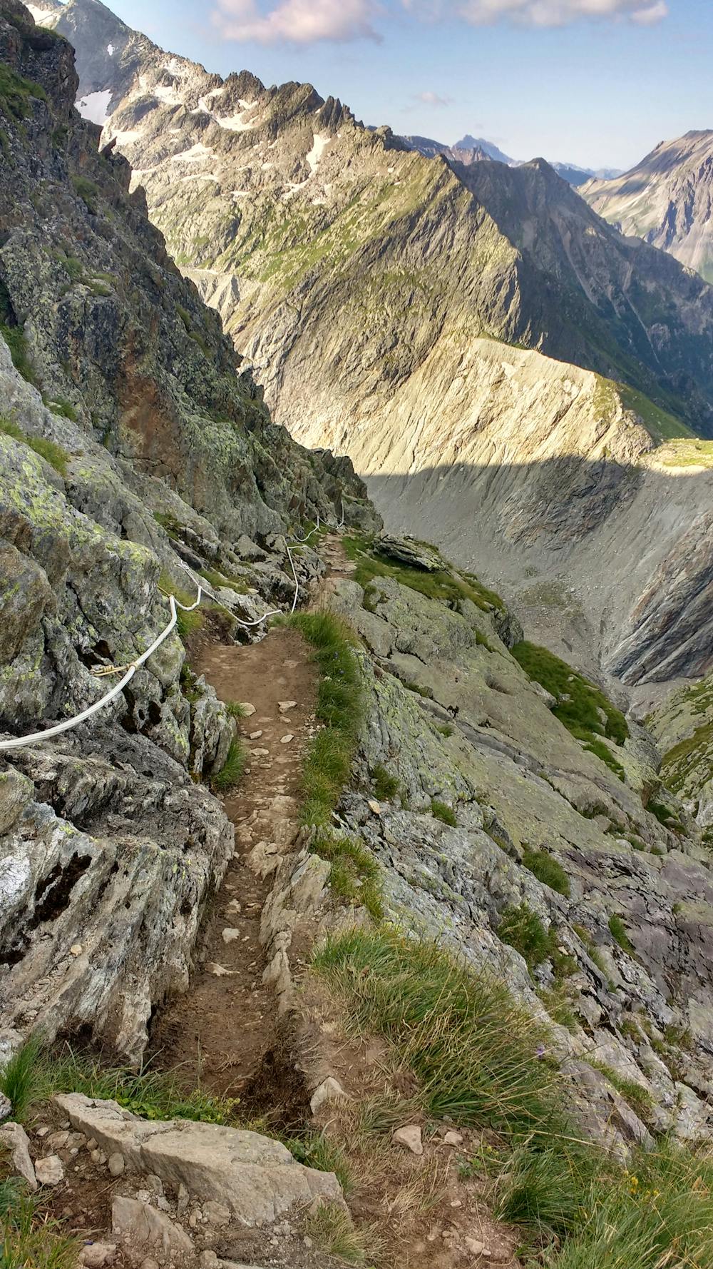
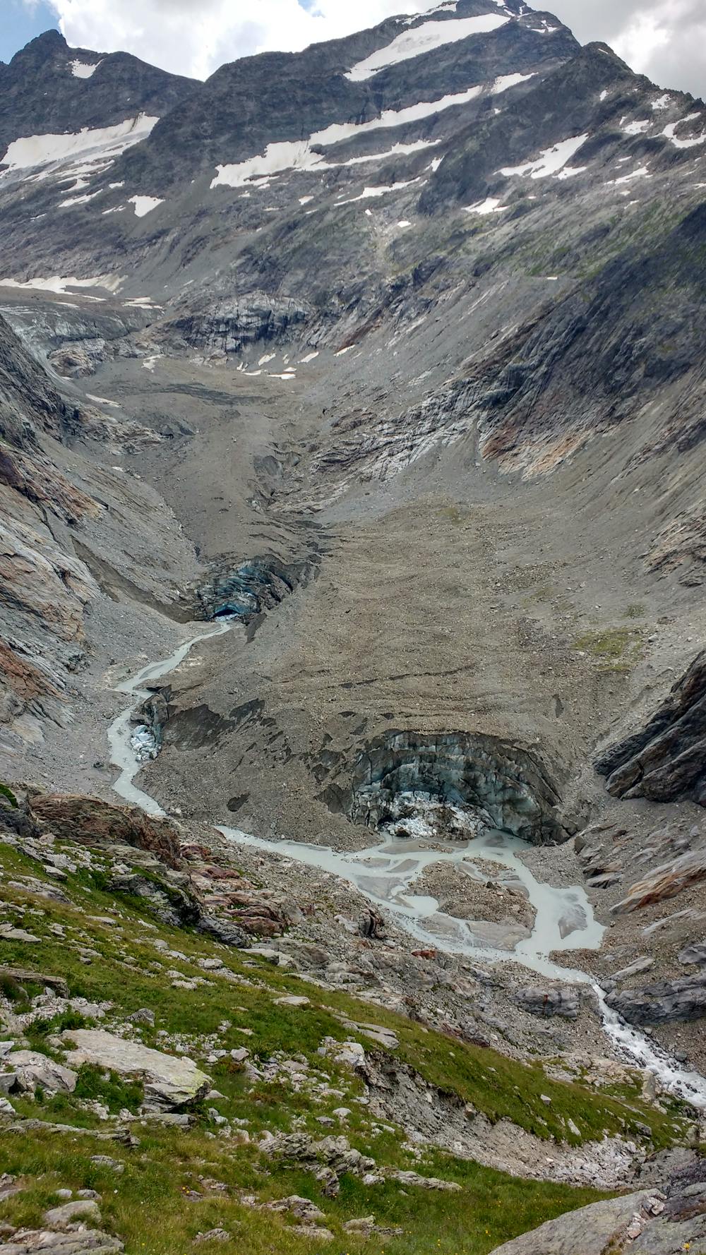
A warning sign will let you know that you are taking a mountaineering trail, meaning it’s more technical and you will have to rely on paint markings and cairns to navigate your way to refuge des Conscrits. The trail should be pretty easy to follow, though, so if you don’t see blue paint/cairns every 50m or so, considering backtracking as you’re probably off route. There will be ropes/chains to assist you in a few exposed parts of the trail where you will have to exercise extra caution.
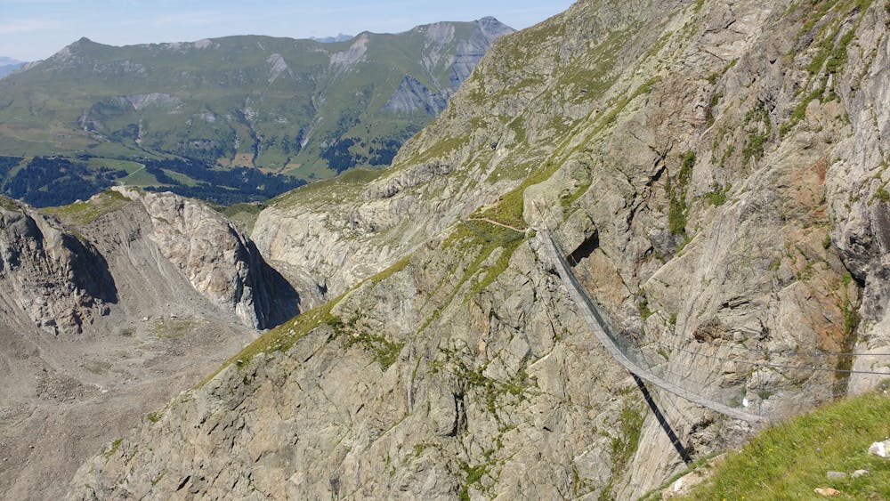
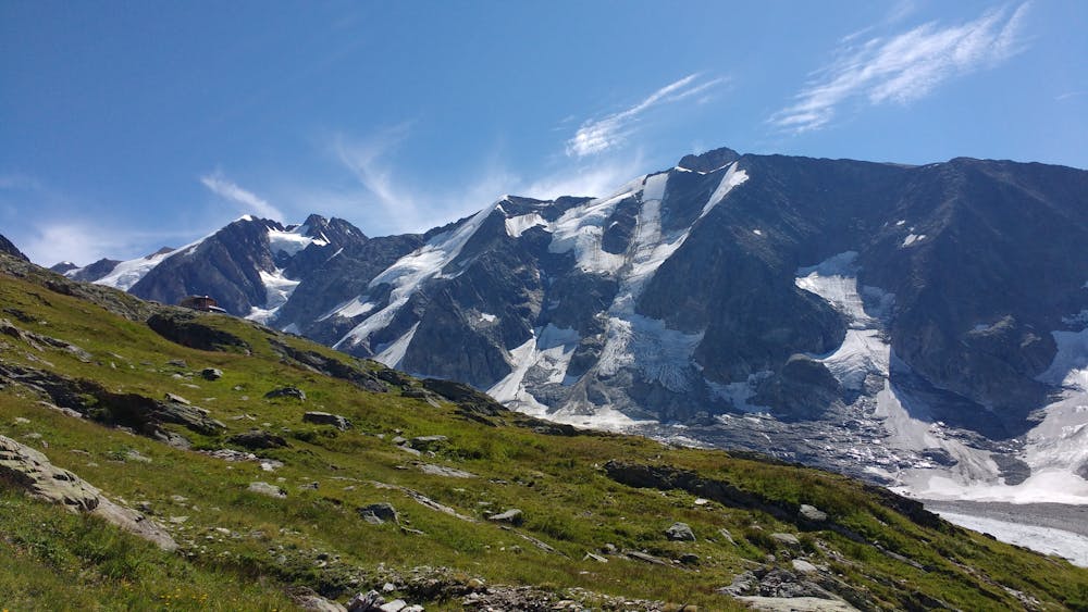
A short descent will take you to the brand new bridge installed in 2012. Crossing it might be the moment where some will get cold shivers, certainly more than on the few easy steps of rock climbing scattered along the hike. Once you’re past it, though, you’re almost at the refuge, where you will be able to enjoy the view of the glacier and the surrounding peaks, sitting comfortably on the terrace.
To return, simply follow the trail you took for the climb, although as previously mentioned you might want to try an alternate route once you’re back at refuge de Tré la Tête.
Severe
Hiking challenging trails where simple scrambling, with the occasional use of the hands, is a distinct possibility. The trails are often filled with all manner of obstacles both small and large, and the hills are very steep. Obstacles and challenges are often unexpected and can be unpredictable.

Some trail sections have exposed ledges or steep ascents/descents where falling could cause serious injury.

Away from help but easily accessed.
1.3 km away
Day 3: A long and wild day which leads to one of the most peaceful little settlements in the French Alps.
Difficult Hiking
1.9 km away
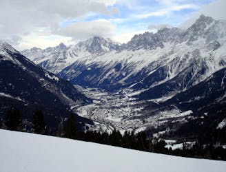
Mingle with Tour du Mont Blanc hikers before going off on less travelled trails.
Severe Hiking
8.2 km away
Day 2: An excellent day taking in a huge variety of views, from alpine meadows to hanging glaciers and rocky ridges.
Difficult Hiking

14 routes · Hiking
3 routes · Alpine Climbing · Hiking

15 routes · Alpine Climbing · Hiking