280 m away
Tête Nord des Fours et Lacs Jovet
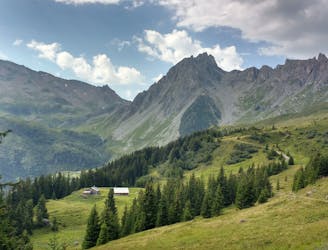
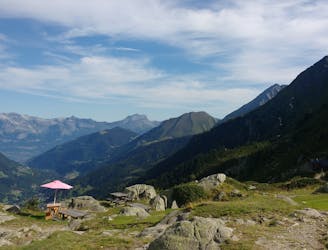
Mingle with Tour du Mont Blanc hikers before going off on less travelled trails.
Severe Hiking
- Distance
- 26 km
- Ascent
- 1.9 km
- Descent
- 1.9 km
Chapel, Jovet, up the Fours, Bonhomme, refuge de Pres, Chapel
Hiking Severe

A high route taking the 3 passes over the Fours. The path initially is following the popular TMB, until it turns towards Lake Juvet. Easy scrambling section about the lake leads to the first pass. Then walk down a little and traverse on the south side to the second pass. The initial descent from the second path is a little unclear and steep, take care when wet or when visibility is poor. After 200-300m the path gets easier. There the path heads up gradually until the top of the Fours with stunning view all around. Then easy descent to the Bonhomme hut and rejoin the TMB. The final pass is about 30 minutes from the hut. Easy, but long, path back to the car park.
Severe
Hiking challenging trails where simple scrambling, with the occasional use of the hands, is a distinct possibility. The trails are often filled with all manner of obstacles both small and large, and the hills are very steep. Obstacles and challenges are often unexpected and can be unpredictable.

The trail contains some obstacles such as outcroppings and rock which could cause injury.
Away from help but easily accessed.
280 m away
Mingle with Tour du Mont Blanc hikers before going off on less travelled trails.
Severe Hiking
2.2 km away
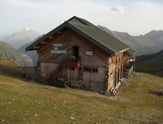
A serene glacier hike to a beautiful high mountain hut
Severe Hiking
3.4 km away
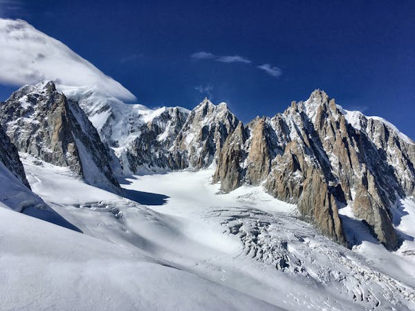
Day 3: A long and wild day which leads to one of the most peaceful little settlements in the French Alps.
Difficult Hiking

14 routes · Hiking
3 routes · Alpine Climbing · Hiking

15 routes · Alpine Climbing · Hiking