57 m away
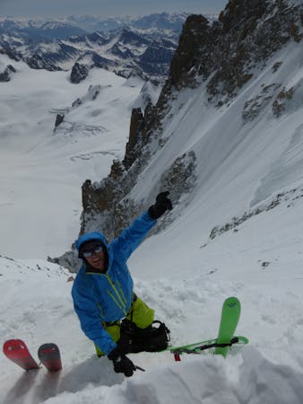
Trappier Couloir
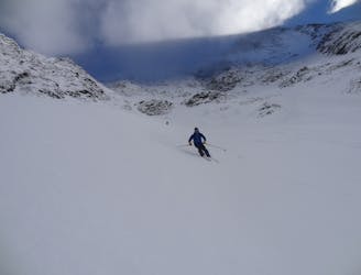
A large and very attractive couloir in plain view from Chamonix
Severe Ski Touring
- Distance
- 10 km
- Ascent
- 1.4 km
- Descent
- 2.1 km
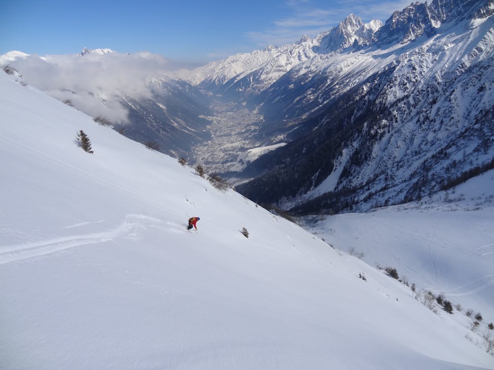
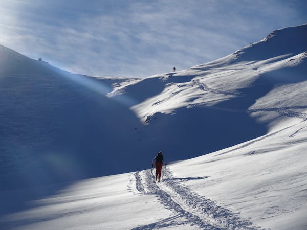
A fantastic and wild line which requires a large and stable snowpack.
Ski Touring Difficult

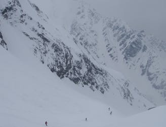
Stable conditions are absolutely vital if you're thinking about skiing this route because it basically follows, and passes under, one big terrain trap after another. Getting avalanched here would be disastrous, so make sure that avalanche conditions are favourable before setting off. A further complication is added by the fact that a deep snowpack is required to make the main gully in the line negotiable. A deep, stable snowpack is not an easy thing to find but when the stars align, this is an incredible trip and given how short the approach to the line is, it is incredible how wild and remote this route feels.
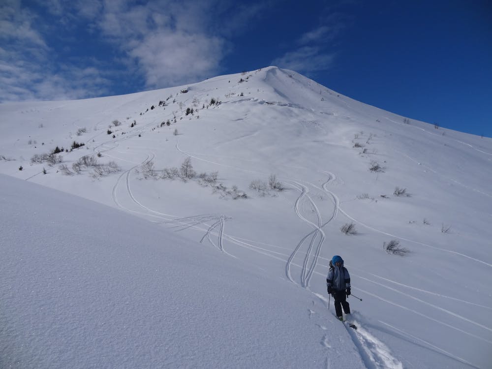
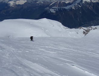
Leave the Bellevue cable car station and skin easily up Mont Lachat's West ridge. It is possible to skin up the train tracks of the Tramway du Mont Blanc and then up onto Mont Lachat's summit from this, but taking the West ridge is more aesthetic and enjoyable, albeit slightly tougher physically.
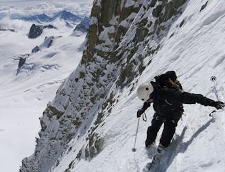
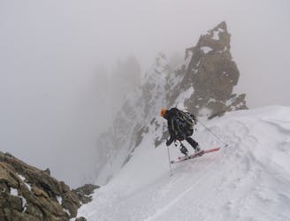
From the summit, ski wherever looks best/safest to the north-east. The exact line you'll take can vary but all are 30 - 40 degrees and provide fantastic skiing high above the Chamonix Valley. All routes lead you naturally down to a small plateau, just above a deep north-east facing gully. Drop into this gully and follow it down on the left bank, picking your exact route according to where the snow looks best/thickest. If the snowpack is not deep enough then negotiating the gully will be extremely arduous, but provided there is enough snow then there is a lot of fun skiing to be had in it. Be aware that all the way down the gully there are huge funnels and gullies above and right of you so even in stable conditions, don't spend any more time skiing the gully than is necessary.
Eventually, as the gully begins to mellow and widen, cross over to the right and get onto the jeep track which descends through forests down to the top of the small beginner's slope in Les Houches. Blast down the slope to the Avenue des Alpages, from where you can access the Chamonix bus system.
Difficult
Serious gradient of 30-38 degrees where a real risk of slipping exists.

As well as the slope itself, there are some obstacles (such as rock outcrops) which could aggravate injury.

Little chance of being seen or helped in case of an accident.
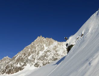
57 m away
A large and very attractive couloir in plain view from Chamonix
Severe Ski Touring
7.5 km away
Scenic alternative exit from the West Face of the Midi
Severe Ski Touring
7.8 km away
A long and adventurous two day tour traversing a breathtaking summit
Difficult Ski Touring
8.1 km away
The 'Himalayan' face of Mont Blanc
Extreme Ski Touring
8.5 km away
One of Chamonix's most famous and sought after steep descents; sustained and an immaculate ski line.
Extreme Ski Touring
8.6 km away
The classic ski-mountaineering trip of the area, taking in some mind-blowing scenery.
Difficult Ski Touring
8.8 km away
A satisfyingly long descent from the Alps' highest summit.
Difficult Ski Touring
8.8 km away
A beautiful and varied run with a tricky ending.
Extreme Ski Touring
9.6 km away
Another gem of a steep line on the East Face of Mont Blanc du Tacul
Extreme Ski Touring
9.9 km away
One of the best and longest extreme couloirs in the Mont Blanc Massif
Extreme Ski Touring
5 routes · Freeride Skiing · Ski Touring

5 routes · Freeride Skiing · Ski Touring

10 routes · Freeride Skiing · Ski Touring
7 routes · Ski Touring

50 routes · Freeride Skiing · Ski Touring

15 routes · Freeride Skiing · Ski Touring
3 routes · Ski Touring