748 m away
Les Bois
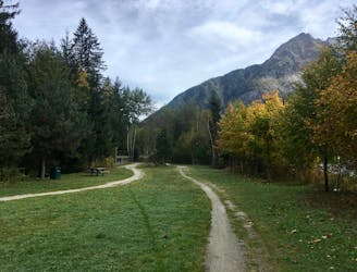
The easiest trail run in Chamonix.
Easy Trail Running
- Distance
- 5.6 km
- Ascent
- 56 m
- Descent
- 56 m
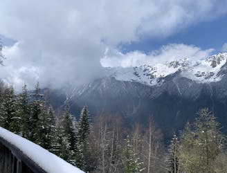
MDMB route Les Praz to Le Tour then cut across to climb to Flegere
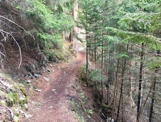
Trail Running Difficult

This is a popular trail running route which is generally considered to be difficult. It's not remote, it features medium exposure and is typically done between May and November. From a low point of 1.1 km to the maximum altitude of 1.9 km, the route covers 20 km, 1535 vertical metres of ascent and 716 vertical metres of descent.
MdMB route Les Praz - Le Tour then Flegere climb
Difficult

The trail contains some obstacles such as outcroppings and rock which could cause injury.

Close to help in case of emergency.
748 m away
The easiest trail run in Chamonix.
Easy Trail Running
752 m away

Le mini cross est un petit trail pour les plus jeunes, de 800m à 3km en fonction des catégories.
Easy Trail Running
763 m away
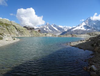
Link four lakes together while enjoying the view of the Chamonix valley.
Severe Trail Running
774 m away

le cross du Mont-blanc
Difficult Trail Running
794 m away

La course format 10k de l'événement
Moderate Trail Running
855 m away
A short loop on one of the best sections of the Petit Balcon Sud trail.
Easy Trail Running
948 m away

A classic loop around the Chamonix Valley.
Easy Trail Running
1.3 km away
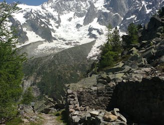
Enjoy the open vistas of the north balcony between Montenvers and Plan de l'Aiguille on vintage Chamonix trails.
Moderate Trail Running
1.4 km away
An amazing way to see some of the best view in Chamonix on foot.
Moderate Trail Running
1.6 km away

La plus longue coure du Marathon
Extreme Trail Running

8 routes · Trail Running