194 m away
Coll blanc

Popular off piste with terrain with easy access.
Severe Freeride Skiing
- Distance
- 508 m
- Ascent
- 0 m
- Descent
- 231 m
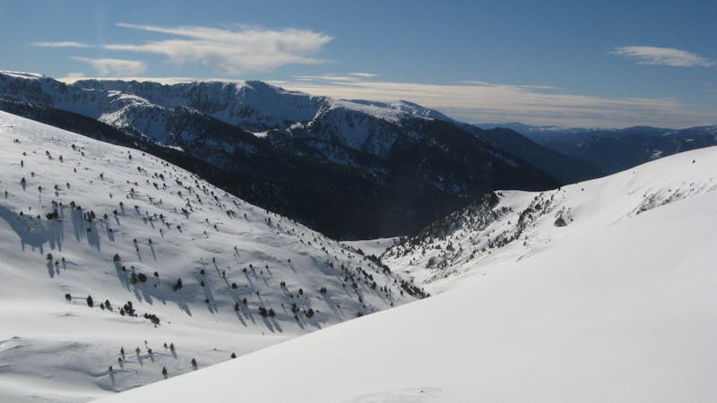
An open terrain freeride area
Freeride Skiing Moderate

The Pic Blanc area is located on the southern face of Pic Blanc just below Pic Blanc chairlift. There are 3 main access to the area: The first is below the top station, traverse to the left and get into the area. The second is a T-bar from the top of Pic Blanc which is sometimes in operation and gives access to the top section halfway to Pic Blanc summit, or the last one you hike until the summit. This is a fun, wide area with a lot of terrain to ride. The very top section dropping from the summit has more gradient. It is an in-resort controlled area but avalanche equipment is recommended. It is a very rocky area so watch out for snow conditions.
Moderate
Slopes become slightly steeper at around 25-30 degrees.

Exposure is limited to that of the slope itself. Getting hurt is still likely if the slope is steep and/or the snow is hard.
Close to help in case of emergency.
194 m away
Popular off piste with terrain with easy access.
Severe Freeride Skiing
233 m away
A steep line through rocky terrain for experienced riders
Difficult Freeride Skiing
319 m away

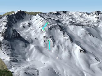
Short, technical and steep couloirs
Severe Freeride Skiing
330 m away

Steep couloirs for experienced riders
Difficult Freeride Skiing
335 m away

Technical and challenging lines on the Pic Blanc North-west face.
Severe Freeride Skiing
582 m away

Steep terrain for alpine off-piste experienced riders.
Severe Freeride Skiing
586 m away

Extreme narrow steep couloir for advanced experienced riders
Difficult Freeride Skiing
723 m away

Wide steep riding from Coll Blanc
Moderate Freeride Skiing
1.5 km away

Easy access freeride area for intermediate riders
Moderate Freeride Skiing
1.6 km away

Classic freeride lines out of the resort boundaries
Moderate Freeride Skiing
22 routes · Freeride Skiing