492 m away
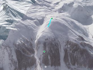
The White Rabbit

Great short descent through open terrain and short forrest.
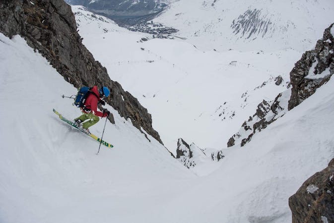
Difficult Freeride Skiing
- Distance
- 1.3 km
- Ascent
- 19 m
- Descent
- 389 m
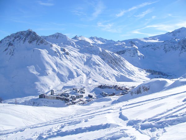
Wide open skiing with a few fun variations.
Freeride Skiing Difficult

This is a popular freeride skiing route which is generally considered to be difficult. It's not remote, it features medium exposure (e2) and is typically done between December and April. From a low point of 2 km to the maximum altitude of 2.6 km, the route covers 4 km, 802 vertical metres of ascent and 1198 vertical metres of descent. It's graded 2.2 and Labande grade 3.
From the Laisinant chair start on the Route du Col piste. Ski off right linking the great rolling terrain following your nose and exploring until rejoining Piste-L below and returning to the chair.
Difficult
Serious gradient of 30-38 degrees where a real risk of slipping exists.

As well as the slope itself, there are some obstacles (such as rock outcrops) which could aggravate injury.

Close to help in case of emergency.
492 m away
Great short descent through open terrain and short forrest.
Difficult Freeride Skiing
835 m away

Great tree skiing - good for bad visibility/weather days
Difficult Freeride Skiing
1.2 km away

Short, steep, easy-access tree lines
Difficult Freeride Skiing
1.2 km away

A popular, easy to access classic couloir - you'll need to get up early to get first tracks here.
Difficult Freeride Skiing
1.3 km away
This alternative line to the Lavancher couloir provides some steep tree skiing but can be dangerous.
Severe Freeride Skiing
1.4 km away

Enjoyable, beautiful skiing but check the snow conditions before setting out
Severe Freeride Skiing
1.4 km away

An easily-accessed bowl to lap straight after snowfall.
Difficult Freeride Skiing
1.6 km away

Good skiing with easy access, close to the pistes
Difficult Freeride Skiing
2 km away

More technical variant of Grand Vallon
Difficult Freeride Skiing
2 km away

Easy access off piste run on a large north facing slope often offering fantastic cold snow.
Difficult Freeride Skiing
70 routes · Freeride Skiing
6 routes · Freeride Skiing