8.8 km away
Marquise

Mellow powder-field opposite the La Marquise chairlift.
Easy Freeride Skiing
- Distance
- 1.9 km
- Ascent
- 2 m
- Descent
- 471 m
North face of Tete de l'Ane.
Freeride Skiing Difficult
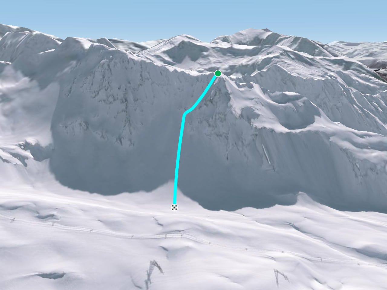
This is a popular freeride skiing route which is generally considered to be difficult. It's not remote, it features medium exposure (e2) and is typically done between January and May. From a low point of 2.3 km to the maximum altitude of 2.7 km, the route covers 628 m, 0 vertical metres of ascent and 398 vertical metres of descent. It's graded 4.1 and Labande grade 4.
North face of Tete de l'Ane.
Difficult
Serious gradient of 30-38 degrees where a real risk of slipping exists.

As well as the slope itself, there are some obstacles (such as rock outcrops) which could aggravate injury.

Close to help in case of emergency.
8.8 km away
Mellow powder-field opposite the La Marquise chairlift.
Easy Freeride Skiing
8.8 km away

All of the joys of Sainte Foy condensed into a single run.
Difficult Freeride Skiing
9.5 km away

Fun terrain for the playful-at-heart
Moderate Freeride Skiing
9.8 km away

Technical, exposed Freeride World Qualifiers face offering a proper steep skiing examination
Severe Freeride Skiing
9.8 km away

A difficult and avalanche prone couloir - check before you go
Severe Freeride Skiing
25 routes · Freeride Skiing
9 routes · Freeride Skiing · Ski Touring