921 m away
Shapers' Paradise

Fun terrain for the playful-at-heart
Moderate Freeride Skiing
- Distance
- 659 m
- Ascent
- 0 m
- Descent
- 286 m
Technical, exposed Freeride World Qualifiers face offering a proper steep skiing examination
Freeride Skiing Severe

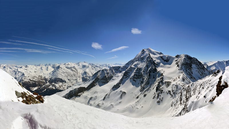
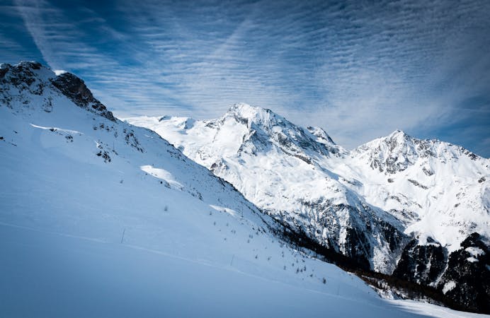
Hike for 30 minutes up towards the summit of Foglietta to reach a large cross from where you can enjoy a great view over Sainte Foy and the Tarentaise valley. This is the starting point to the west face of Foglietta. This is a venue for a Freeride World Qualifying event, which should tell you a little bit about the type of challenges you can expect to encounter. Steep couloirs, blind rollovers, cliffs... they're all here, so be extra sure of snow conditions before tackling this face.
On your way up, a detour via the Marquise chair and Grand Solliet piste is well worth it to scope all of the possible lines from the bottom, mindful of the fact that they'll look very different from the top! There are four main couloirs that connect the steep upper section with the wide open slopes above the Plan des Veaux and Grand Solliet pistes. Two straight down the fall line from the cross, two more accessed by traversing skier's right. Depending on snow conditions, there may be tight chokes or even mandatory airs to negotiate.
All in all, a face only to be tackled by expert skiers comfortable on steep, committing terrain.
Severe
Steep skiing at 38-45 degrees. This requires very good technique and the risk of falling has serious consequences.

In case of a fall, death is highly likely.

Away from help but easily accessed.
921 m away
Fun terrain for the playful-at-heart
Moderate Freeride Skiing
977 m away

All of the joys of Sainte Foy condensed into a single run.
Difficult Freeride Skiing
977 m away

Mellow powder-field opposite the La Marquise chairlift.
Easy Freeride Skiing
1.2 km away

A feast of fun terrain
Difficult Freeride Skiing
1.3 km away

A gorgeous, gentle introduction to backcountry skiing, the route to Le Monal is a lovely journey back in time through stunning scenery.
Easy Freeride Skiing
1.3 km away

More adventurous variant of Crystal Dark
Difficult Freeride Skiing
7.1 km away

An amazing journey on to the wild side on the edge of the nature reserve
Difficult Freeride Skiing
7.2 km away

A magnificent steep and committing line backside of the Aiguille Rouge
Severe Freeride Skiing
7.2 km away

One of the only authorized routes on the Aiguille Rouge
Difficult Freeride Skiing
7.2 km away

One of the most exposed faces in Les Arcs
Extreme Freeride Skiing
25 routes · Freeride Skiing
9 routes · Freeride Skiing · Ski Touring