402 m away
Les Cascades

One of the most exposed faces in Les Arcs
Extreme Freeride Skiing
- Distance
- 1.7 km
- Ascent
- 2 m
- Descent
- 687 m
An amazing journey on to the wild side on the edge of the nature reserve
Freeride Skiing Difficult
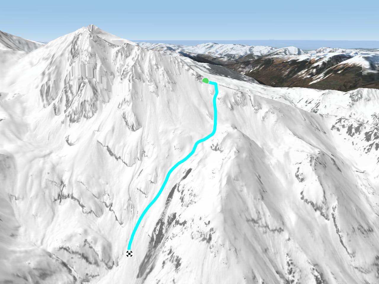
One of many lines down this incredible face. This is the last line skiers left of the Aiguille Rouge that is permitted before the nature reserve boundary. The tempting bowl skiers left of the line is strictly forbidden as it is a nature reserve. Please respect this directive. Follow the fall-line being careful to stay skiers right of the ridge that separates the line and the nature reserve. Continue down until you reach the forest path that takes you back round to the resort.
Difficult
Serious gradient of 30-38 degrees where a real risk of slipping exists.

As well as the slope itself, there are some obstacles (such as rock outcrops) which could aggravate injury.

Little chance of being seen or helped in case of an accident.
402 m away
One of the most exposed faces in Les Arcs
Extreme Freeride Skiing
780 m away

A magnificent steep and committing line backside of the Aiguille Rouge
Severe Freeride Skiing
962 m away

One of the only authorized routes on the Aiguille Rouge
Difficult Freeride Skiing
1.1 km away

A steep direct start to the Robert Blanc piste
Severe Freeride Skiing
1.3 km away

Exposed Bowl on north west face
Severe Freeride Skiing
1.3 km away
One of the big Paradiski classics remains a serious undertaking
Difficult Freeride Skiing
1.8 km away

Easy descent that is just outside the national park
Moderate Freeride Skiing
2.3 km away

An incredible off-piste journey on the wild-side of the Aiguille Rouge
Difficult Freeride Skiing
2.9 km away

One of the narrowest and steepest in Les Arcs
Severe Freeride Skiing
3.1 km away

a fairly exposed and often untracked line
Difficult Freeride Skiing
25 routes · Freeride Skiing