189 m away
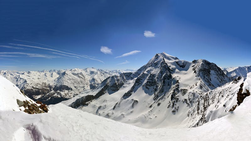
Les Couloirs de Comborcière, the Y Couloir

Steep couloir with a wide runout
Difficult Freeride Skiing
- Distance
- 557 m
- Ascent
- 0 m
- Descent
- 339 m
One of the narrowest and steepest in Les Arcs
Freeride Skiing Severe

Follow the same hike as if you were aiming for the Comborciere couloirs, carrying on as far along the ridgeline as possible. Once you get to the last couloir on your right ( facing back into the Fond blanc bowl) you will have to ski down it maybe halfway and then take a sharp left turn. Stop here and put your skis on your back and start the hike up the next couloir. Once you reach the top of this you will be on a flat platform and can either ski straight in front of you or if you look to your right you will see the narrow and steep entry into the Pointe du Four Couloir, this is the goal. With good snow this is an enjoyable run, it will require jump turns at the top but once you have come out of the narrow part of the couloir you will be face with a wide open gully where you can open up your turns. Keep skiing the fall line, through a short narrow gully, after this you are in a forest that will end up on the piste next to the Pre St Esprit chairlift.
This is a couloir that will give you massive sense of achievement and it worth the effort to reach. Try and get to it as early as you can and be wary of sluff if there is powder snow. It is doable in spring but the snow may be less stable.
Severe
Steep skiing at 38-45 degrees. This requires very good technique and the risk of falling has serious consequences.

As well as the slope itself, there are some obstacles (such as rock outcrops) which could aggravate injury.

Little chance of being seen or helped in case of an accident.
189 m away
Steep couloir with a wide runout
Difficult Freeride Skiing
345 m away

Steep north facing couloirs
Severe Freeride Skiing
463 m away

The bowl that hosted the Red Bull Linecatcher
Moderate Freeride Skiing
577 m away

A popular wide open bowl often with great snow
Easy Freeride Skiing
709 m away

a fairly exposed and often untracked line
Difficult Freeride Skiing
897 m away

Rolling through the open Malgovert Forest
Moderate Freeride Skiing
968 m away

A difficult and avalanche prone couloir - check before you go
Severe Freeride Skiing
977 m away

A mini-adventure with some steeper skiing at the start
Difficult Freeride Skiing
1.7 km away

Easy descent that is just outside the national park
Moderate Freeride Skiing
2.2 km away

One of the only authorized routes on the Aiguille Rouge
Difficult Freeride Skiing
25 routes · Freeride Skiing