584 m away
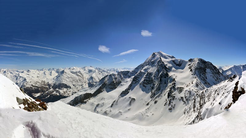
Malgovert Forest

Rolling through the open Malgovert Forest
Moderate Freeride Skiing
- Distance
- 875 m
- Ascent
- 0 m
- Descent
- 291 m
A difficult and avalanche prone couloir - check before you go
Freeride Skiing Severe

This is a popular freeride skiing route which is generally considered to be severe. It's very remote, it features low exposure (e1) and is typically done between January and April. From a low point of 1.8 km to the maximum altitude of 2.2 km, the route covers 1.1 km, 16 vertical metres of ascent and 409 vertical metres of descent. It's graded 4.2 and Labande grade 4.
An easy to access, steep and sustained couloir which is very avalanche prone - check the conditions before you go.
Severe
Steep skiing at 38-45 degrees. This requires very good technique and the risk of falling has serious consequences.

Exposure is limited to that of the slope itself. Getting hurt is still likely if the slope is steep and/or the snow is hard.

Little chance of being seen or helped in case of an accident.
584 m away
Rolling through the open Malgovert Forest
Moderate Freeride Skiing
865 m away

Steep north facing couloirs
Severe Freeride Skiing
866 m away

Steep couloir with a wide runout
Difficult Freeride Skiing
924 m away

A popular wide open bowl often with great snow
Easy Freeride Skiing
968 m away

One of the narrowest and steepest in Les Arcs
Severe Freeride Skiing
972 m away

The bowl that hosted the Red Bull Linecatcher
Moderate Freeride Skiing
1.6 km away

a fairly exposed and often untracked line
Difficult Freeride Skiing
1.8 km away

A mini-adventure with some steeper skiing at the start
Difficult Freeride Skiing
2 km away

Easy descent that is just outside the national park
Moderate Freeride Skiing
2.7 km away

One of the only authorized routes on the Aiguille Rouge
Difficult Freeride Skiing
25 routes · Freeride Skiing