1 km away
La Combe Ouest des Arandelieres

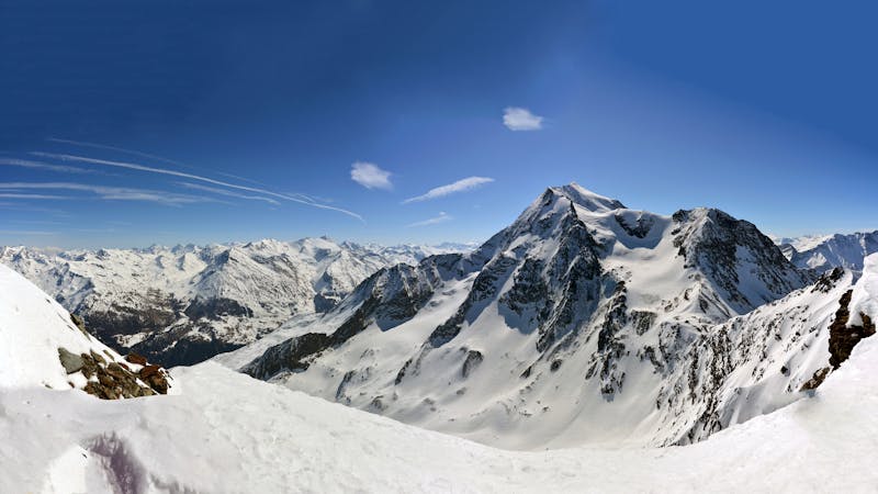
Exposed Bowl on north west face
Severe Freeride Skiing
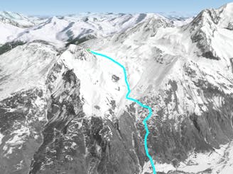
- Distance
- 815 m
- Ascent
- 0 m
- Descent
- 443 m
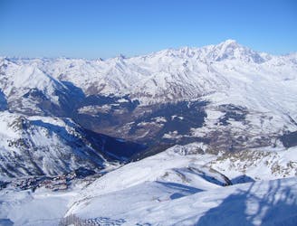
An incredible off-piste journey on the wild-side of the Aiguille Rouge
Freeride Skiing Difficult

A great journey through some wild off-piste terrain in a beautiful valley. This is a serious off-piste run for which you should be prepared, experienced, know the conditions and completely autonomous. The skiing is never too difficult but you are far from the safety of the resort. There is often significant avalanche risk here - know the conditions! Those with the skills and experience who are willing to hike the 20-30 mins to the Grand Col will be handsomely rewarded. The line follows the obvious line of the valley, always trending left. If you are tempted to stray skiers right for more turns, make sure you head left at the flat section to pick up the critical passage at around 2200m to which all the routes funnel to. If you miss this you will be stuck above cliffs with no way out. Pick up the forest path that heads down to Planay which crosses a number of avalanche couloirs. Re-join the resort via the blue piste.
Difficult
Serious gradient of 30-38 degrees where a real risk of slipping exists.

As well as the slope itself, there are some obstacles (such as rock outcrops) which could aggravate injury.

Little chance of being seen or helped in case of an accident.
1 km away
Exposed Bowl on north west face
Severe Freeride Skiing
1 km away
One of the big Paradiski classics remains a serious undertaking
Difficult Freeride Skiing
1.2 km away

A steep direct start to the Robert Blanc piste
Severe Freeride Skiing
1.6 km away

A magnificent steep and committing line backside of the Aiguille Rouge
Severe Freeride Skiing
1.9 km away

One of the most exposed faces in Les Arcs
Extreme Freeride Skiing
2.3 km away

An amazing journey on to the wild side on the edge of the nature reserve
Difficult Freeride Skiing
2.5 km away
Another long interesting itinerary into the deep valley separating Les Arcs from La Plagne
Difficult Freeride Skiing
2.5 km away

A long, interesting route away from the ski area
Difficult Freeride Skiing
2.6 km away

The easier way down the Aiguille Grive
Difficult Freeride Skiing
3 km away

A steep rarely skied line from the top of the Aiguille Grive
Severe Freeride Skiing
25 routes · Freeride Skiing