143 m away
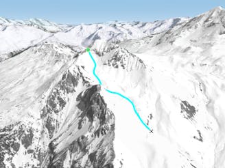
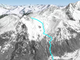
Aiguille Grive - Col d'Entreporte
A wild, steep line that needs stable snow conditions and finishes outside the lift served area
Severe Freeride Skiing
- Distance
- 3.1 km
- Ascent
- 30 m
- Descent
- 898 m
A steep rarely skied line from the top of the Aiguille Grive
Freeride Skiing Severe

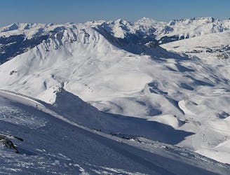
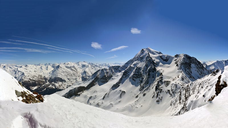
A steep and serious line from the summit of the Aiguille Grive. The line is rarely skied but offers some good steep and tight couloir skiing when in condition. Take some time to admire the view from the summit. Thanks to its northerly aspect and enclosed nature the snow stays cold and fresh for a while. From the top of the Transarc, Arcabulles or Plagnettes lifts, hike the ridge to the summit of the Aiguille Grive. Beware! The entrance is often corniced. Drop into the couloir which is steep from the start and even more so where it narrows around 150m in from the start. The couloir itself ends in a rock band so make sure you exit skiers right to the second couloir and then down the wide opens slopes to the Renard pistes.
Severe
Steep skiing at 38-45 degrees. This requires very good technique and the risk of falling has serious consequences.

As well as the slope itself, there are some obstacles (such as rock outcrops) which could aggravate injury.
Away from help but easily accessed.
143 m away
A wild, steep line that needs stable snow conditions and finishes outside the lift served area
Severe Freeride Skiing
145 m away
A hike to some great views followed by a flowing descent down a west facing bowl
Moderate Freeride Skiing
461 m away

The easier way down the Aiguille Grive
Difficult Freeride Skiing
519 m away
Another long interesting itinerary into the deep valley separating Les Arcs from La Plagne
Difficult Freeride Skiing
522 m away

A long, interesting route away from the ski area
Difficult Freeride Skiing
1.1 km away

Short but sweet in bounds face
Moderate Freeride Skiing
2.8 km away

A mini-adventure with some steeper skiing at the start
Difficult Freeride Skiing
3 km away

An incredible off-piste journey on the wild-side of the Aiguille Rouge
Difficult Freeride Skiing
3 km away

a fairly exposed and often untracked line
Difficult Freeride Skiing
3.3 km away

Exposed Bowl on north west face
Severe Freeride Skiing
25 routes · Freeride Skiing