2 m away
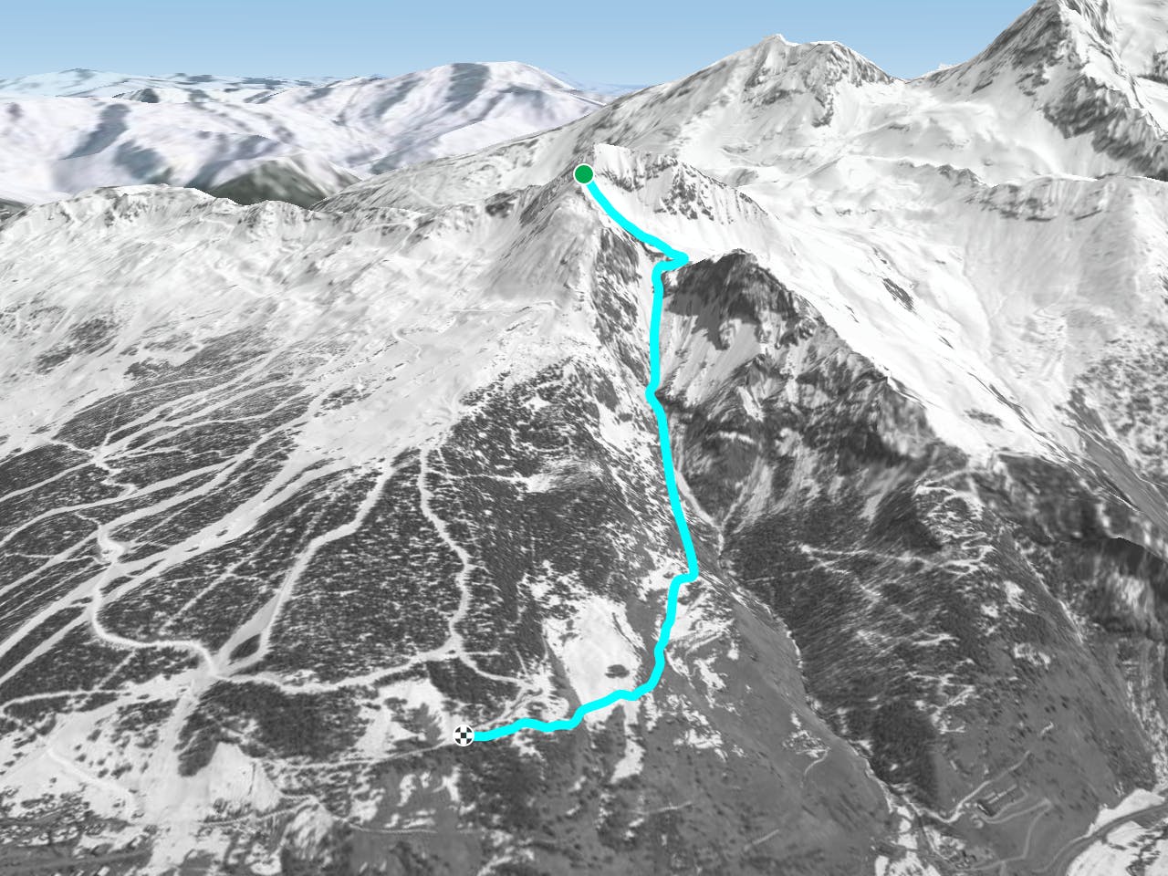
Grangettes Bowl
A hike to some great views followed by a flowing descent down a west facing bowl
Moderate Freeride Skiing
- Distance
- 1.3 km
- Ascent
- 0 m
- Descent
- 422 m
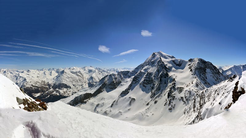
A wild, steep line that needs stable snow conditions and finishes outside the lift served area
Freeride Skiing Severe
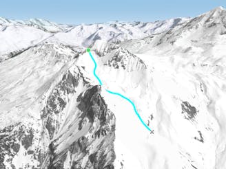
A steep line from the Col d'Entreporte that finishes outside the ski resort. It needs stable snow conditions and is usually in condition earlier in the season. From the top of the Plagnettes, Arcabulle or Transarc 2 lift, take the ridge to the top of the Aiguille Grive. Ski the west facing descent to the Col d'Entreporte. From the col head straight down the steep descent towards Nancroix. The descent is steep and sustained. As the drainage line narrows at spot height 2039m on the IGN map you need to head skiers right to rejoin the Vernettes chapelle. From here you can continue to traverse round to the bottom of the Combe chair lift (skins handy) or if there is enough snow descend the south west facing slopes to the valley and arrange transport back to the resort.
Severe
Steep skiing at 38-45 degrees. This requires very good technique and the risk of falling has serious consequences.

As well as the slope itself, there are some obstacles (such as rock outcrops) which could aggravate injury.

Little chance of being seen or helped in case of an accident.
2 m away
A hike to some great views followed by a flowing descent down a west facing bowl
Moderate Freeride Skiing
143 m away

A steep rarely skied line from the top of the Aiguille Grive
Severe Freeride Skiing
600 m away

The easier way down the Aiguille Grive
Difficult Freeride Skiing
661 m away
Another long interesting itinerary into the deep valley separating Les Arcs from La Plagne
Difficult Freeride Skiing
661 m away

A long, interesting route away from the ski area
Difficult Freeride Skiing
1.1 km away

Short but sweet in bounds face
Moderate Freeride Skiing
2.8 km away

A mini-adventure with some steeper skiing at the start
Difficult Freeride Skiing
3 km away

a fairly exposed and often untracked line
Difficult Freeride Skiing
3.1 km away

An incredible off-piste journey on the wild-side of the Aiguille Rouge
Difficult Freeride Skiing
3.5 km away

Exposed Bowl on north west face
Severe Freeride Skiing
25 routes · Freeride Skiing