49 m away
Beaupraz

Another long interesting itinerary into the deep valley separating Les Arcs from La Plagne
Difficult Freeride Skiing
- Distance
- 3.7 km
- Ascent
- 1 m
- Descent
- 1 km

A long, interesting route away from the ski area
Freeride Skiing Difficult

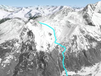
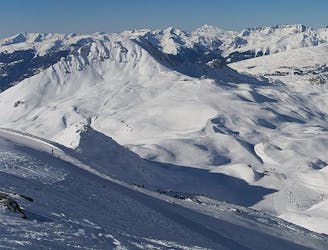
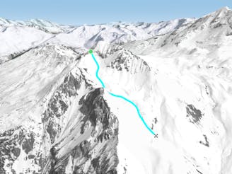
A long, interesting and beautiful off-piste run, well away from the crowds. The skiing is never too hard, but it covers some remote ground, so make sure you're properly prepared, and the conditions are appropriate. The finish is low and west-facing, so ensure there is enough snow on the final slopes. From behind the restaurant at Le Chal, head SW across gentle open slopes, towards the right, near the bottom of the steeper slopes of the Aiguille Grive. Bear gradually rightwards around the base of the Aiguille Grive, and follow a natural line around the blunt ridge into a shallow west facing bowl. Ski down lovely open slopes in a spectacular location, cross the shallow valley bottom, and continue rightwards into another shallow bowl. Follow this straight down until, just as the slope starts to steepen, you pick up a large track - turn right down this, and enjoy an endless winding descent through the forest to the hamlet of Nancroix. An alternative possibility is to follow the start of the Beaupraz route until just before that route crosses the valley bottom, but continue on the right bank of the stream until you pick up the same track higher up.
Difficult
Serious gradient of 30-38 degrees where a real risk of slipping exists.
49 m away

Another long interesting itinerary into the deep valley separating Les Arcs from La Plagne
Difficult Freeride Skiing
62 m away

The easier way down the Aiguille Grive
Difficult Freeride Skiing
522 m away

A steep rarely skied line from the top of the Aiguille Grive
Severe Freeride Skiing
661 m away

A wild, steep line that needs stable snow conditions and finishes outside the lift served area
Severe Freeride Skiing
663 m away

A hike to some great views followed by a flowing descent down a west facing bowl
Moderate Freeride Skiing
1.1 km away

Short but sweet in bounds face
Moderate Freeride Skiing
2.5 km away

An incredible off-piste journey on the wild-side of the Aiguille Rouge
Difficult Freeride Skiing
2.6 km away

A mini-adventure with some steeper skiing at the start
Difficult Freeride Skiing
2.8 km away

a fairly exposed and often untracked line
Difficult Freeride Skiing
2.8 km away

Exposed Bowl on north west face
Severe Freeride Skiing

25 routes · Freeride Skiing