5.9 km away
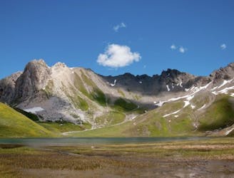
Aiguille de la Grande Sassière Summit
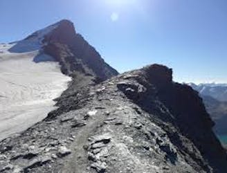
This summit climb provides a high alpine challenge along a ridgeline beside Sassière glacier, with stunning views the entire route.
Difficult Hiking
- Distance
- 22 km
- Ascent
- 2.1 km
- Descent
- 2.1 km
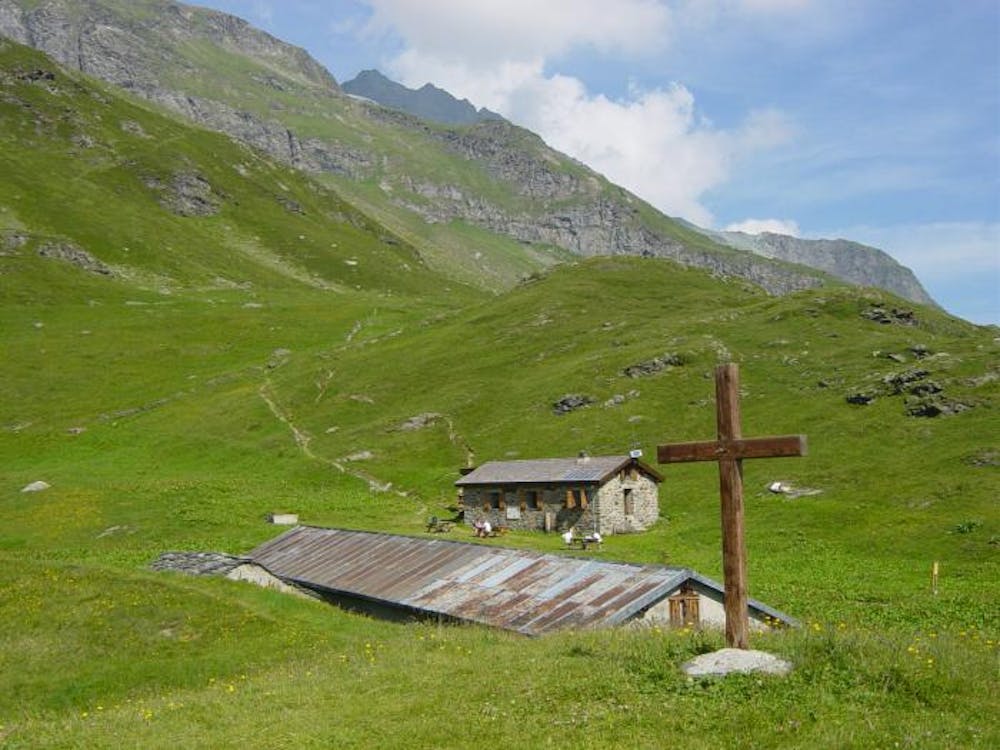
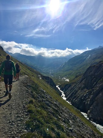
Hike to an incredible glacier from the small town of La Gurraz.
Hiking Moderate

This hike on the vertiginous east face of Mont Pourri will lead you from the world of men, with the hamlet of Gurraz and Chevril dam, up to the kingdom of the glaciers, where only the ibex venture.
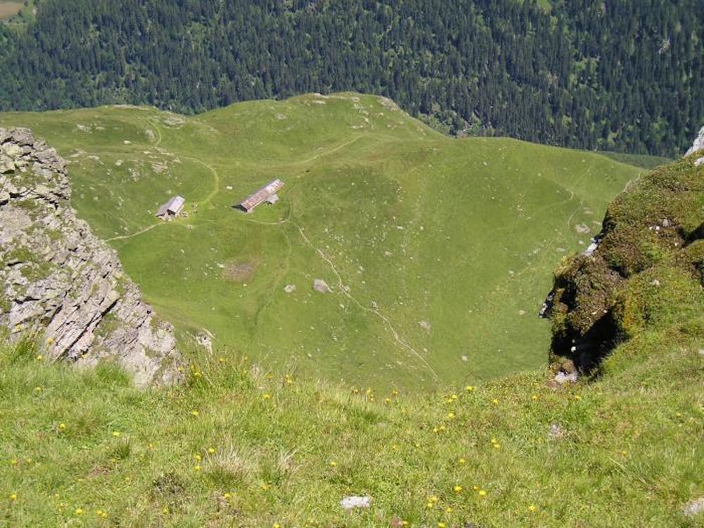
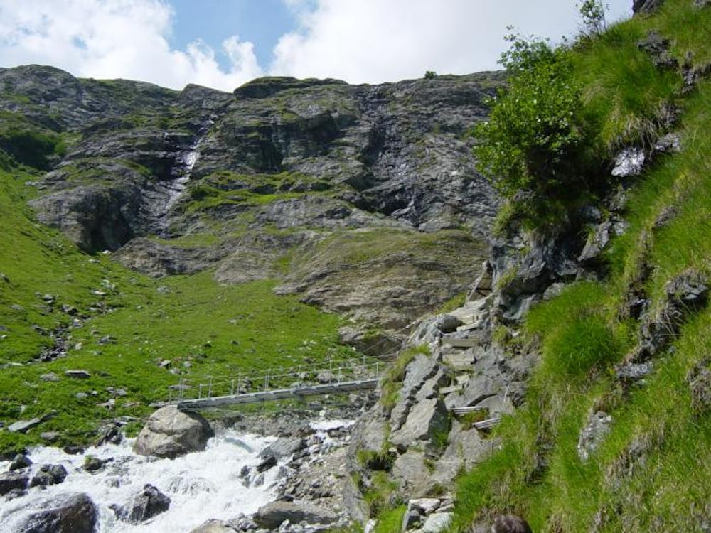
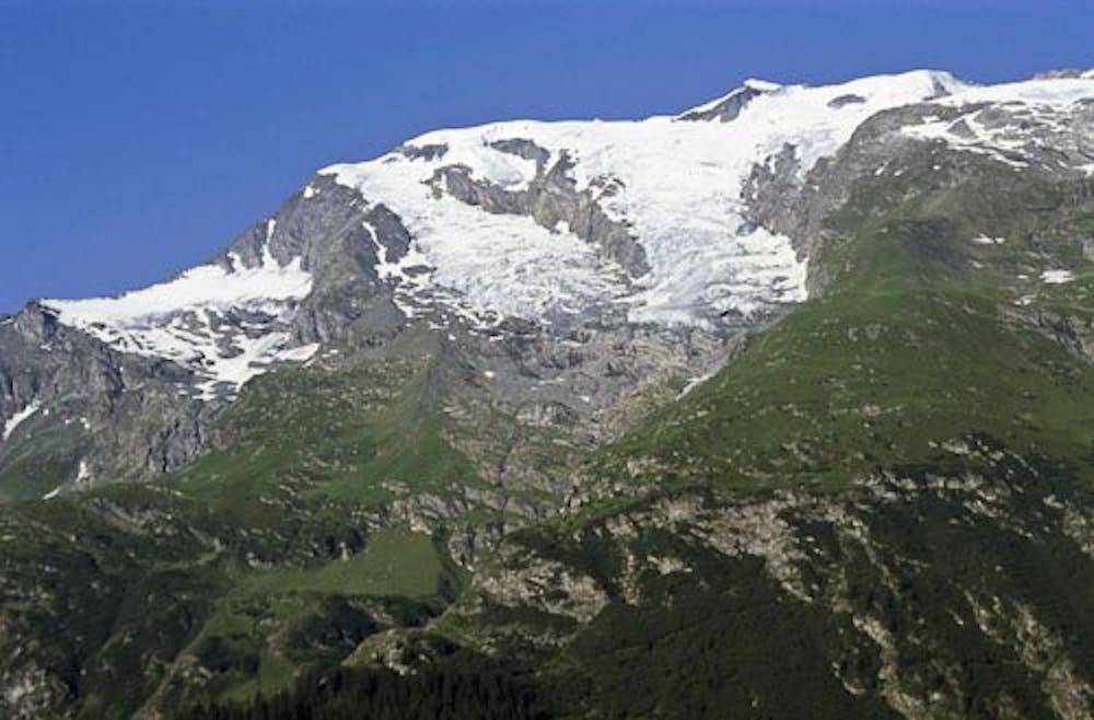
The route crosses the Mont-Pourri stream, a footbridge over the Savinaz stream, meanders through the shrub and vegetation of the forest and through mountain pastures, until reaching the Refuge de la Martin. Eventually, the route climbs into the midst of moutonnées and moraines rocks of the Glacier de la Savinaz.
At the end of the trail, it is not recommended to venture further without being accompanied by a professional mountain guide. In the summer, ice blocks can come loose from the glaciers without warning.
To return, follow the path in the reverse direction.
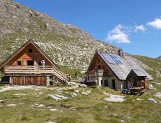
Dogs are permitted, but only up to Refuge de la Martin. Beyond the refuge, you enter the heart of the Vanoise National Park. Read the latest regulations at www.vanoise-parcnational.fr
Facilities and refreshments are available at Refuge de la Martin.
Moderate
Hiking along trails with some uneven terrain and small hills. Small rocks and roots may be present.

The path is on completely flat land and potential injury is limited to falling over.
Close to help in case of emergency.
5.9 km away
This summit climb provides a high alpine challenge along a ridgeline beside Sassière glacier, with stunning views the entire route.
Difficult Hiking
7.6 km away
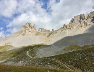
A hike to one of the best geological curiosities in Vanoise National Park: the "eye of the needle" and a spectacular high alpine ridgeline trail.
Difficult Hiking
8.4 km away

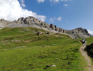
A lovely route with lakes, a dam, traditional alpine hamlets, and beautiful views of Mount Pourri.
Moderate Hiking
8.4 km away
From the shores of Tignes Lake, pass two Cols on your way to the peaceful refuge below Grande Motte.
Moderate Hiking
8.4 km away
Instead of riding the lift, follow this hike to reach the top of the Palafour Lift and extend the Aiguille Percée hike.
Moderate Hiking
8.4 km away
A combination of the Tignes Resort and the heart of the national park. The contrast is amazing but telling of the history of the Vanoise.
Moderate Hiking
8 routes · Hiking

14 routes · Hiking