1.3 km away
Palafour Lift Hike
Instead of riding the lift, follow this hike to reach the top of the Palafour Lift and extend the Aiguille Percée hike.
Moderate Hiking
- Distance
- 2.2 km
- Ascent
- 462 m
- Descent
- 0 m
A hike to one of the best geological curiosities in Vanoise National Park: the "eye of the needle" and a spectacular high alpine ridgeline trail.
Hiking Difficult

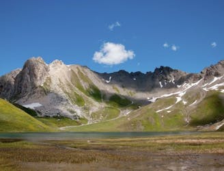
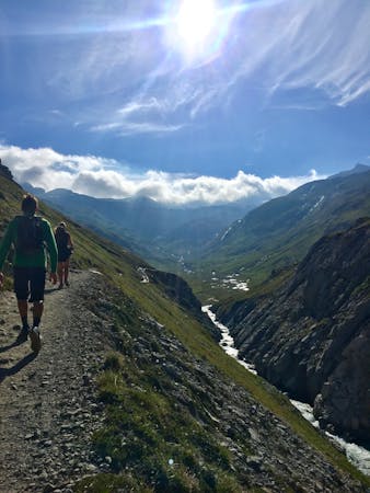
The French Alps are famed for offering a spectacular landscape in a mountainous environment—a truly magical and stunning place to hike. This hike takes you to one of the best geological curiosities in Vanoise National Park: the "eye of the needle."
The route is best serviced from Tignes 1,800 as it starts from the top of the Palafour chairlift. There is plenty of parking in Tignes. Alternatively, there is a trail starting from the bottom of the lift area, should you choose to extend the hike and walk up instead of taking the lift.
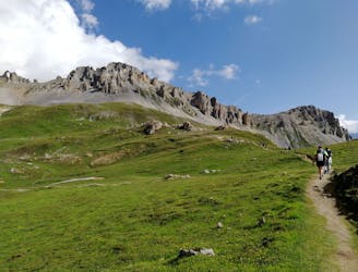
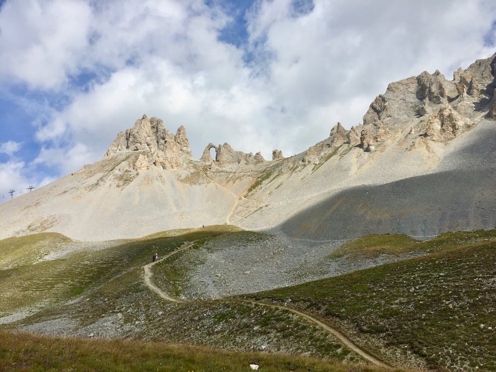
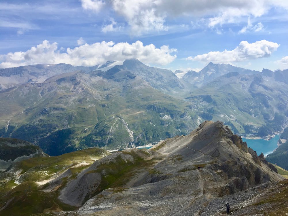
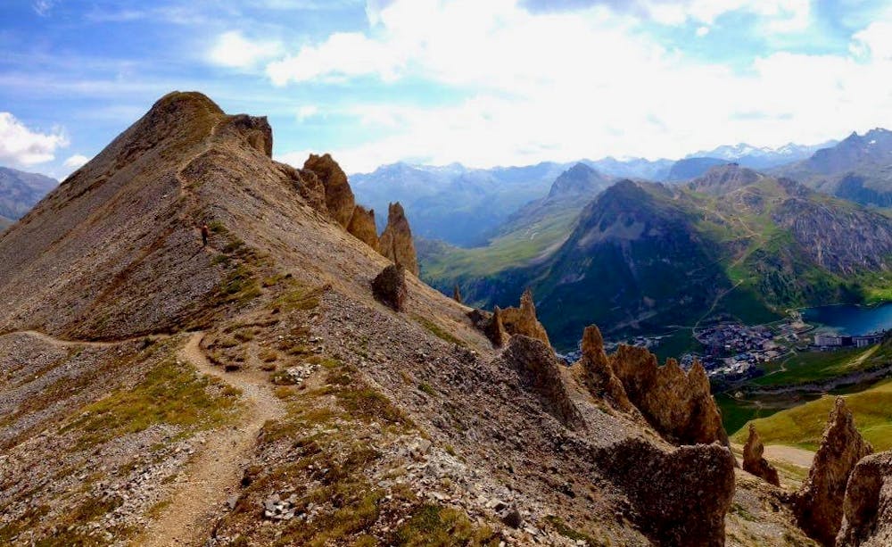
Waymarkers clearly direct the way straight from the top of the chairlift, following signs for Aiguille Percée. The intended tagged ridgeline with the famous natural archway is looming and inviting in the distance. The route is visibly laid out ahead of you towards the archway of Aiguille Percée.
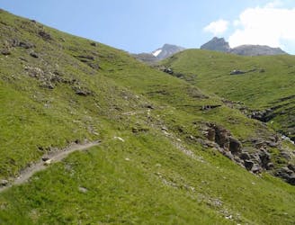
Initially, the route is easy going, but as soon as the path zigzags ahead it rises steeply to almost a scramble. The approach to the archway is very steep.
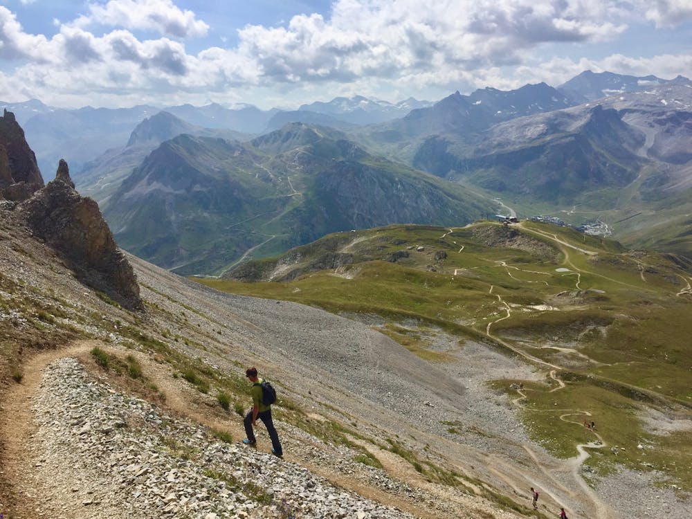
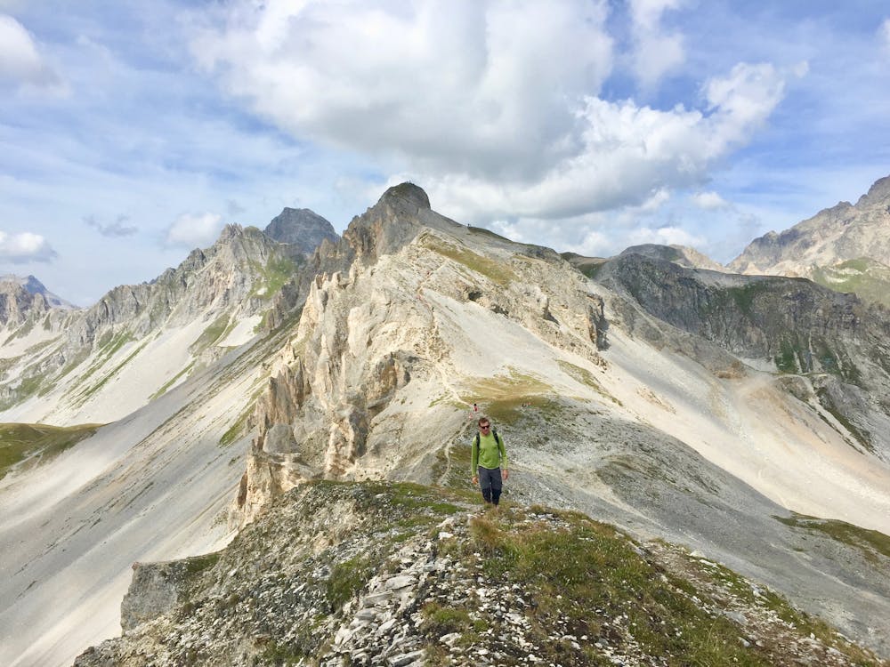
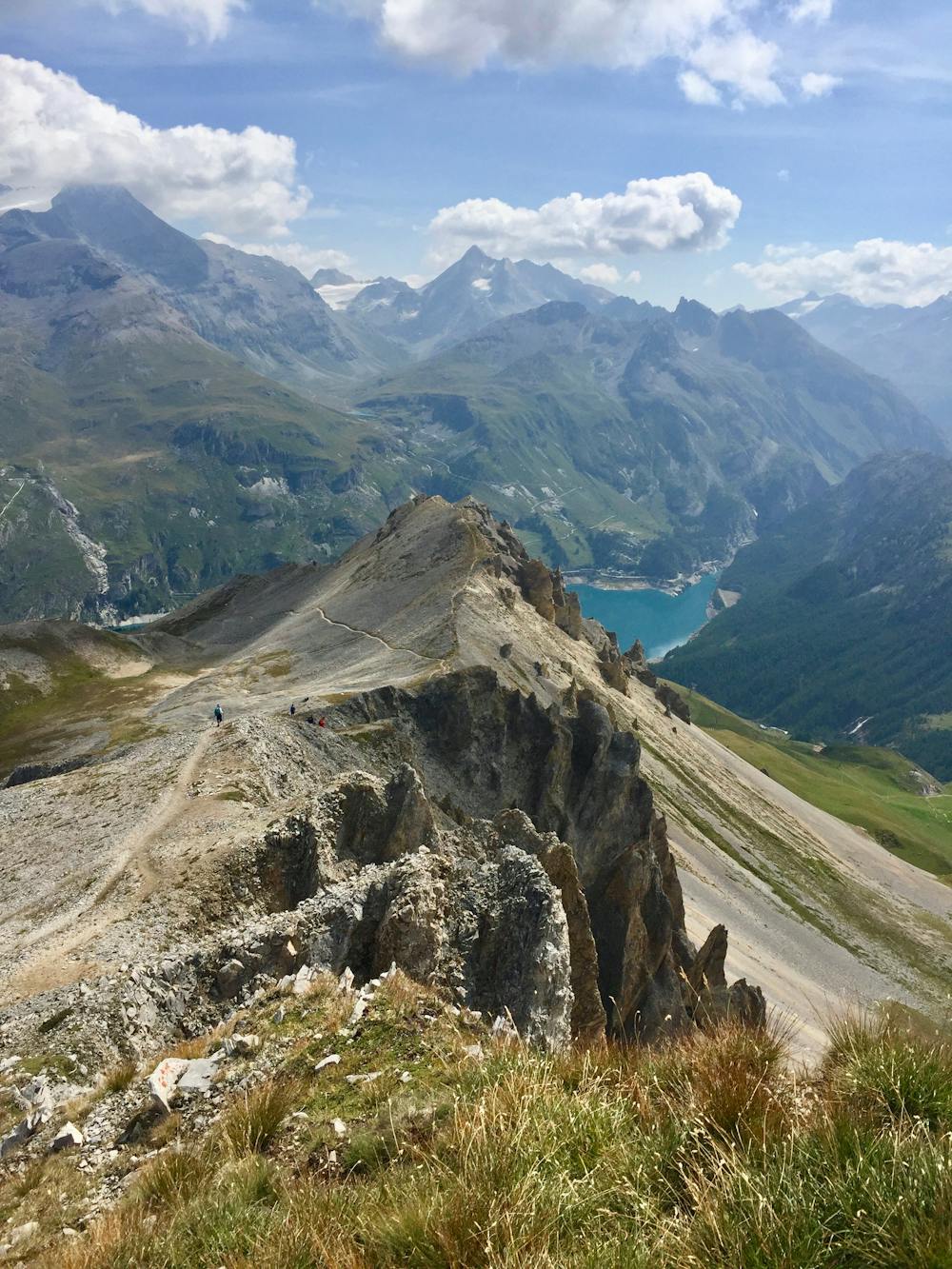
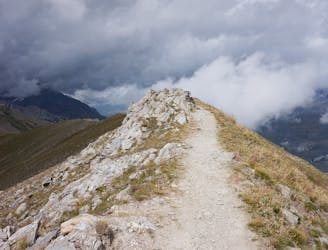
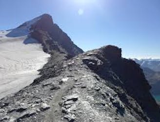
Once at the archway, you cannot climb the Aiguille Percée but you can "thread the needle" by standing in the archway. From here, the panoramic views across the entire Tignes valley, the Grande Motte, and the Grande Casse are truly stunningd—and they continue for the remainder of the ridgeline.
The trail continues along the top of the ridgeline and then starts to descend to one side of the ridge. At times the trail is very steep and loose underfoot.
There are a couple of ways to descend the ridgeline and drop back to Tignes—all of which end at the same point. The option shown here takes a slightly less steep way down the initial drop off the ridgeline.
Note that the lifts are only open for a short, summer period between July and August.
Difficult
Hiking trails where obstacles such as rocks or roots are prevalent. Some obstacles can require care to step over or around. At times, the trail can be worn and eroded. The grade of the trail is generally quite steep, and can often lead to strenuous hiking.

Some trail sections are extremely exposed where falling will almost certainly result in serious injury or death.

Little chance of being seen or helped in case of an accident.
1.3 km away
Instead of riding the lift, follow this hike to reach the top of the Palafour Lift and extend the Aiguille Percée hike.
Moderate Hiking
1.3 km away
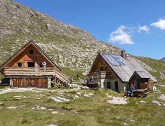
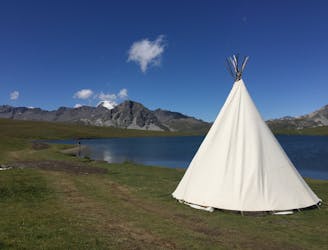
A combination of the Tignes Resort and the heart of the national park. The contrast is amazing but telling of the history of the Vanoise.
Moderate Hiking
1.3 km away

A lovely route with lakes, a dam, traditional alpine hamlets, and beautiful views of Mount Pourri.
Moderate Hiking
1.3 km away
From the shores of Tignes Lake, pass two Cols on your way to the peaceful refuge below Grande Motte.
Moderate Hiking
3.1 km away
A true alpine experience with high exposure along the Tovière ridge.
Moderate Hiking
3.9 km away
This summit climb provides a high alpine challenge along a ridgeline beside Sassière glacier, with stunning views the entire route.
Difficult Hiking
7.1 km away
A stunning and strenuous round circuit through the Bailletaz Nature Reserve, passing above the glacial Lac de la Sassière.
Difficult Hiking
7.1 km away
Discover Lac d'Ouillette, hidden from view from the Val d'Isere resort and onwards to a remote, rugged Col.
Moderate Hiking
7.6 km away
Hike to an incredible glacier from the small town of La Gurraz.
Moderate Hiking
8.6 km away
This hike towards the Col and Lake Grand Fond in Vanoise National Park offers a superb view of the glaciers, the peaks, and a beautiful lake.
Difficult Hiking
8 routes · Hiking

14 routes · Hiking