1.9 km away
Via Alpina: Tignes Lake to Leisse Refuge
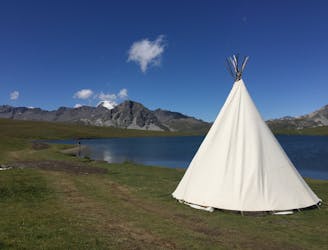
From the shores of Tignes Lake, pass two Cols on your way to the peaceful refuge below Grande Motte.
Moderate Hiking
- Distance
- 12 km
- Ascent
- 701 m
- Descent
- 306 m
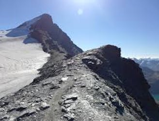
A true alpine experience with high exposure along the Tovière ridge.
Hiking Moderate

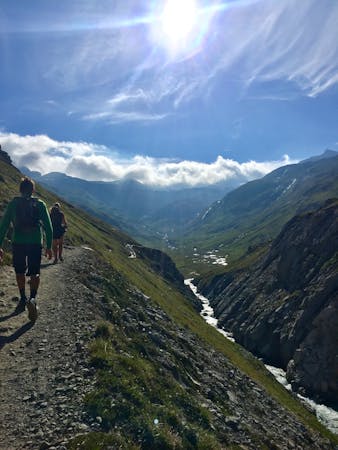
The French Alps are famed for offering a spectacular landscape in a mountainous environment—a truly magical and stunning place to hike. This route offers a true alpine experience with high exposure along the Tovière ridge.
Lac de Tignes is the best place to park, as the trail starts from the top of the Tovière lift, which is taken from this centre. Alternatively, this trail can be combined with other trails in the area for a longer hike or to connect to/from other areas.
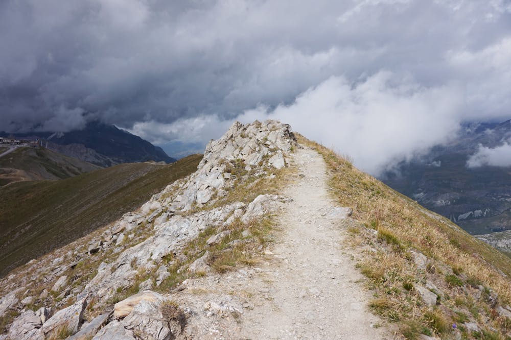
Pas de la Tovière is reached at the top of the Tovière lift at 2,704m alt. The trail starts here and is signed as the "Pointe de Fresse," all though you may have heard of this route referred to as "Ice Tignes."
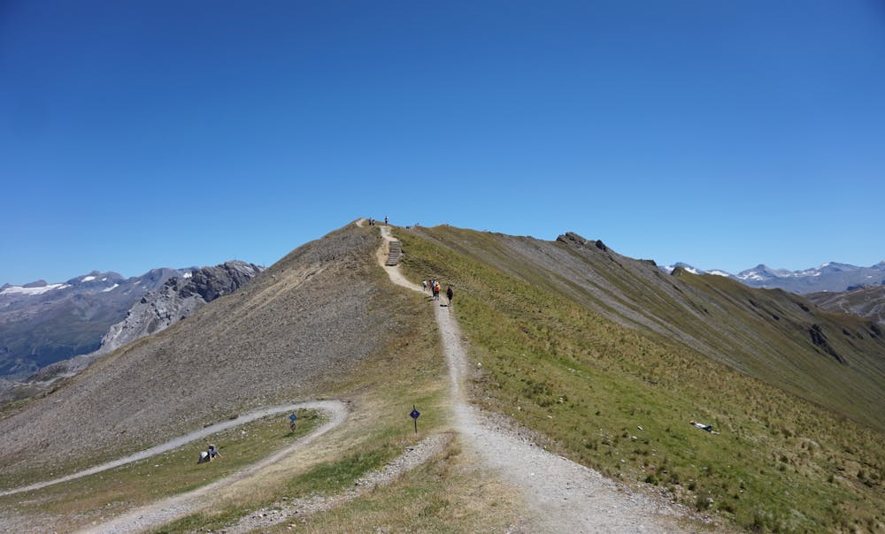
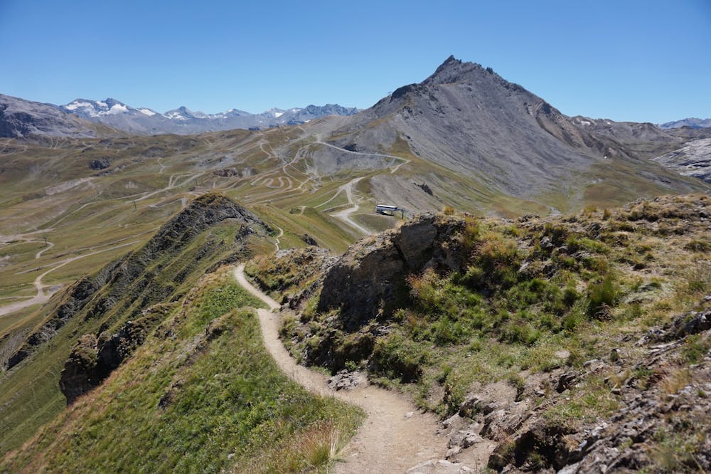
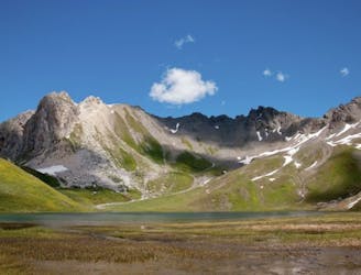
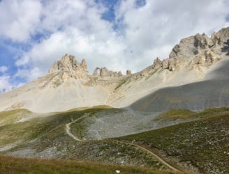
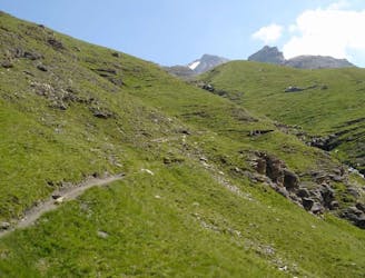
The trail begins with a short descent. The route is clearly visible ahead and opposite as it climbs back up and along the ridgeline. It continues to climb until the high point of the ridge is reached: Pointe de Fresse (2,694m).
The panoramic views all along the ridge are stunning! Take the time to stop at Pointe de Fresse to absorb them.
Continue along the ridge trail, which will now descend. As this is an "out and back" route, the return will be the reverse of what you've already walked. You can turn around at any time along the ridge or continue to the end.
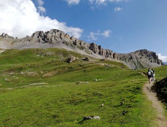
The trail is an easy, well-trodden path with very few rocks/boulders to walk over, but there is a high level of exposure—which you would expect from walking along a ridgeline, as the terrain falls away at each side.
The lifts are open for a short summer period between July and August. Hiking is possible outside of the summer season with the correct equipment and experience for the given conditions.
Moderate
Hiking along trails with some uneven terrain and small hills. Small rocks and roots may be present.

Some trail sections are extremely exposed where falling will almost certainly result in serious injury or death.

Little chance of being seen or helped in case of an accident.
1.9 km away
From the shores of Tignes Lake, pass two Cols on your way to the peaceful refuge below Grande Motte.
Moderate Hiking
1.9 km away

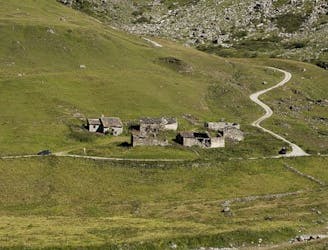
A lovely route with lakes, a dam, traditional alpine hamlets, and beautiful views of Mount Pourri.
Moderate Hiking
1.9 km away
A combination of the Tignes Resort and the heart of the national park. The contrast is amazing but telling of the history of the Vanoise.
Moderate Hiking
1.9 km away
Instead of riding the lift, follow this hike to reach the top of the Palafour Lift and extend the Aiguille Percée hike.
Moderate Hiking
3.1 km away
A hike to one of the best geological curiosities in Vanoise National Park: the "eye of the needle" and a spectacular high alpine ridgeline trail.
Difficult Hiking
4.5 km away
A stunning and strenuous round circuit through the Bailletaz Nature Reserve, passing above the glacial Lac de la Sassière.
Difficult Hiking
4.5 km away
Discover Lac d'Ouillette, hidden from view from the Val d'Isere resort and onwards to a remote, rugged Col.
Moderate Hiking
4.8 km away
This summit climb provides a high alpine challenge along a ridgeline beside Sassière glacier, with stunning views the entire route.
Difficult Hiking
5.5 km away
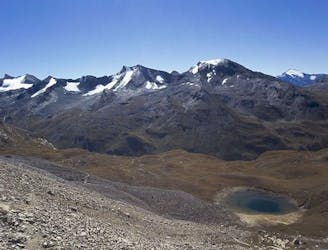
This hike towards the Col and Lake Grand Fond in Vanoise National Park offers a superb view of the glaciers, the peaks, and a beautiful lake.
Difficult Hiking
7 km away
A long-distance hike with a rare landscape on arrival.
Moderate Hiking
8 routes · Hiking

14 routes · Hiking