5.8 km away
Lavoir to the Refuge du Mont Thabor
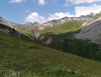
A lovely day trip on its own, or a positioning day ahead of summiting Mont Thabor
Moderate Hiking
- Distance
- 5.2 km
- Ascent
- 597 m
- Descent
- 11 m
Follow the Via Alpina from Savoy to the Hautes Alps.
Also in Hautes-Alpes, France
Hiking Moderate

This route is full of gorgeous landscapes and brings you to remote alpine settlements in Italy and France. Plus, there’s a bonus challenge for the mega fit- summiting Mount Thabor!
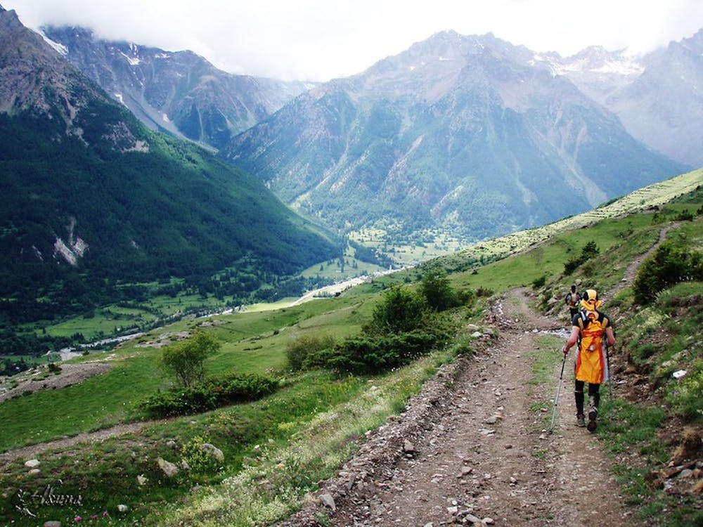
Day 1 Begin at Modane- a border town in the French Savoie close to Italy, which is easily accessible by train from Chambery, Lyon, or Turin. You will be starting on the Via Alpina R125 Red route passing from Mondane to Charmaix, ascending through dense forest, meandering through meadows before reaching the day’s hiking highlight as the trail opens out onto the Mount Thabor Massif. Find out more about the Modane Canton here and book your night's accommodation in the Mount Thabor hut here.
Day 2 A short walking day of only 2.5 hours from Refuge Mont Thabor to the Granges de la Vallée Étroite. The trail continues to follow the R125 Red Via Alpina Route. Taking you through a narrow valley, the Vallée Etroite pass, you cross over to Italy, descending steeply down to the Granges de la Vallée Etroite hamlet, a French enclave on Italian territory. It’s quaint and well set up for tourists as it transforms into a ski village in the winter months. Find out more about Granges de la Vallée Etroite and where to stay here..
Day 3 Brace yourself for your toughest walking day: 7 hours with a total 1030m ascent. The trail goes along the Via Alpina R126 and R127 stages, leaving the Granges de la Vallée Etroite, it heads up to the beautiful high altitude Chevillon lake at the Thures pass. The trail then comes back down again, heading in the direction of the protected Clarée valley. Rest up in the traditional village of Névache, before tackling your final climb of the day up to the Refuge de Buffère.
Day 4 The final day is 4 hours of glorious views and varied terrain. Upon leaving the Refuge de Buffère, continue following the R127 which will lead you through the Buffère Pass into the Guisane Valley, where you’ll have splendid views of the Ecrins massif. The trail starts a period of descent, pulling away from the R127 as it climbs down to the Roman thermal town of Monêtier-les-Bains. Rest up for a night in the very comfortable and affordable Gite le Flourou before taking a bus to either Grenoble or Briançon train stations.
Souces
Moderate
Hiking along trails with some uneven terrain and small hills. Small rocks and roots may be present.

The trail contains some obstacles such as outcroppings and rock which could cause injury.
Away from help but easily accessed.
5.8 km away
A lovely day trip on its own, or a positioning day ahead of summiting Mont Thabor
Moderate Hiking
9.5 km away
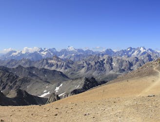
A wild mountain day taking you to one of France's best known summits
Difficult Hiking

3 routes · Hiking