5.2 km away
Berni Couloir

One of the most aesthetic couloirs on this side of the mountain
Severe Ski Touring
- Distance
- 2.9 km
- Ascent
- 55 m
- Descent
- 880 m
initiation into steep skiing?
Ski Touring Difficult

This line is the easiest of the couloirs that descend from the Testa Grigia. Although it's the easiest is quite difficult indeed, it could be a first approach to a good ski mountaineer that wants to try steep skiing. It's a remote itinerary far from lifts so you have to be completely autonomous. The slopes are wide and gentle at the beginning then you'll have to ski a steep couloir to access again ample slopes. Stay on the right and reach Hochene Stei, those are summer stables, and then reach the wood just above Gressoney La Trinitè.
Difficult
Serious gradient of 30-38 degrees where a real risk of slipping exists.

In case of a fall, death is highly likely.

In the high mountains or remote conditions, all individuals must be completely autonomous in every situation.
5.2 km away
One of the most aesthetic couloirs on this side of the mountain
Severe Ski Touring
7.7 km away
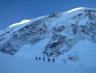
Day 3: Traverse of Passo del Naso of Lyskamm and summit of Pyramid Vincent, beginning at Rifugio Quintino Sella and ending at Capanna Gnifetti.
Severe Ski Touring
7.7 km away
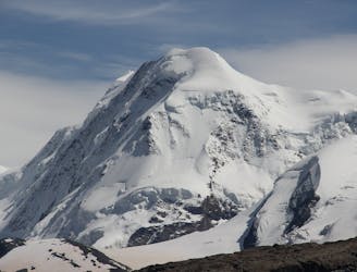
Venture up Switzerland’s famously treacherous Liskamm 4000er, affectionately nicknamed the “people eater”.
Severe Ski Touring
9.5 km away
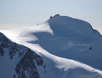
Day 4: Margherita Hut and the Grenz Glacier, beginning at Gnifettti Hut and ending at Neue Monte Rosa Hut
Difficult Ski Touring
9.7 km away
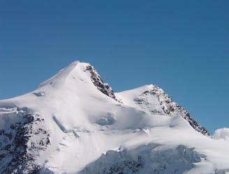
Day 2: Traverse of Castor, optional extra summit of Pollux, beginning at Rifugio Guide d'Ayas and ending at Rifugio Quintino Sella
Severe Ski Touring

5 routes · Ski Touring

16 routes · Ski Touring