324 m away
Monte Rosa Haute Route: Margherita Hut and the Grenz Glacier
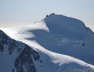
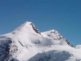
Day 4: Margherita Hut and the Grenz Glacier, beginning at Gnifettti Hut and ending at Neue Monte Rosa Hut
Difficult Ski Touring
- Distance
- 12 km
- Ascent
- 1 km
- Descent
- 1.8 km
Capanna Gnifetti - Punta Gnifetti - Gabiet
Also in Vercelli, Italy
Ski Touring Moderate

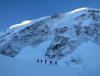
This is a popular ski touring route which is generally considered to be moderate. It's remote, it features low exposure (e1) and is typically done between January and June. From a low point of 1.9 km to the maximum altitude of 4.5 km, the route covers 19 km, 1019 vertical metres of ascent and 2780 vertical metres of descent. You'll need rope, skins, ice axe, crampons and glacier kit to complete it safely.
Capanna Gnifetti - Punta Gnifetti - Gabiet
Beautiful altitude ski touring on mellow slopes in a well frequented area. Good concentration of easy to reach 4000+m peaks. Perfect for acclimatization. Long and enjoyable descent to as low as the snow cover allows.
Moderate
Slopes become slightly steeper at around 25-30 degrees.

Exposure is limited to that of the slope itself. Getting hurt is still likely if the slope is steep and/or the snow is hard.

Away from help but easily accessed.
324 m away
Day 4: Margherita Hut and the Grenz Glacier, beginning at Gnifettti Hut and ending at Neue Monte Rosa Hut
Difficult Ski Touring
4.6 km away
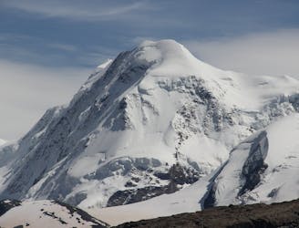
Day 3: Traverse of Passo del Naso of Lyskamm and summit of Pyramid Vincent, beginning at Rifugio Quintino Sella and ending at Capanna Gnifetti.
Severe Ski Touring
4.6 km away
Venture up Switzerland’s famously treacherous Liskamm 4000er, affectionately nicknamed the “people eater”.
Severe Ski Touring
5.9 km away

One of the most aesthetic couloirs on this side of the mountain
Severe Ski Touring
6.7 km away
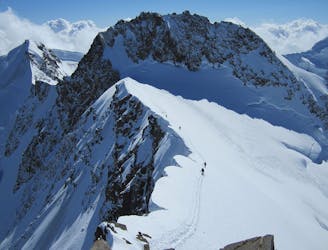
Day 5: A huge skin to a high col and optional climb up Europe's 2nd highest peak
Severe Ski Touring
6.9 km away
Day 2: Traverse of Castor, optional extra summit of Pollux, beginning at Rifugio Guide d'Ayas and ending at Rifugio Quintino Sella
Severe Ski Touring

5 routes · Freeride Skiing · Ski Touring

5 routes · Ski Touring

16 routes · Ski Touring