1.2 km away
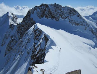
Monte Rosa Haute Route: Margherita Hut and the Grenz Glacier
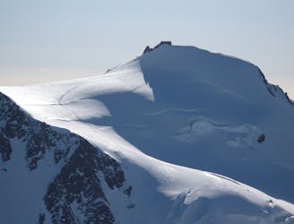
Day 4: Margherita Hut and the Grenz Glacier, beginning at Gnifettti Hut and ending at Neue Monte Rosa Hut
Difficult Ski Touring
- Distance
- 12 km
- Ascent
- 1 km
- Descent
- 1.8 km
Another entrance for Lys valley
Ski Touring Severe

Another couloir to access the Lys Valley, this is a bit lower then Guides Couloir but more skiable. Often a 60m rappel is required to enter the first part then it's pure freeride into this magic itinerary. From Indren keep skiing on your right and continue skiing till you pass under the first big rock bar. Here the slope will be flat so you can easily put on your skins. Go uphill for about half an hour towards Mantova Refuge. When you're about under the refuge stay on your left following the evident rock ridge till a cross. From here starts the couloir. The first section is quite steep (45°), 40m of rope are useful to ski this first part. There are some bolts where you can set up the rappel. The first part is the steepest then the slope gently descends into the Lys glacier. This line follows the amazing Lys glacier till town. The slope is never too steep and always nicely skiable. The last section follows a deep forest into town (Staffal). You'll reach the lifts with skis on your feet!
Severe
Steep skiing at 38-45 degrees. This requires very good technique and the risk of falling has serious consequences.

In case of a fall, death is highly likely.

In the high mountains or remote conditions, all individuals must be completely autonomous in every situation.
1.2 km away
Day 4: Margherita Hut and the Grenz Glacier, beginning at Gnifettti Hut and ending at Neue Monte Rosa Hut
Difficult Ski Touring
4.3 km away
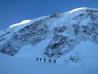
Day 3: Traverse of Passo del Naso of Lyskamm and summit of Pyramid Vincent, beginning at Rifugio Quintino Sella and ending at Capanna Gnifetti.
Severe Ski Touring
4.3 km away
Venture up Switzerland’s famously treacherous Liskamm 4000er, affectionately nicknamed the “people eater”.
Severe Ski Touring
5 km away

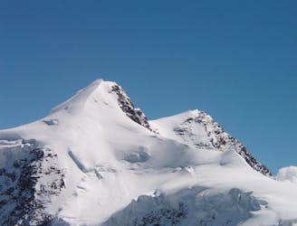
One of the most aesthetic couloirs on this side of the mountain
Severe Ski Touring
7 km away
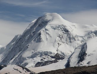
Day 2: Traverse of Castor, optional extra summit of Pollux, beginning at Rifugio Guide d'Ayas and ending at Rifugio Quintino Sella
Severe Ski Touring
7.8 km away
Day 5: A huge skin to a high col and optional climb up Europe's 2nd highest peak
Severe Ski Touring

5 routes · Freeride Skiing · Ski Touring

5 routes · Ski Touring

16 routes · Ski Touring