4.5 km away
Peitlerkofel / Sass de Putia
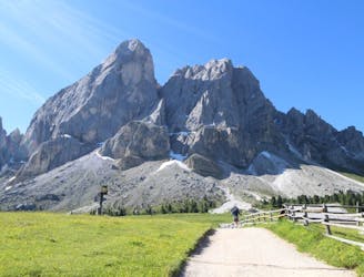
A long, beautiful day up and around a quintessential Dolomites peak.
Severe Hiking
- Distance
- 17 km
- Ascent
- 1.1 km
- Descent
- 1.1 km
A real contender in the views department!
Hiking Severe

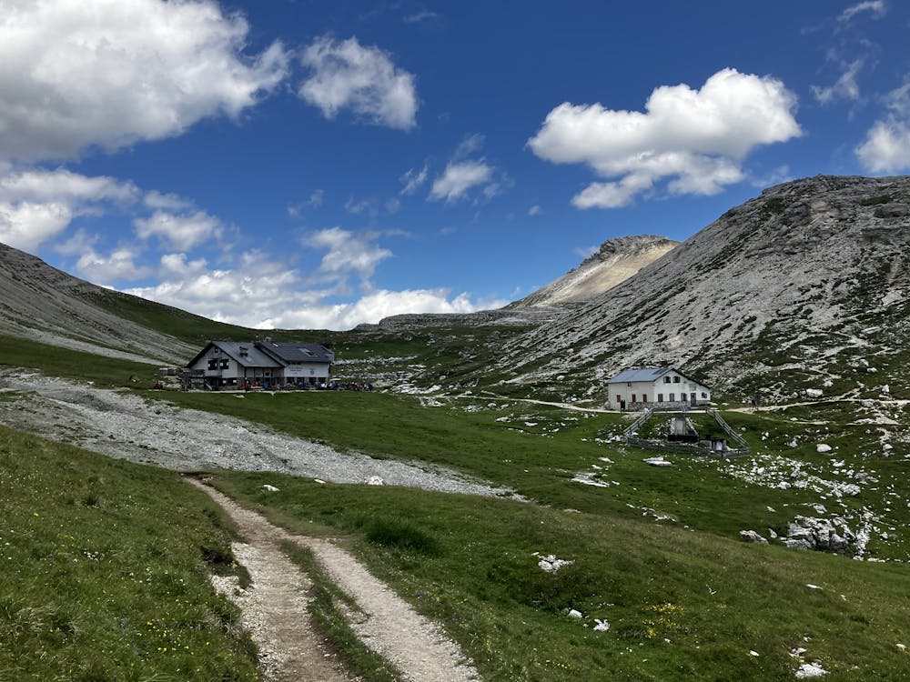
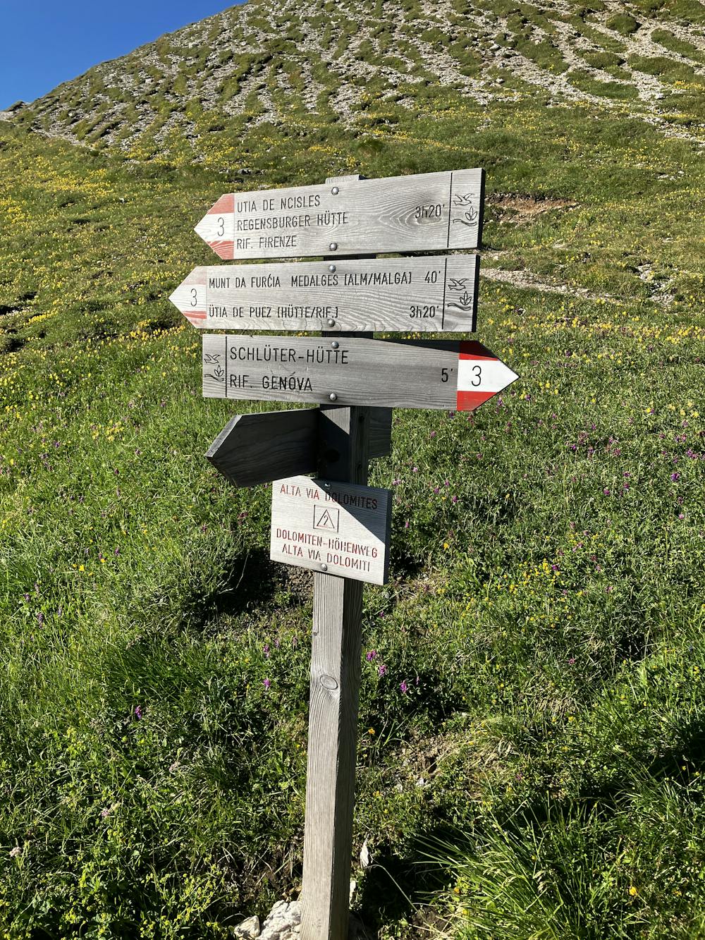
Starting Location: Rifugio Genova Ending Location: Rifugio Puez Optional Routes: (A) Path 3 leading to 2 to avoid easy via ferrata Regional Map: Tabacco Map 030 Path Numbers: 3, 3A, 3B Places to eat/drink on route: None, order pack lunch from Rif. Genova the night before
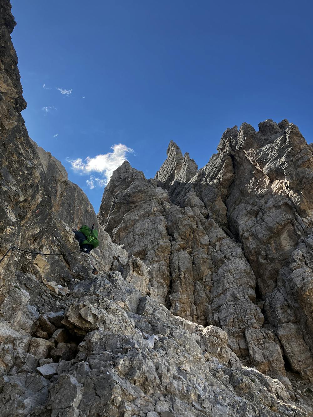

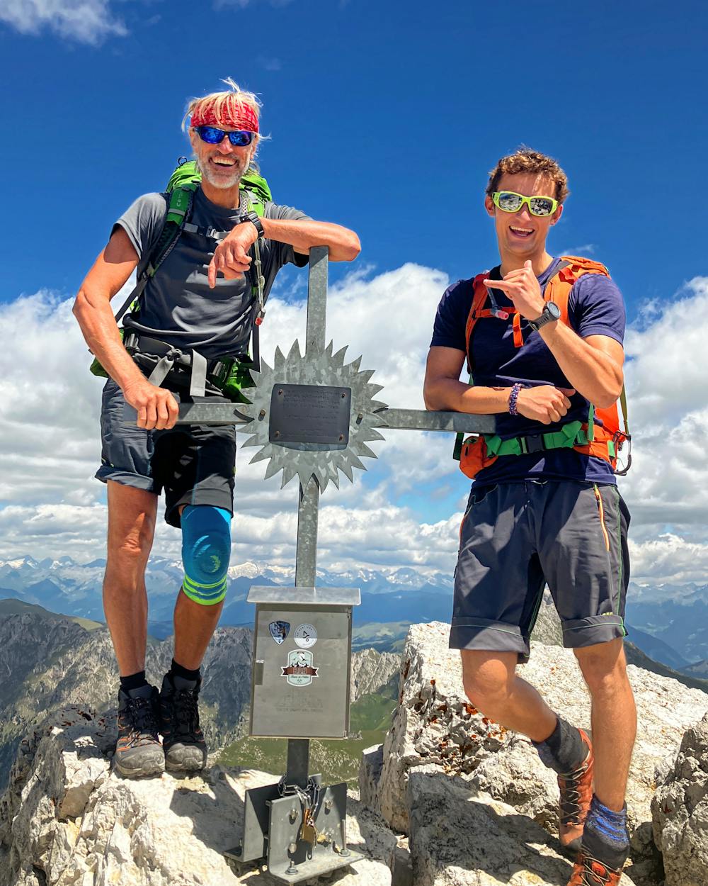
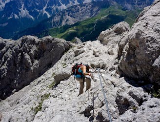
This section of the AV2 really pumps you up for some Dolomiti terrain, encountering somewhat everything. Nice paths, sweaty ascents, sharp descents, an easy via ferrata and a summit on Piz Duleda (2,909m).
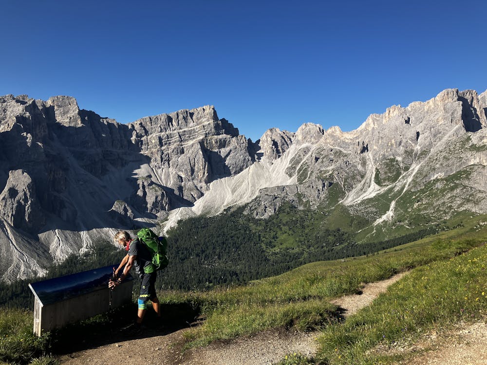
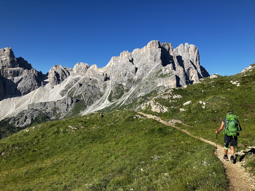
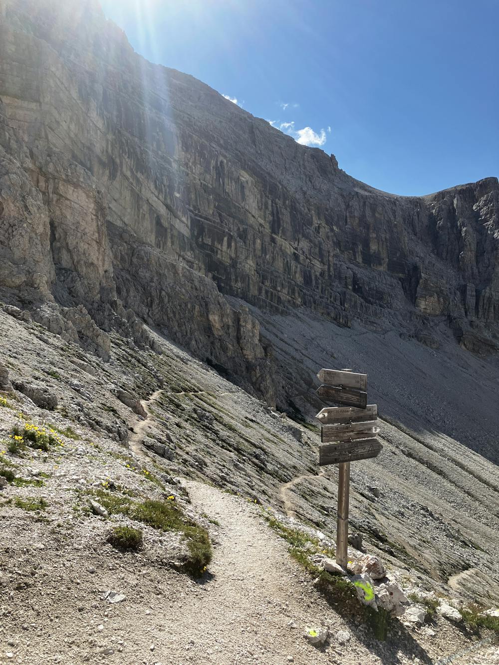
Take path 3 from Rifugio Genova and embrace a gentle climb to an outstanding viewpoint. Once it’s all soaked in, traverse across that big valley you’ve been staring at for the past 10 minutes. Keep an eye out for marmots in this region, they seem to be incredibly friendly here and will hang about while you stare at each other for a long time. The traverse starts to climb up to the Forcella della Roa saddle. The scree slope is tricky and steep, so watch out for rocks being kicked by hikers above you.
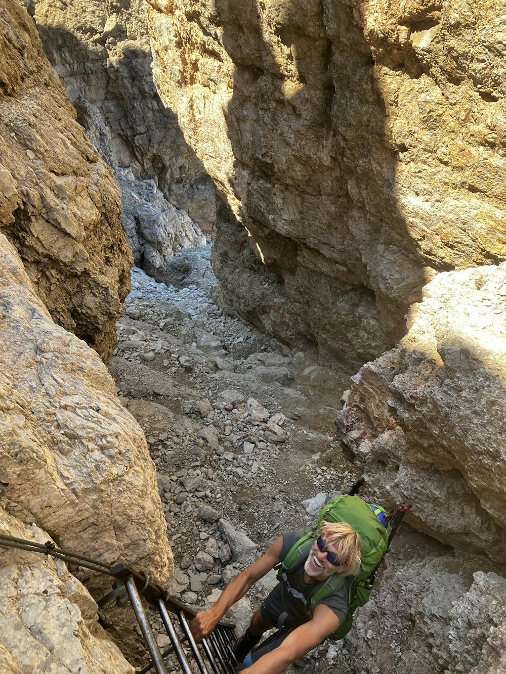
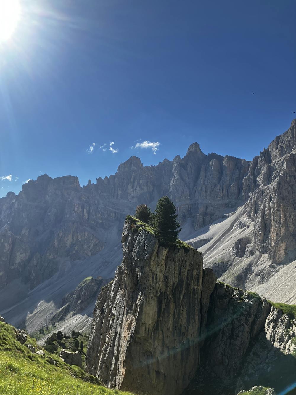
Reach the saddle, admire the view, and have a mild panic attack while you observe the terrain that path 3A leads you into. Now you can stop panicking because it presents much worse than it actually is. Follow the path as it traverses the slope of Piz Duleda and make your way to the start of the via ferrata. Via ferrata equipment is advised but perfectly achievable without (it’s up to you to make that decision). Ascend the easy via ferrata section being mindful for loose rocks coming down from above and top out on the Forcella di Sielles saddle.
Optional Route (A) – To avoid the 3A via ferrata, at Forcella della Roa take path 3 down the valley and then turn left onto path 4. Ascend the ridge before turning right following signs for Rifugio Puez.
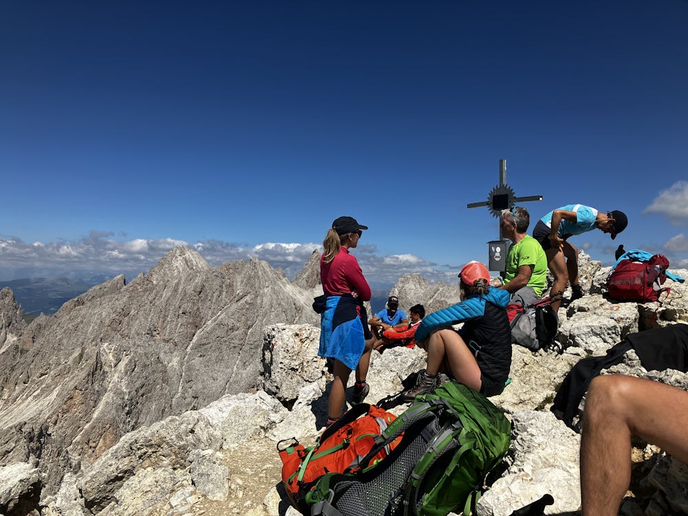
At the Forcella di Sielles saddle, summit Piz Duleda. The views are outstanding and it really displays how incredible this region is. Write your names in the book and then head back down the way you came. Follow the GPX file and signs aiming for Rifugio Puez.
Rifugio Puez https://www.rifugiopuez.it/en/
This hike and guide were completed during summer weather conditions. This is just one opinion of this route. Make sure to do your own research by consulting internet resources, mountain guides or guidebooks to evaluate other opinions so you can be best prepared for the terrain.
A Guide by Red
Severe
Hiking challenging trails where simple scrambling, with the occasional use of the hands, is a distinct possibility. The trails are often filled with all manner of obstacles both small and large, and the hills are very steep. Obstacles and challenges are often unexpected and can be unpredictable.

Some trail sections have exposed ledges or steep ascents/descents where falling could cause serious injury.
Little chance of being seen or helped in case of an accident.
4.5 km away
A long, beautiful day up and around a quintessential Dolomites peak.
Severe Hiking
5.4 km away

One of the best viewpoints in the Dolomites with a fantastic via ferrata to go with it!
Extreme Hiking
9.1 km away
The strenuous “Way of the Legends” high altitude hiking trail across the Dolomites.
Difficult Hiking
9.1 km away
The first day of the legendary AV2!
Severe Hiking
3 routes · Hiking

10 routes · Hiking
6 routes · Mountain Biking · Hiking

11 routes · Hiking