5.8 km away
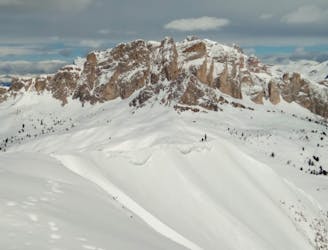
Cima Setsass
A scenic cruise which uses lifts to maximum effect.
Easy Ski Touring
- Distance
- 9 km
- Ascent
- 532 m
- Descent
- 1 km
A varied and exciting tour through some wild Dolomitic peaks.
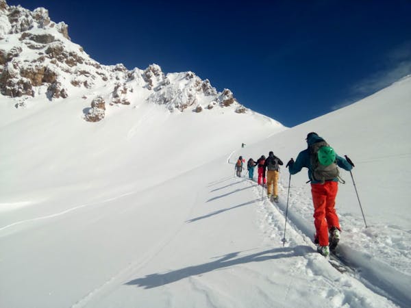
Ski Touring Severe

A linear tour over a towering summit, there are some logical issues to solve before taking on this trip, but it's simple and well worth the effort to deal with them. The reward for your logistical and physical efforts are a magnificent trip through some of the finest and most remote terrain in the Dolomites.
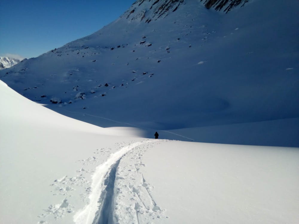
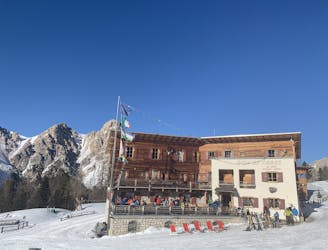
Park up and start skinning at the Rifugio Capanna Alpina and follow a clear and steep track through cliffs until the Col Locia, at which point the landscape really opens up.
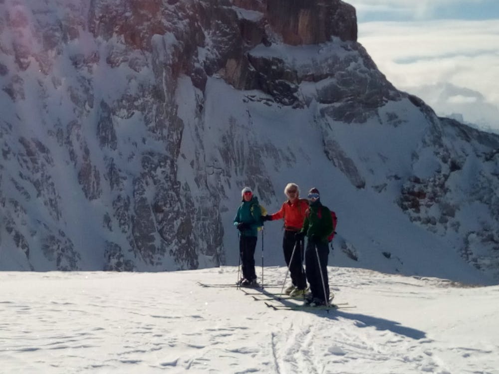
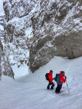
Keep climbing easily up to the Alpe di Fanes Grande valley. Turn left at the top and continue up a big, wide valley to a col from where you can look down into the Alta Badia valley. Put crampons on, turn right and climb a broad shoulder to reach a ridge which leads to the summit of Lavarella. The ridge is narrow without being terrifying, but experience and competence in cramponing is essential if you're to enjoy the ridge and climb it in safety.
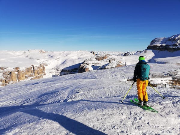
The view from the summit is staggering, and is a great location from which to get your bearings. The Dolomites can feel slightly maze-like when you're in their valleys, but from the summit of Lavarela you will be able to pick out the Sella towers, the Marmolada and several other major landmarks, all of which should give you a better understanding of how the range fits together.
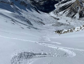
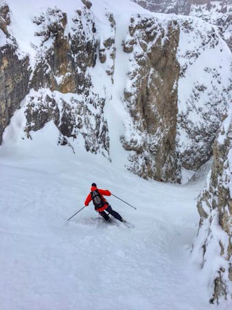
Put skis on and drop down the peak's hanging north face, keeping left to reach a short gully on the right which accesses the fabulous north bowl of the mountain, called Parom valley. Follow it and go left underneath a rock pillar and then put skins on again to climb the gentle slopes leading to the Forcella Lavarella.
Descend the Val Medesc. It faces south and has a totally different ambience to what's preceded it. Follow it down to the trees, then drift right (which the terrain does naturally anyway) to reach a jeep track. Follow this down to the village of Costamoling. If there's enough snow you can continue to Costadedoi but it's unusual.
Wherever you end up, call a taxi back to the car using the following number - 00393356116528.
Once reunited with your car, you will have plenty of charming villages to head for for dinner!
Severe
Steep skiing at 38-45 degrees. This requires very good technique and the risk of falling has serious consequences.

As well as the slope itself, there are some obstacles (such as rock outcrops) which could aggravate injury.

Little chance of being seen or helped in case of an accident.
5.8 km away
A scenic cruise which uses lifts to maximum effect.
Easy Ski Touring
6.3 km away
Peaks and Couloirs - A fantastic varied day tour from the Rifugio Fanes
Severe Ski Touring
7.9 km away
A staggering trip along a ridge deep in the heart of the Dolomites
Moderate Ski Touring
9.8 km away
A big and incredibly beautiful trip which can be split in 2 if required.
Moderate Ski Touring
7 routes · Freeride Skiing · Ski Touring
7 routes · Ski Touring
3 routes · Ski Touring
6 routes · Ski Touring