523 m away
Calcheira classic

A nice tree line in a magic forest
Moderate Freeride Skiing
- Distance
- 1.1 km
- Ascent
- 0 m
- Descent
- 338 m

A nice tree line with some open fields parts
Freeride Skiing Difficult

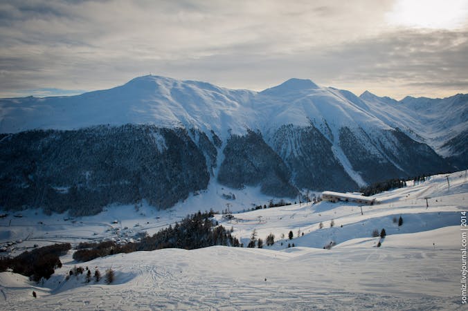
From Costaccia top station head left to the wooden cross facing the valley of Livigno. Descend just under it and at first keep to the right above a shoulder with some bigger trees. Avoid the left part which is more steep. Then after the first 200 metres start heading left, picking whichever line looks best. You will then see a path that goes again to the left to a wider forest that you can ski all the way until its end. At the final open fields you will see the lifts of the Costaccia in the bottom and you can decide which one to head to.
Difficult
Serious gradient of 30-38 degrees where a real risk of slipping exists.
523 m away

A nice tree line in a magic forest
Moderate Freeride Skiing
3.7 km away

A typical Livigno run: a gentle open field followed by a steeper forest down to the valley.
Moderate Freeride Skiing
3.8 km away

A great way to finish your off piste day in Mottolino area.
Moderate Freeride Skiing
4.3 km away

A long run in a wild valley close to the resort
Difficult Freeride Skiing
4.3 km away

Pleasant off piste which holds powder long after snowfall.
Moderate Freeride Skiing
4.5 km away

Best approach to off piste terrain in Livigno
Moderate Freeride Skiing
4.5 km away

An extended run in the famous Vallaccia
Difficult Freeride Skiing
4.5 km away

THE off-piste run in Livigno
Moderate Freeride Skiing

7 routes · Freeride Skiing