4.2 km away
Alta Via 2 – Rifugio Passo Valles to Rifugio Mulaz
A shorter day on the AV2 but options to explore!
Severe Hiking
- Distance
- 6.5 km
- Ascent
- 748 m
- Descent
- 227 m
A moderately hard day with some tiresome ascents and steep descents!
Hiking Extreme

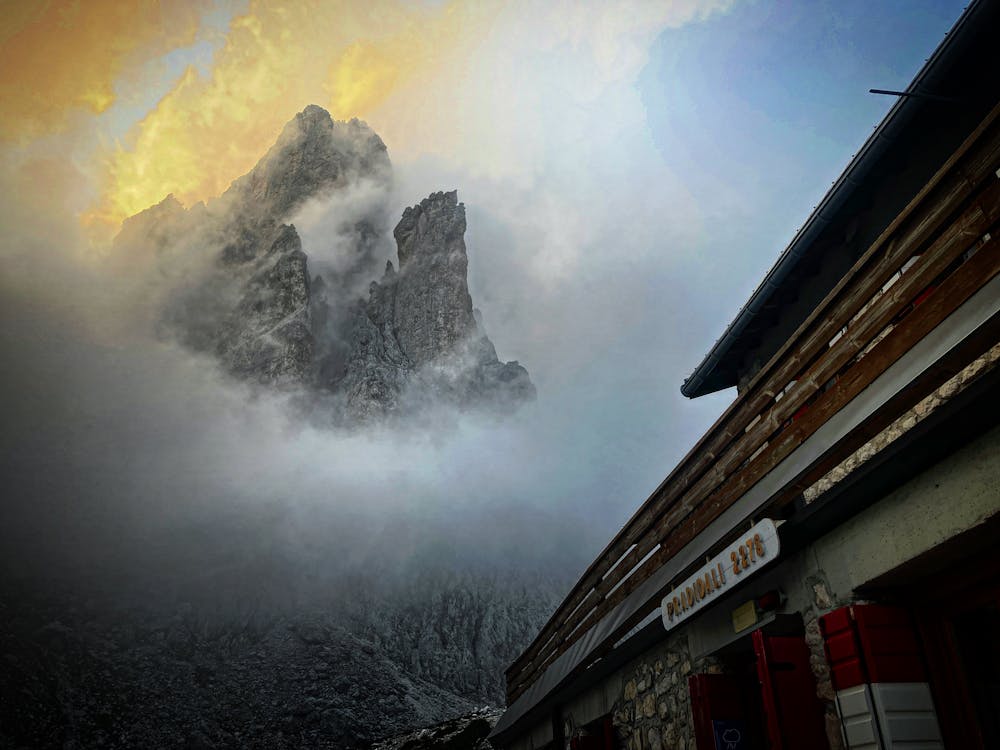
Starting Location: Rifugio Mulaz Ending Location: Rifugio Pradidali Optional Routes: (A) Via Ferrata Del Porton Regional Map: Tabacco Map 022 Path Numbers: 703, 702, 715 Places to eat/drink on route: Rifugio Rosetta Pedrotti
This section of the AV2 can be completed in 2 days if you so desire, staying at Rifugio Rosetta Pedrotti. This however would make for an incredibly short day on the second day, so the recommendation is to start at Rifugio Mulaz and hike through to Rifugio Pradidali.
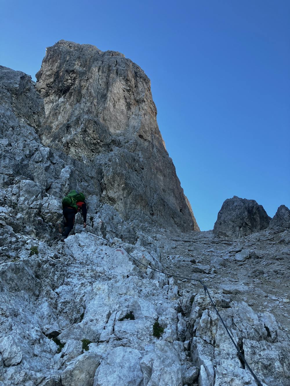
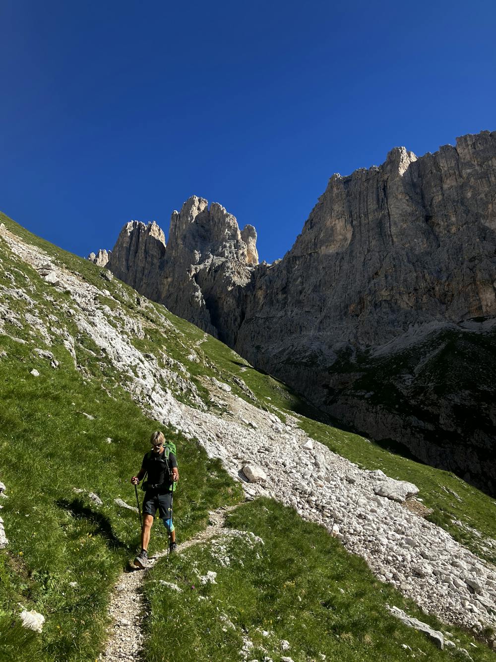
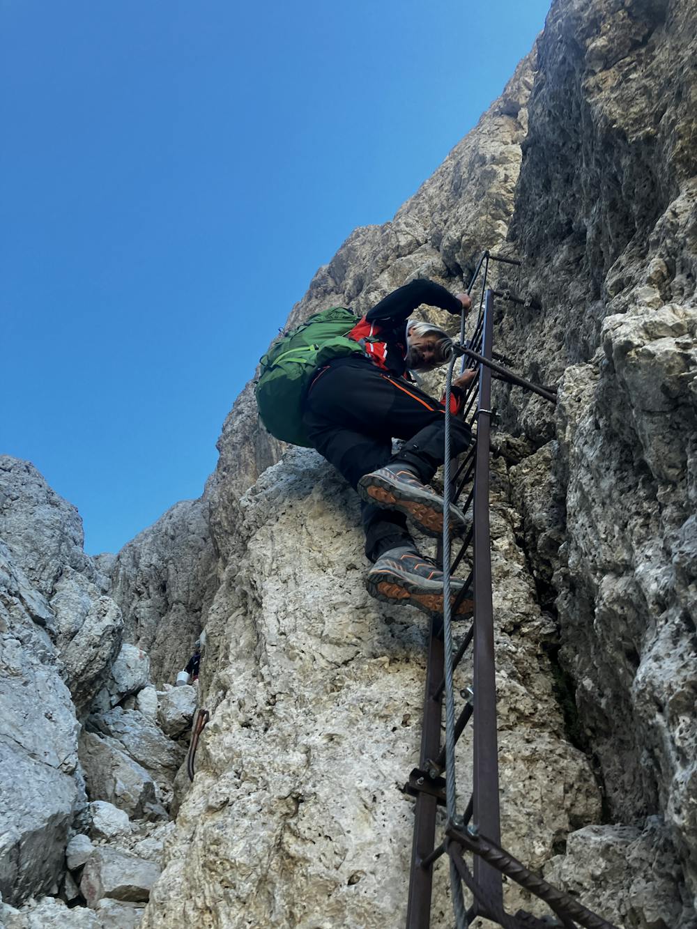
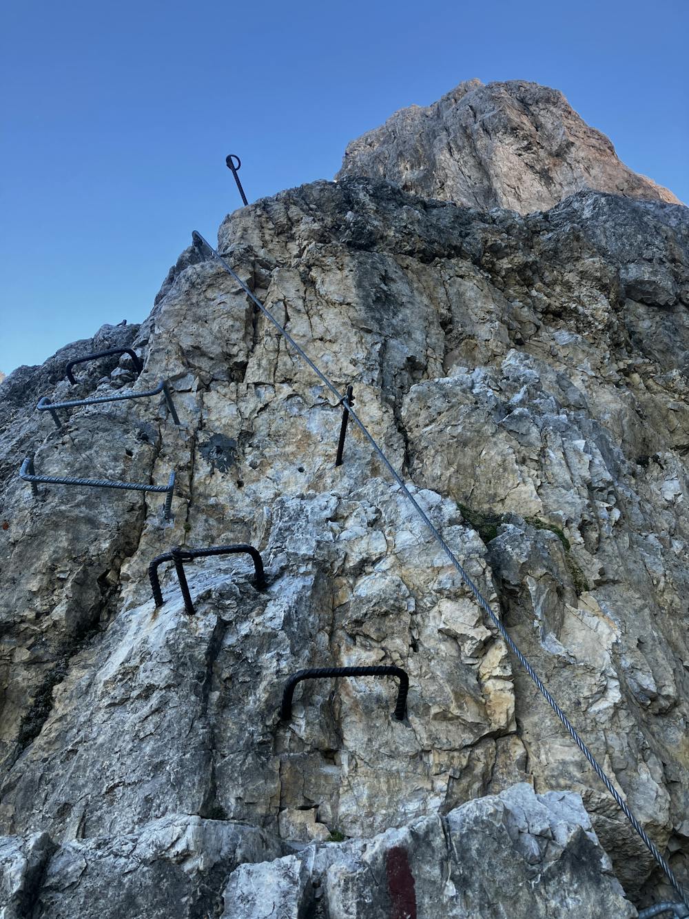
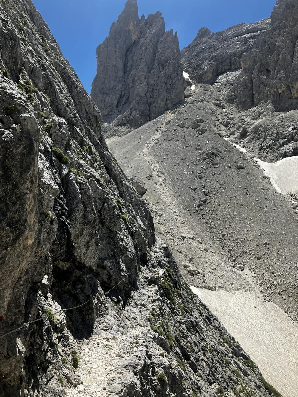
Take path 703 to climb steeply up towards Forcella Margherita. Once again there are sections of the path that are cable-aided. Continue onto Passo delle Farangole for a steep descent on the southeast facing slope with more cables to provide a handrail and even a ladder.
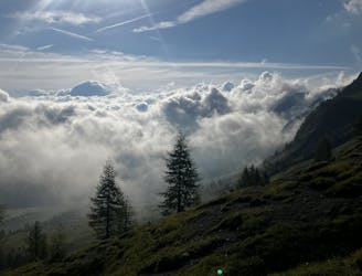
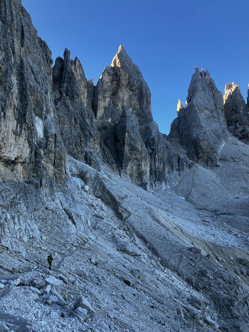
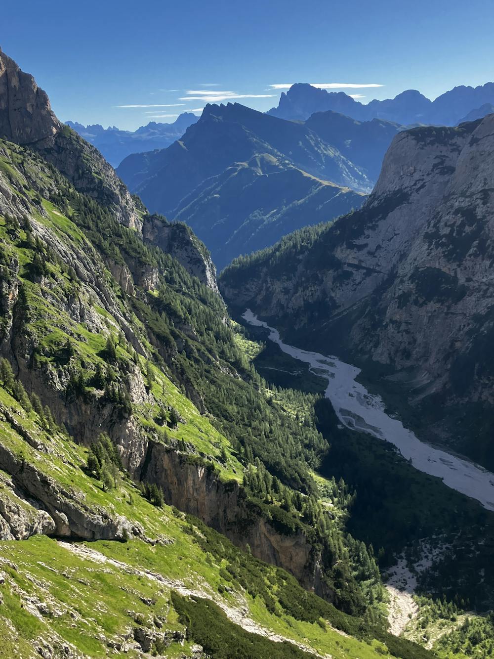
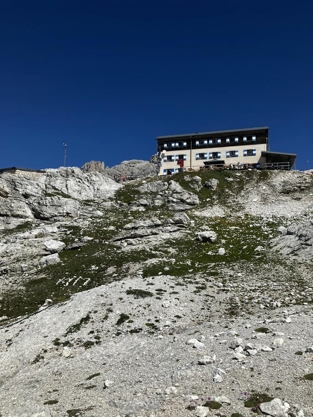
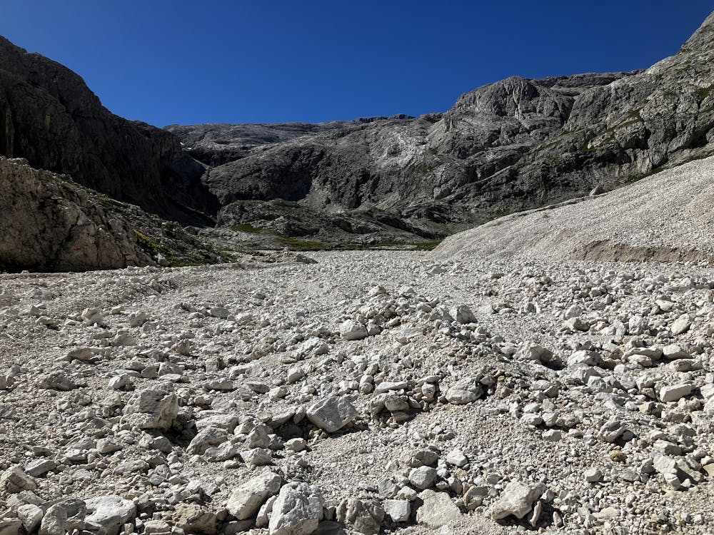
Traverse the steep grassy slopes of the Vezzana (3,192m) mountain and enter the valley. If the sun is out, prepare for a roasting as the heat gets trapped making it very hot during the day, drink plenty of water. Ascend the other side of the valley following the GPX file to snake your way up to Rifugio Rosetta Pedrotti. Enjoy a drink and a snack here while you observe the tourists pouring off the Col Verde gondola.
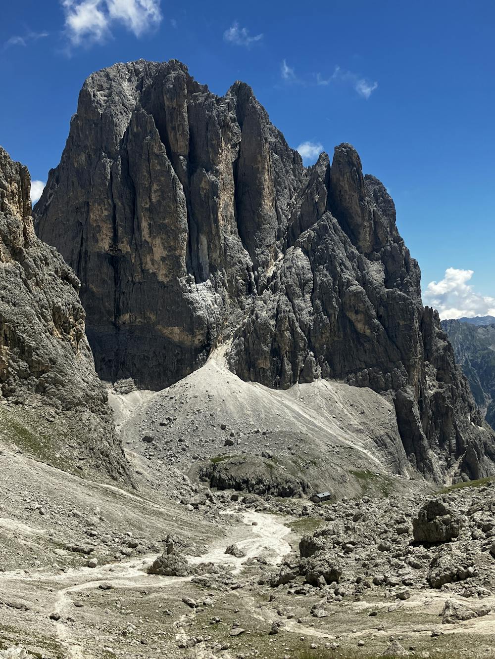
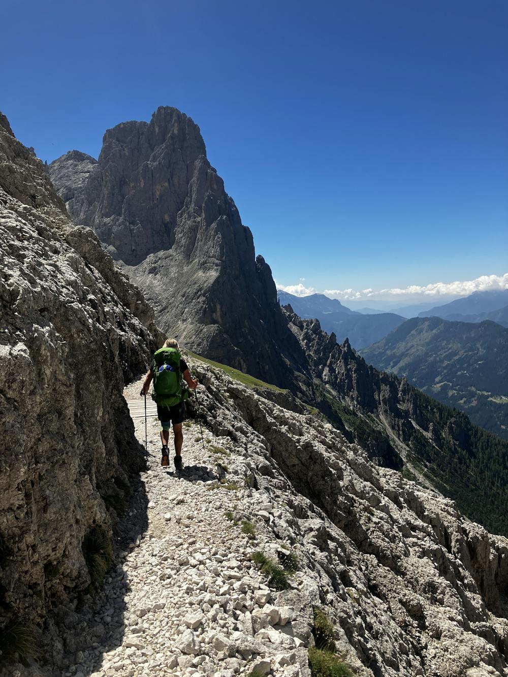
From Rifugio Rosetta Pedrotti, take path 702 that aims directly south to disappear steeply down the valley. The path eventually traverses left in an eastly direction.
Optional Routes (A) – Via ferrata Del Porton is situated in this area and can be joined via some trails. The via ferrata can also be attempted from Rifugio Pradidali. For more information on this via ferrata, click the link below:
https://www.ferrate365.it/en/vie-ferrate/ferrata-del-porton/
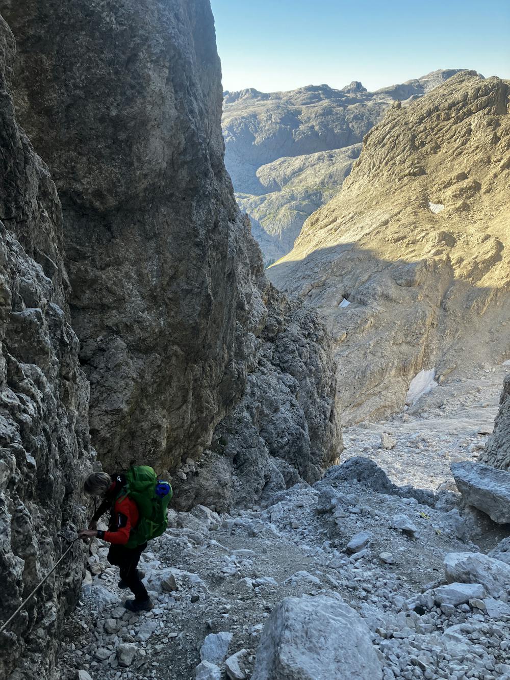
Path 702 merges into path 715 which contains some steeper terrain and cable-aided sections. These sections are exposed and falls here would be fatal. It is your decision whether to wear via ferrata equipment or not. The path eventually leads up Passo del Ball where you should be able to see Rifugio Pradidali down below.
Rifugio Pradidali http://www.rifugiopradidali.com/pradidali/Home.html
This hike and guide were completed during summer weather conditions. This is just one opinion of this route. Make sure to do your own research by consulting internet resources, guidebooks or mountain guides to evaluate other opinions so you can be best prepared for the terrain.
A Guide by Red
Extreme
Scrambling up mountains and along technical trails with moderate fall exposure. Handholds are necessary to navigate the trail in its entirety, although they are not necessary at all times. Some obstacles can be very large and difficult to navigate, and the grades can often be near-vertical. The challenge of the trail and the steepness of the grade results in very strenuous hiking. Hikes of this difficulty blur the lines between "hiking" and "climbing".

Some trail sections are extremely exposed where falling will almost certainly result in serious injury or death.

Little chance of being seen or helped in case of an accident.
4.2 km away
A shorter day on the AV2 but options to explore!
Severe Hiking
7.6 km away
Prepare the mind, body and soul for 1300m of descent!
Extreme Hiking
9.7 km away

A never-ending section of the AV2!
Severe Hiking

11 routes · Hiking