28 m away
Punta Penia
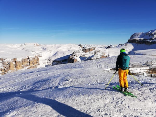
Climb the highest peak in the Dolomites and then ski an exciting north-facing bowl and an epic canyon.
Severe Ski Touring
- Distance
- 9.7 km
- Ascent
- 1.3 km
- Descent
- 1.7 km
A classic journey through some of the most famous mountains in the Dolomites.
Ski Touring Severe

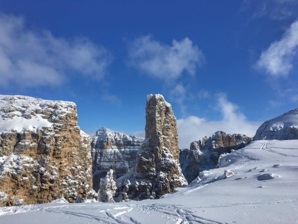
This is a classic journey which takes you below and amongst some truly legendary peaks including the Marmolada - the highest peak in the whole Dolomites.
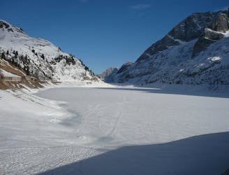
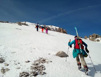
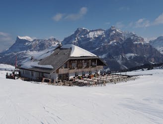
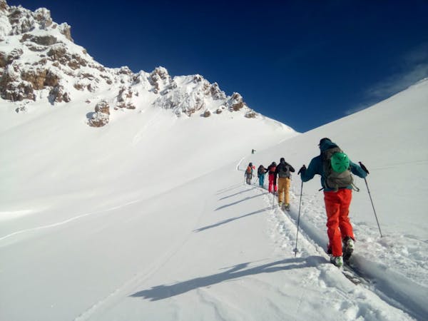
Start out from the dam at Lago di Fedaia where there's parking and a bar. The lift just above the bar is - unfortunately - being removed now so you've got to skin the whole way. Follow the old piste towards the top of the lift, where there's a refuge called Pian dei Fiacconi - which is open from end of February onwards - you can stay there to break up this trip if required.
Climb up towards the Rifugio but branch off right after passing the Col de Bousc peak. There's an old military hut ruin which serves as a good landmark just below Col de Bousc.
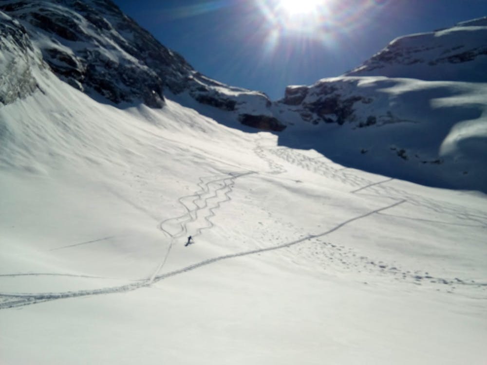
Traverse rightwards easily across a shelf and then turn left and resume climbing once you've passed under a large rocky pillar. Climb up towards the Forcella (col) - about halfway up you get onto a glacier but there are virtually no crevasses - and then be prepared to gasp at the panorama which reveals itself as you arrive. The views to both the north and south are utterly spectacular and the Forcella feels truly "out there".
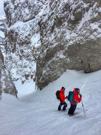
Descend for about 100m below the col to reach a cliff band which you negotiate via a zig zag path/cable. Either rappel (20 metre rappel) or descend the in-situ metal ladder down the far side. The terrain right below the ladder is really steep so be careful if it's icy.
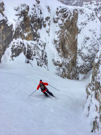
Ski down the valley below, which gradually eases from 40 degrees all the way down. The skiing is superb but this route isn't recommended after a snowfall because the descent faces south and so could be dangerous.
Ski down to Rifugio Contrin (which closed in winter/spring) and then follow a good track down to civilisation. You might need to pole a bit at times but it's easy enough, and there's the prospect of pizza and cold beer to keep you going!
Severe
Steep skiing at 38-45 degrees. This requires very good technique and the risk of falling has serious consequences.

As well as the slope itself, there are some obstacles (such as rock outcrops) which could aggravate injury.

Little chance of being seen or helped in case of an accident.
28 m away
Climb the highest peak in the Dolomites and then ski an exciting north-facing bowl and an epic canyon.
Severe Ski Touring
6.3 km away
An iconic peak followed by a long and varied descent.
Severe Ski Touring
6.3 km away
A true Dolomites classic with a short approach and some atmospheric skiing.
Difficult Ski Touring
6.3 km away
A Stunning Journey Across the Sella Massif Followed By An Aesthetic Steep Descent
Severe Ski Touring
6.7 km away
A staggering trip along a ridge deep in the heart of the Dolomites
Moderate Ski Touring
7.2 km away
A fine summit and then an abseil-accessed couloir make this a Dolomites classic.
Severe Ski Touring
9.3 km away
A scenic cruise which uses lifts to maximum effect.
Easy Ski Touring

50 routes · Freeride Skiing · Ski Touring
7 routes · Freeride Skiing · Ski Touring
5 routes · Freeride Skiing · Ski Touring
7 routes · Ski Touring
3 routes · Ski Touring
6 routes · Ski Touring