3.1 km away
Ball Pass - the modern route
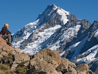
An epic mountaineering adventure crossing 2 alpine passes and traversing the Mount Cook Range. Spectacular views of New Zealand's highest peaks.
Extreme Hiking
- Distance
- 7.9 km
- Ascent
- 633 m
- Descent
- 1.5 km
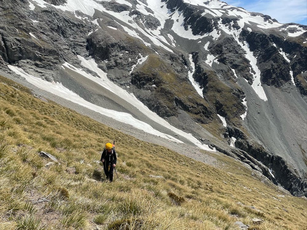
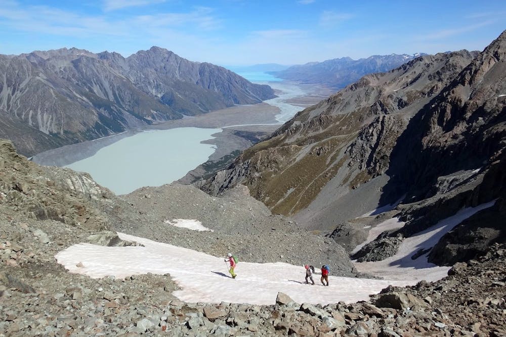
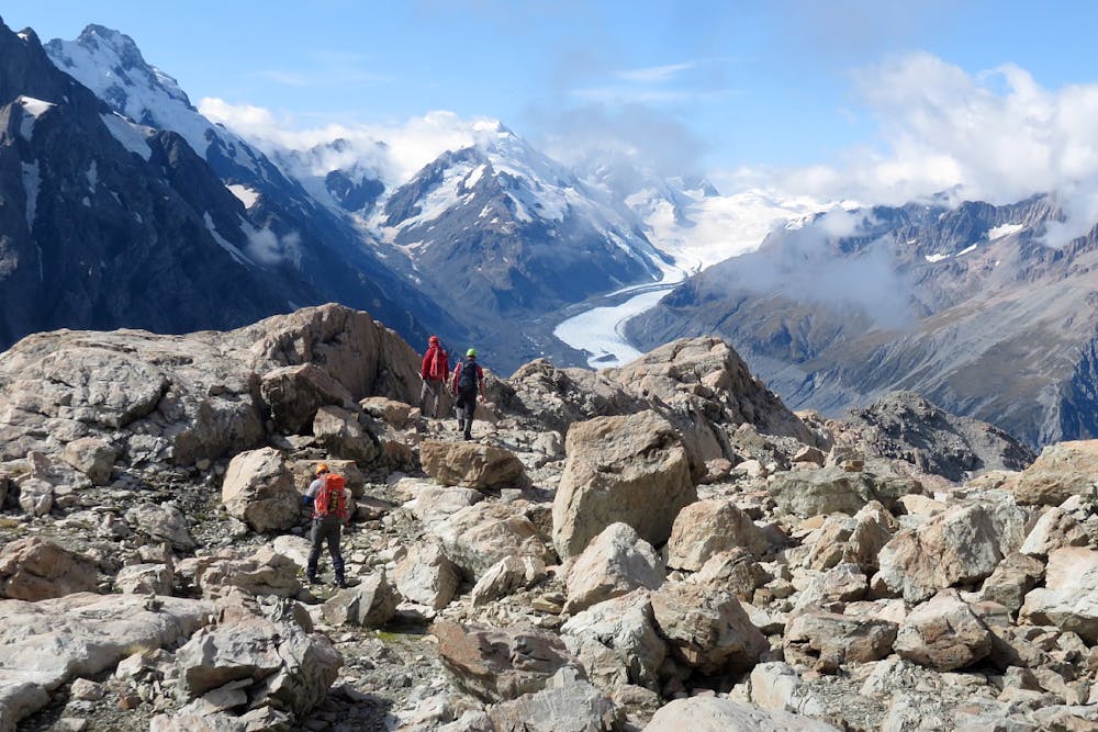
Modern route to Ball Ridge and Ball Pass. Climbs up next to the Cove Stream Gorge, with nice views of waterfalls and the Tasman and Murchison Valleys. Crosses large sections of alpine scrub, scree and boulder fields, steep tussock slopes and snow fields.
Hiking Extreme

Challenge yourself to an adventurous alpine trek, crossing snow fields, a small glacier and untracked, rugged terrain. Trek through amazing alpine terrain, surrounded by New Zealand's highest peaks and longest glaciers.
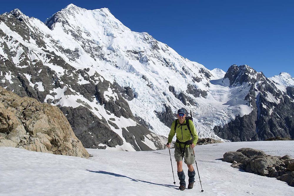
This modern route is a nice alternative to the classic Ball Ridge route to Ball Pass and avoids the Husky Flat washout. It climbs up next to the impressive Cove Stream Gorge, with nice views of waterfalls and the Tasman and Murchison Valleys. Camp on Ball Ridge before returning via the classic Ball Ridge route and Ball Shelter or continue up to climb Kaitiaki Peak and cross Ball Pass.
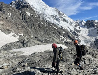
The route crosses exposed ledges, large sections of alpine scrub, scree and boulder fields, steep tussock slopes, mountain streams and snow fields. The slopes below Kaitiaki Peak can have significant avalanche hazard until the snow melts away during summer. Cove Stream and Husky Stream often have large amounts of avalanche debris until mid summer - take care crossing these as the water melts out holes underneath.
Crampons, ice axe and mountaineering experience are recommended if doing this route unguided. Expect a significant amount of snow on the route early in the season and icy conditions on the final section of the route late in the season.
From Husky Flat to Ball Ridge takes around 5-7 hours.
Enjoy this adventurous alpine route with a professional IFMGA / NZMGA mountain guide on Alpine Recreation's trips: → <a href="https://alpinerecreation.com/ballpass.html">Ball Pass Summit Trek</a> → <a href="https://alpinerecreation.com/ballpasscrossing.html">Ball Pass Crossing</a>
Extreme
Scrambling up mountains and along technical trails with moderate fall exposure. Handholds are necessary to navigate the trail in its entirety, although they are not necessary at all times. Some obstacles can be very large and difficult to navigate, and the grades can often be near-vertical. The challenge of the trail and the steepness of the grade results in very strenuous hiking. Hikes of this difficulty blur the lines between "hiking" and "climbing".

Some trail sections are extremely exposed where falling will almost certainly result in serious injury or death.

Little chance of being seen or helped in case of an accident.
3.1 km away
An epic mountaineering adventure crossing 2 alpine passes and traversing the Mount Cook Range. Spectacular views of New Zealand's highest peaks.
Extreme Hiking
4 km away
A 2-3 day mountaineering adventure crossing the Mount Cook Range
Extreme Hiking
9.1 km away
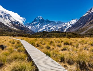
Boasting stunning views of the Mueller Glacier, Hooker Lake and Aoraki/Mount Cook, the Hooker Valley Track is a justifiably popular hike on New Zealand's South Island.
Easy Hiking