6.1 km away
Ball Pass - The Traditional Route
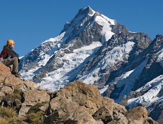
A 2-3 day mountaineering adventure crossing the Mount Cook Range
Extreme Hiking
- Distance
- 27 km
- Ascent
- 1.8 km
- Descent
- 1.7 km
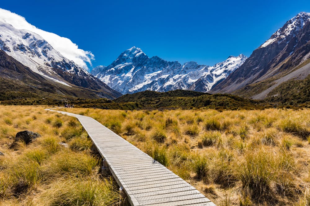
Boasting stunning views of the Mueller Glacier, Hooker Lake and Aoraki/Mount Cook, the Hooker Valley Track is a justifiably popular hike on New Zealand's South Island.
Hiking Easy

The Hooker Valley Track is a popular hiking trail in Aoraki/Mount Cook National Park, located in the South Island of New Zealand. The track is relatively easy and suitable for most fitness levels, and it offers stunning views of the Southern Alps, including Aoraki/Mount Cook, the Mueller Glacier, and Hooker and Mueller Lakes.
The trail starts at the White Horse Hill Campground and follows the Hooker River through the Hooker Valley. Along the way, hikers will pass through grassy meadows, beech forests, and over several swing bridges that cross the river. The track ends at the base of the Hooker Glacier, where you can get close to the massive ice wall and see the glacial meltwater flowing into the Hooker Lake.
The entire round-trip hike takes about 2-3 hours, depending on your pace. It's a popular destination for tourists and locals alike (arrive early to avoid the crowds), and it's a great way to experience the natural beauty of the Aoraki/Mount Cook region.
Easy
Walking along a well-kept trail that’s mostly flat. No obstacles are present.

Close to help in case of emergency.
6.1 km away
A 2-3 day mountaineering adventure crossing the Mount Cook Range
Extreme Hiking
9.1 km away
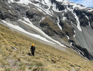
Modern route to Ball Ridge and Ball Pass. Climbs up next to the Cove Stream Gorge, with nice views of waterfalls and the Tasman and Murchison Valleys. Crosses large sections of alpine scrub, scree and boulder fields, steep tussock slopes and snow fields.
Extreme Hiking