0 m away
Mt. Elie de Beaumont West Face
A beautiful and wild roundtrip over to the west side and back again
Severe Ski Touring
- Distance
- 10 km
- Ascent
- 1.5 km
- Descent
- 1.5 km
The northernmost of the Southern Alps' 3000m peaks
Ski Touring Severe

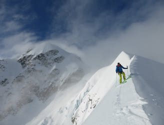
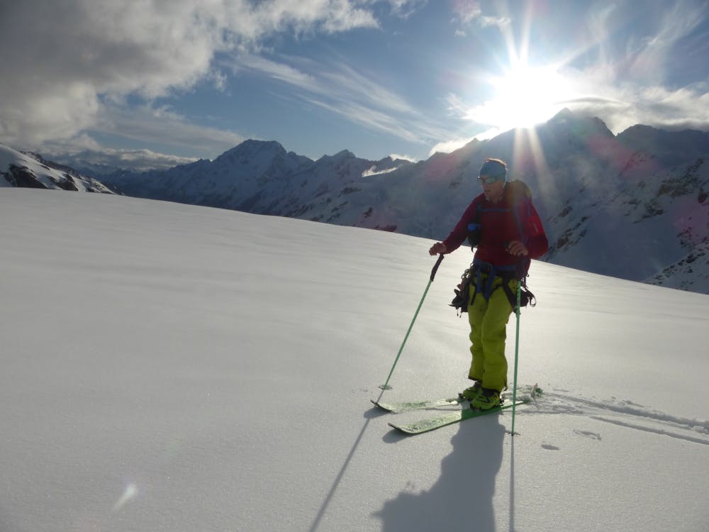
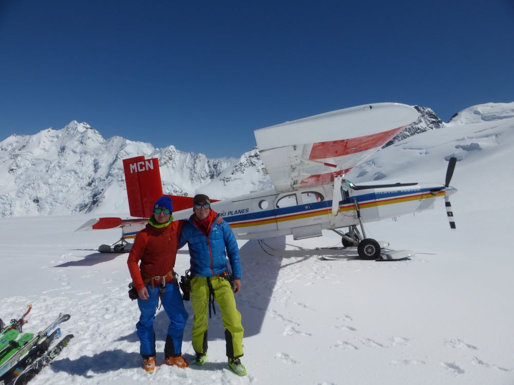
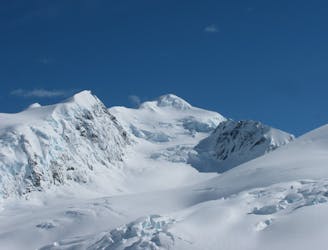
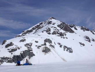
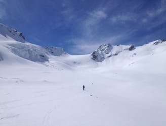
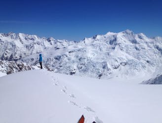
A fantastic mountain and one of the most worthwhile and prominent summits accessible from the upper reaches of the Tasmin Glacier. A popular introductory alpine climb, Elie de Beaumont is often guided in the spring and early summer months. However during the main summer climbing season the Anna Glacier may become impassable. Despite the peak seeing more ascents by mountaineers on foot it does however make for a great ski descent with several variations possible. Due to the serious nature of the glacier, any team must be experienced at navigating complex glacial terrain as well as cramponing up exposed slopes.
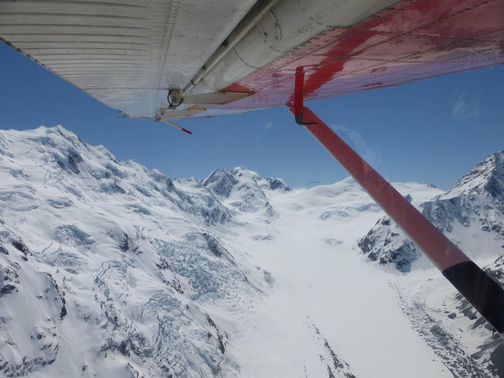
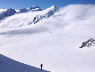
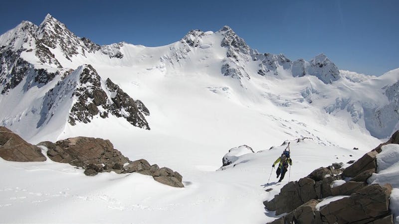
Elie de Beaumont forms part of the ‘great divide’ of the Southern Alps, an expansive ridgeline separating the east and west sides of the South Island and it is thus subjected to typically temperamental weather. The mountain is named after a prominent 19th century French geologist whose full name Jean-Baptiste Armand Louis Léonce Élie de Beaumont is a bit of a mouthful.
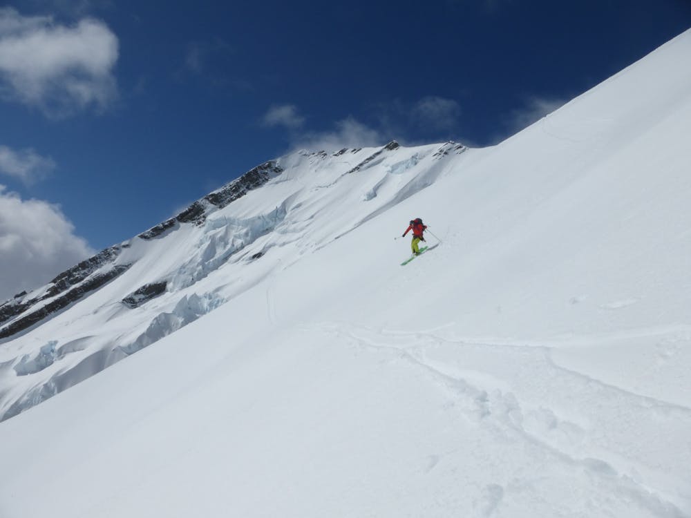
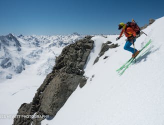
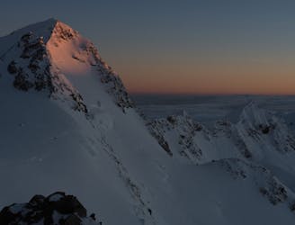
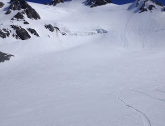
The normal ascent route up the south-east flank is relatively straightforward, however crossing the Anna Glacier can become complicated late in the season. The slope between Mt. Walter and Elie de Beaumont approaches 45 degrees in places, although it is not very sustained nor exposed. The final climb to the summit is often exposed ice and may not be skiable. From below the final summit slopes ski back down roughly following the line of ascent.
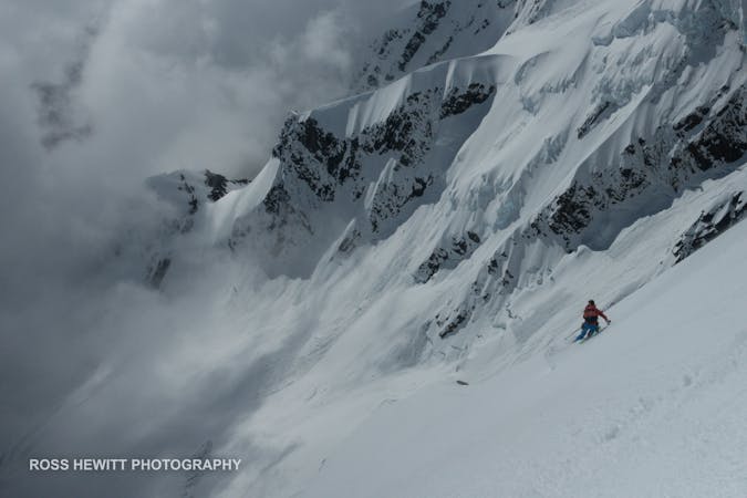
An alternative descent takes the west flank starting from before the summit and just above the col with Mt. Walter. This descent is sustained at 40-45 degrees and good conditions and snow stability are imperative. It is then possible to climb back up the col to a via a couloir or to climb a couloir further to the right which comes out behind Mt. Walter.
Severe
Steep skiing at 38-45 degrees. This requires very good technique and the risk of falling has serious consequences.

As well as the slope itself, there are some obstacles (such as rock outcrops) which could aggravate injury.

Little chance of being seen or helped in case of an accident.
0 m away
A beautiful and wild roundtrip over to the west side and back again
Severe Ski Touring
46 m away
A great introductory ski tour on the Tasmin Glacier's friendliest peak.
Moderate Ski Touring
1.6 km away
One of the more stunning summits within the Tasman Glacier Area
Difficult Ski Touring
1.6 km away
A fantastic half day and accessible ski mountaineering loop
Severe Ski Touring
1.6 km away
One of the more sustained routes within the Tasman Glacier area
Difficult Ski Touring
1.6 km away
Exploring the seldom visited corners of Mount Cook National Park
Moderate Ski Touring
1.6 km away
A great afternoon run on the Tasman Glacier
Easy Ski Touring
1.6 km away
A nice steep face transitioning from the Tasman to Murchison Glacier
Moderate Ski Touring
1.6 km away
A great ski tour explore the more remote areas near the Tasman Glacier
Moderate Ski Touring
1.6 km away
A nice line within the reach of the Kelman Hut
Difficult Ski Touring
3 routes · Ski Touring
17 routes · Ski Touring