0 m away
Mt. Elie de Beaumont via the Anna Glacier
The northernmost of the Southern Alps' 3000m peaks
Severe Ski Touring
- Distance
- 9.1 km
- Ascent
- 1.1 km
- Descent
- 1.1 km
A beautiful and wild roundtrip over to the west side and back again
Ski Touring Severe

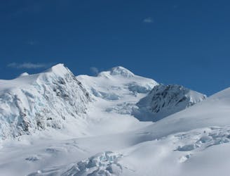
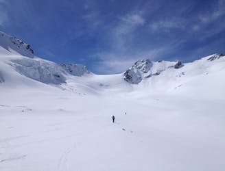
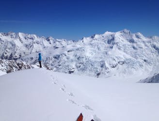
Elie de Beaumont is a beautiful mountain and a popular mountaineering objective situated right on the great divide of west coast and east coast. Its normal route is a relatively non-technical climb and also makes for a good ski descent. However, the west side of the mountain is much more impressive, and wild.
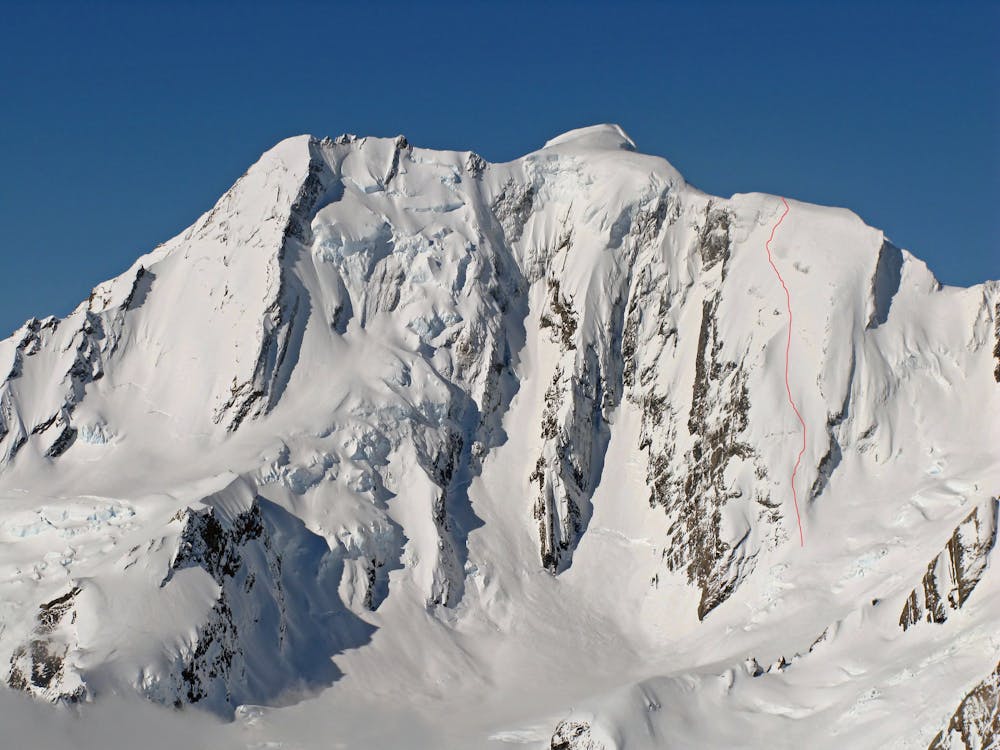
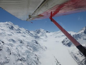
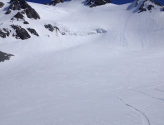
There are two separate lines that have been skied on the west face; one on the far north side of the mountain starting from a subsidiary summit at 3054 meters elevation and another line on the far southern side of the west face starting 100 meters elevation lower than the main summit and due south of it. This line starting south of the main summit has the advantage of having a far easier approach if coming from the upper Tasmin Glacier, therefore it is the line that is described here. These lines could also be approached and climbed from the west side of the range. However, any ski mountaineering trip starting and ending on the west side of Elie de Beaumont is a much more remote and serious proposition than approaching from the east side as recommended here.
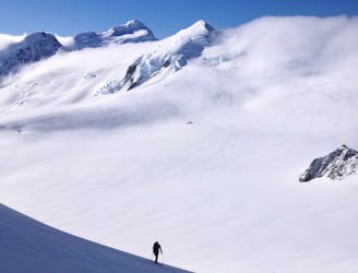
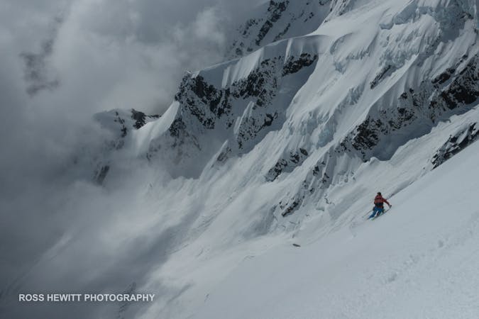
The West Face of Elie de Beaumont is between 500 and 600 meters vertical and ranges from 40-45 degrees. It is therefore fairly easy to ski in good conditions for experienced ski mountaineers. However, it is a wild and committing line that is also difficult to scout if skiing it in a roundtrip as described here. The best way to scout it would be from the plane or heli during the flight in. The West Face of Elie de Beaumont is one of the only lines on the west side of the divide that can be skied in a roundtrip starting from the east side.
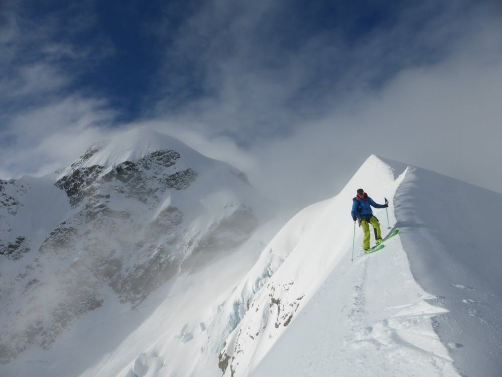
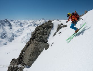
Start by ascending the normal route for Elie de Beaumont (also described in Fatmap) until it is possible to drop into the face from a broad, flat ridge. Descend down pleasant open slopes, exiting skiers left as it steepens to 45 degrees. The line is on a giant rock slab so be sure of the snow stability.
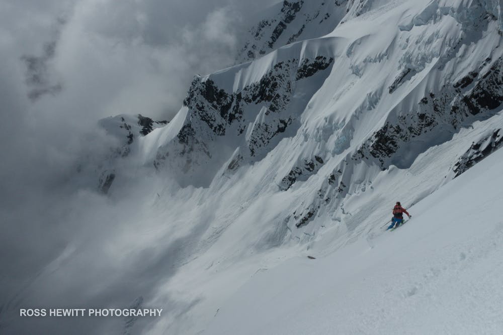
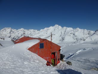
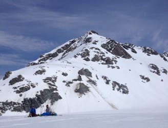
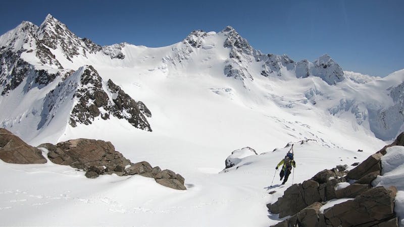
Once on the Times Glacier, there are two options to get back to the east side. The first is to climb immediately left up 35 degree slopes to a col south of the ski line and to the north of Mt. Walter. The second option is to ascend a 50 degree couloir to looker’s right side of the col. This then brings you out to the south-west of Mt. Walter. After climbing back up to the east side of the divide there are multiple fun ways to ski back down to the Tasmin Saddle Hut or the Kelman Hut.
Severe
Steep skiing at 38-45 degrees. This requires very good technique and the risk of falling has serious consequences.

As well as the slope itself, there are some obstacles (such as rock outcrops) which could aggravate injury.

In the high mountains or remote conditions, all individuals must be completely autonomous in every situation.
0 m away
The northernmost of the Southern Alps' 3000m peaks
Severe Ski Touring
46 m away
A great introductory ski tour on the Tasmin Glacier's friendliest peak.
Moderate Ski Touring
1.6 km away
One of the more stunning summits within the Tasman Glacier Area
Difficult Ski Touring
1.6 km away
A fantastic half day and accessible ski mountaineering loop
Severe Ski Touring
1.6 km away
One of the more sustained routes within the Tasman Glacier area
Difficult Ski Touring
1.6 km away
Exploring the seldom visited corners of Mount Cook National Park
Moderate Ski Touring
1.6 km away
A great afternoon run on the Tasman Glacier
Easy Ski Touring
1.6 km away
A nice steep face transitioning from the Tasman to Murchison Glacier
Moderate Ski Touring
1.6 km away
A great ski tour explore the more remote areas near the Tasman Glacier
Moderate Ski Touring
1.6 km away
A nice line within the reach of the Kelman Hut
Difficult Ski Touring
3 routes · Ski Touring
17 routes · Ski Touring