400 m away
Gun Barrel

A natural halfpipe that is great fun for banked slalom
Moderate Freeride Skiing
- Distance
- 1 km
- Ascent
- 0 m
- Descent
- 422 m
Another bowl in the Home Basin offering incredible views and great terrain.
Freeride Skiing Difficult

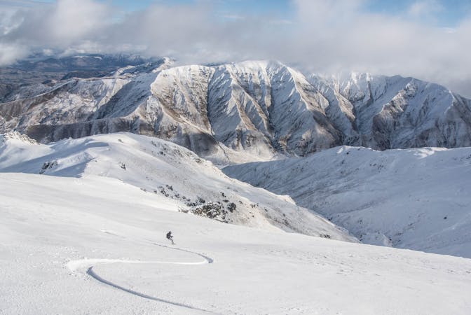
The Matukituki Basin is another gem. It has very playful terrain and stunning views up the Matukituki river. It's only skiable when there has been a good dump of snow, so be careful in here if its low tide,as the run back to the Home Basin can be tricky.
You can ski anywhere within the boundaries (which are obvious due to the sheer cliffs that drop away to the valley floor) . But you need to start heading skiers right to find the path out. There is a boundary fence which can be seen from the top. Don't go any lower than this - when stood on the ridgeline at the top look for this fence and then look to the right, you will see an obvious track out..
When the snow is good this area is a goldmine, a lot of people forget about it and head straight to the saddle, meaning that you can have a lot of fun in here with few others.
Difficult
Serious gradient of 30-38 degrees where a real risk of slipping exists.

As well as the slope itself, there are some obstacles (such as rock outcrops) which could aggravate injury.

Close to help in case of emergency.
400 m away
A natural halfpipe that is great fun for banked slalom
Moderate Freeride Skiing
438 m away

An unmarked area that is full of features
Difficult Freeride Skiing
612 m away

One of many gullies that make up the saddle, this is a big wide one that collects snow.
Difficult Freeride Skiing
717 m away

A steeper walled pipe that collects a lot of snow
Difficult Freeride Skiing
791 m away

A short hike up from Saddle Chairlift
Difficult Freeride Skiing
796 m away

The most playful gully in the saddle
Difficult Freeride Skiing
828 m away

Slightly steeper terrain than Powder Bowl
Difficult Freeride Skiing
928 m away

A short but fun gully
Difficult Freeride Skiing
998 m away

Hike to access Hidden Valley
Moderate Freeride Skiing
1.1 km away

The classic Treble Cone area, perfect for freeride, plus you finish back at the base building.
Difficult Freeride Skiing
10 routes · Freeride Skiing · Ski Touring