11 m away
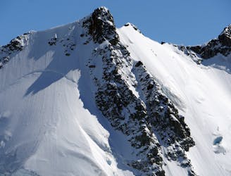
The Minarets
A great and semi easy access ski tour on the West Coast
Moderate Ski Touring
- Distance
- 8.6 km
- Ascent
- 1.1 km
- Descent
- 1.1 km
A stunning and semi-technical ski tour on the West Coast
Ski Touring Difficult

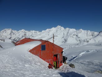
The West Coast of New Zealand is a stunning and rugged area where you are at the mercy of the weather. What seems to the locals like a little wind could feel like a hurricane to the unaware tourist. Good weather days are rare but if the stars align than Glacier Peak is a great yet semi technical ski usually based out of the Pioner Hut but can also be accessed like we did it from the Centennial Hut.

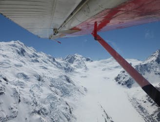
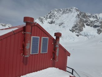
Unless you feel like a strugglefest of epic proportions the best way to access the West Coast Glaciers is via the use of a helicopter. This place is incredibly popular for tourism so finding a flight up is just an easy phone call away. Leaving from the town of Franz Joesph it will take you on a scenic flight past the Ice falls on land within a 5 minute walk to the Centennial Hut. Once there it is time to dig out the porch, get the evening forecast and wait for a weather window. Like so many tours in New Zealand white out conditions can be fatal so patience is key.
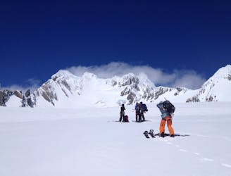
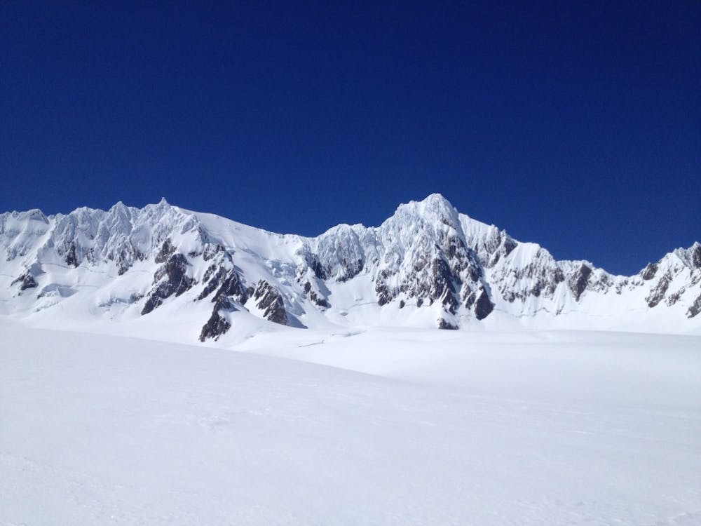
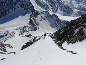
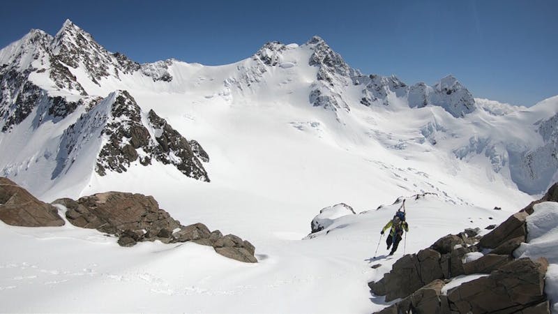
Leaving from the hut start heading west on a low angle traverse across the Davis Glacier before reaching West Hoe Pass. Once standing on top you will have a great view of the Fox Glacier where you will need to descend onto. Before dropping in you should know there is a good chance that there could be crevasses on the sloped section so proceed with caution before arriving on the flats of the Explorer Glacier. From here look Southeast towards the Crest and spot the high point in the Middle which is Glacier Peak.
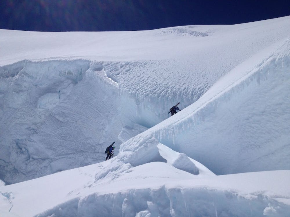
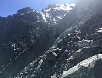
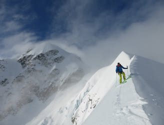
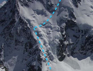
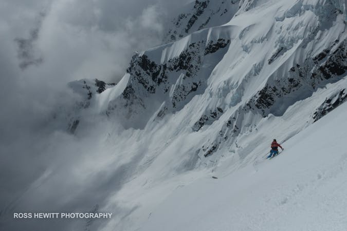
Heading up to Glacier Peak can be intimidating as there is a route up but you need to climb through a small section with crevasses on both sides. Once you’ve reached the base of the mountain it is time to rope up and put on your crampons for the 400 meter climb. Starting off make your way up the lookers left side of the slopes which is usually an easy ramp mid winter before reaching the midway point. Now you should be below a massive crevasse that crosses the entire slope but you should notice a small ramp in the middle of it, this is the way to get through. From here on out it is a straightforward climb all the way to the summit.
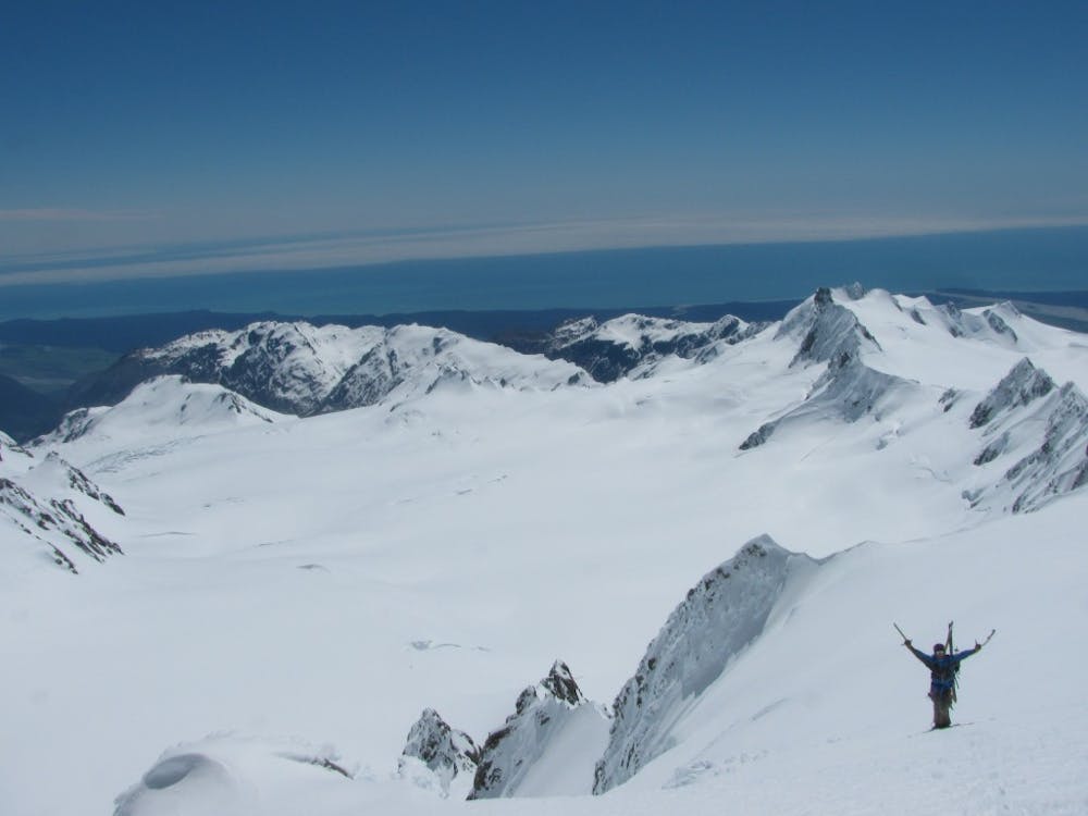
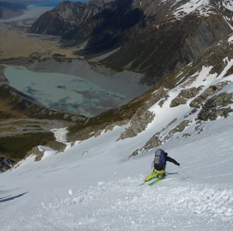
Once on top you have a great view of Mount Cook National Park to the East and the Tasman Sea to the West. The views are stunning but make sure not to go to far to the east as there is a good chance you will find yourself on a cornice and if you fall off things will end bad. Once you’ve had enough it is time to descend back down the way you came up by following your climbing tracks. Make sure to make cautious turns as for the first half you have the crevasse below you. Once past the crux then it is just wide open riding back down to the Explorer Glacier before climbing back up to the pass and heading back to the Centennial Hut.
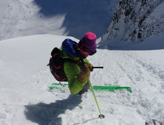
This is a great tour but definitely not recommended for anyone who is not confident with both there cramponing and skiing skills. It is a bit of a long day tour so remember that it is always better to be a bit early than to be a bit late. When we skied this we were there for corn snow so had to wait for the afternoon sun to soften the slopes before descending.
For more pictures and the full story check out this link https://www.whereiskylemiller.com/new-zealand/franz-joesph-glacier/
Difficult
Serious gradient of 30-38 degrees where a real risk of slipping exists.

As well as the slope itself, there are some obstacles (such as rock outcrops) which could aggravate injury.
Away from help but easily accessed.
11 m away
A great and semi easy access ski tour on the West Coast
Moderate Ski Touring
5.7 km away
An awesome ski face above the secluded Darwin Glacier
Severe Ski Touring
8.2 km away
Superb spring skiing on a beautiful and open face.
Difficult Ski Touring
8.3 km away
A very technical and spectacular line on a major peak
Extreme Ski Touring
8.7 km away
A great introductory ski tour on the Tasmin Glacier's friendliest peak.
Moderate Ski Touring
8.8 km away
A beautiful and wild roundtrip over to the west side and back again
Severe Ski Touring
8.8 km away
The northernmost of the Southern Alps' 3000m peaks
Severe Ski Touring
8.9 km away
One for connoisseurs of steep ice faces
Extreme Ski Touring
9.3 km away
A classic and popular mountaineering peak, this is the easiest of the big peaks to ski from the Plateau Hut.
Severe Ski Touring
9.3 km away
A collossal line and a truly world class ski face.
Extreme Ski Touring
5 routes · Ski Touring
3 routes · Ski Touring
17 routes · Ski Touring