24 m away
Silvretta Ski Tour: Wiesbadener Hut to Galtur via the Rauhkopfscharte
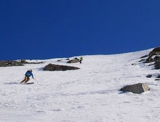
Day 5: Ascent of the Rauhkopfscharte then final descent to the North
Difficult Ski Touring
- Distance
- 17 km
- Ascent
- 604 m
- Descent
- 1.5 km
The last part of the 4 day crossing of the scenic Silvretta Alps from Guarda in Lower Engadine to Klosters in the Prättigau.
Also in Tirol, Austria • Vorarlberg, Austria
Ski Touring Moderate

Program: 'Today, our goal is the highest Swiss mountain, the Dufourspitze, 4,633 meters. Starting out early in the morning, you will climb over the Monte Rosa Glacier up to the start of the west ridge, where you will leave your skis. You will then continue from here to the summit. The run down is long, beautiful and unforgettable. (Distance: 6.5 km; Hiking time: 5 hours. Ascent: 1,750 vertical meters).The route will take you over the Ochsental Glacier to the final summit, the Egghorn at 3,147 meters, offering an amazing view over to the Silvrettahorn and Piz Buin. Followed by a long and fast descent into the Verstancla valley, to Monbiel and Klosters. (Distance: 4 km, Hiking time: 3 hours, Ascent: 850 vertical meters).' (https://www.mammutalpineschool.com/en/skitour-silvretta-durchquerung/?cache-refresh=1).
Moderate
Slopes become slightly steeper at around 25-30 degrees.

In case of a fall, death is highly likely.

Away from help but easily accessed.
24 m away
Day 5: Ascent of the Rauhkopfscharte then final descent to the North
Difficult Ski Touring
5 km away
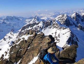
Day 3: A day tour from the Jamtal Hut
Difficult Ski Touring
5 km away
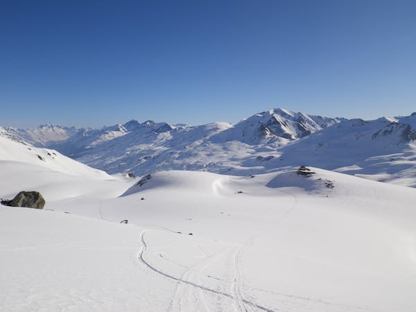
Day 4: Jamtal Hut to Wiesbadener Hut
Difficult Ski Touring
5 routes · Ski Touring

17 routes · Ski Touring