146 m away
Schwarztor
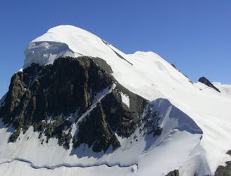
An amazing mountain journey through complex glaciers with stunning views of the Matterhorn
Difficult Freeride Skiing
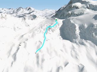
- Distance
- 14 km
- Ascent
- 275 m
- Descent
- 2.1 km
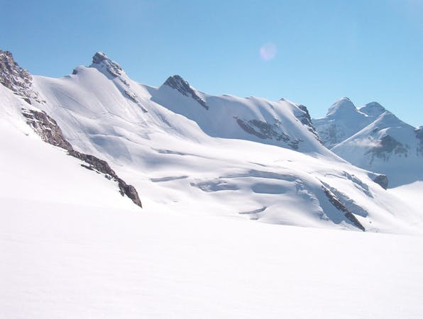
A steep and playful run leading you down to the glacier below.
Freeride Skiing Difficult

This is a popular freeride skiing route which is generally considered to be difficult. It's remote, it features medium exposure (e2) and is typically done in an unknown time of year. From a low point of 3.4 km to the maximum altitude of 3.8 km, the route covers 1.4 km, 0 vertical metres of ascent and 436 vertical metres of descent. It's graded 2.2 and Labande grade 3. You'll need rope to complete it safely.
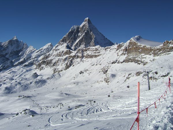
Take a hard right after you have put your skis at the top of the lift station. Steep slopes follow; keep left to avoid the cliffs. This is a fantastic descent which joins up with the Gandegg piste.
Difficult
Serious gradient of 30-38 degrees where a real risk of slipping exists.

As well as the slope itself, there are some obstacles (such as rock outcrops) which could aggravate injury.
Away from help but easily accessed.
146 m away
An amazing mountain journey through complex glaciers with stunning views of the Matterhorn
Difficult Freeride Skiing
175 m away

Steep powder under the serac
Extreme Freeride Skiing
1.6 km away

A nice line over the glacier
Difficult Freeride Skiing
1.6 km away

A classic line starting from Plateau Rosa and going towards the very center of the resort. For advanced and experienced skiers.
Severe Freeride Skiing
1.6 km away

Another great classic, it's the more challenging line of Carlo off-piste route. For expert riders.
Severe Freeride Skiing
1.7 km away

A very classic ride below Plateau Rosa for intermediate to expert riders
Difficult Freeride Skiing
1.7 km away

An easy wide off piste run that must be made with someone that knows this area, plenty of hidden crevasses here.
Difficult Freeride Skiing
1.7 km away

The very classic Teodulo freeride slope is one of the most known and haunted off-piste run.
Severe Freeride Skiing
1.8 km away

From the drop in, follow the upper left line as close as possible to the Theodul. The is the classic old line which is for experienced riders only!
Severe Freeride Skiing
1.9 km away
A classic ride between Theodulo and Bontadini runs. Sunny and wide.
Easy Freeride Skiing
20 routes · Freeride Skiing
10 routes · Freeride Skiing