119 m away
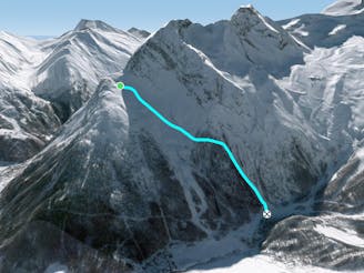
Plattjen Pillow Line

A great pillow line for those looking to hop from snowcapped rock to snowcapped rock.
Moderate Freeride Skiing
- Distance
- 1 km
- Ascent
- 0 m
- Descent
- 527 m
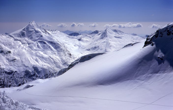
A classic tree run. Easily accessible and very open to find your own fresh lines even on the busiest of days.
Freeride Skiing Easy

From the top of the Plattjen lift you want to take the North most piste (Number 1) follow this red until it meets with a yellow itinerary run. From here continue straight downhill and ignore the piste markers for the itinerary. This freeride route will take you down through the woodland but with many open gaps for some nice long powder turns. Keep an eye out as there may be some drops but after a heavy snowfall hit these nice powder pillows! During the middle of winter the powder is sure to be found in the woods and will stick around all day with you able to ski a different line each time. Simply follow yourself down through the woods making sure that you don't ski too far right (North) all the time. Keep fairly straight or even left (south) and eventually you'll meet up with the itinerary run or even the blue path back to the lift station. With the lift being so short and fast you'll be wanting to take this tree run several times to make the most of the powder here.
Easy
Wide gentle slopes at around 20 degrees or less.

Exposure is limited to that of the slope itself. Getting hurt is still likely if the slope is steep and/or the snow is hard.

Away from help but easily accessed.
119 m away
A great pillow line for those looking to hop from snowcapped rock to snowcapped rock.
Moderate Freeride Skiing
683 m away
A steep river bed off piste line
Difficult Freeride Skiing
2.1 km away

A short but fun riverbed ski line, close to the pistes and not too challenging so open to many levels of skier and snowboarder.
Moderate Freeride Skiing
3.2 km away

A large area full of fun and wide off piste sections of plenty of powder with various gradients.
Difficult Freeride Skiing
3.3 km away

A large area full of fun and wide off-piste sections of plenty of powder with various gradients.
Difficult Freeride Skiing
6 routes · Freeride Skiing