11 m away
Approach to Dom Hut
A bruiser of a hut approach, but in a beautiful environment.
Severe Hiking
- Distance
- 5.4 km
- Ascent
- 1.5 km
- Descent
- 0 m
A lovely but long walk through the forest with panoramic views of the 4000m giants
Hiking Difficult

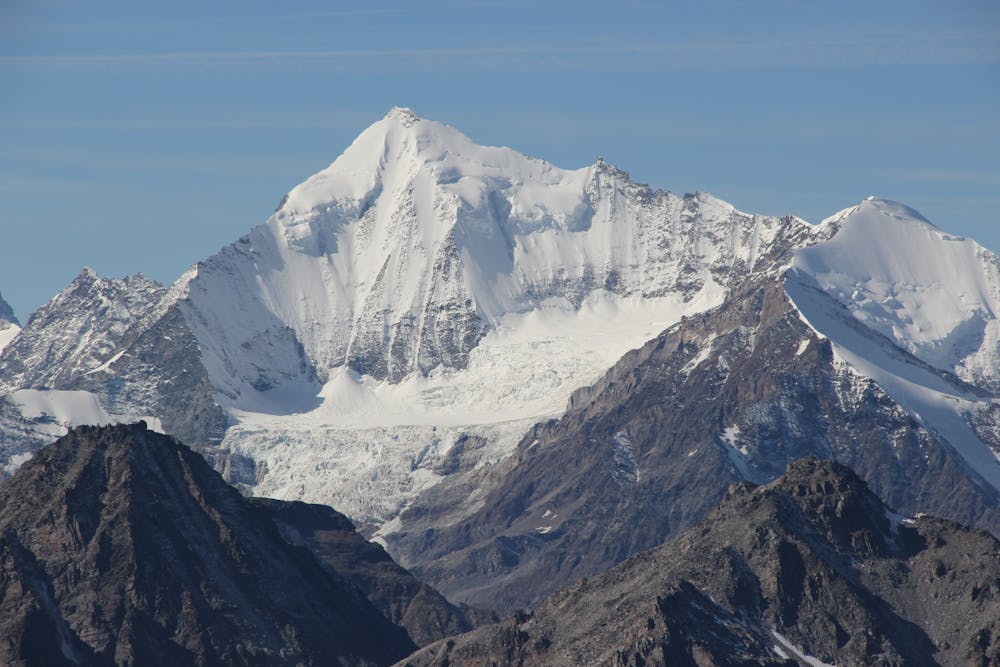
The Weisshorn is one of the truly great mountains of the Alps and dominates the area. Whilst similar in height to the Dom and Tächshhorn, on the other side of the valley, it lies in isolation with nothing as big in its’ immediate vicinity. Even the Bishorn on its flank appears little more than a pimple on the ridge, compared to this majestic giant.
To access this steep but rewarding approach, park in Randa Village, cross the river and follow the path up through the forest. Ignore paths to the right early on and take the left fork at 1970m. Towards the top of the treeline, between 2100m and 2250m will be the steepest sections on this hike. A series of steep zig-zag tracks will bring you above the trees to more moderate ground.
Beyond the treeline fabulous views of the Nadelgrat, Tächshhorn and the Dom are revealed. This is a good place for a break after the steepest and most intense section of the approach. While the rest will be less steep, you will find it to be more exposed, with very little shade on these sunny slopes.
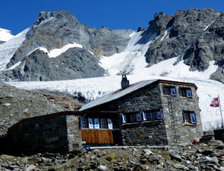
After joining with a slightly larger path at 2840m, a final few zig zags will see you reach the hut, where you will be rewarded with staggering views of the 4000 metre giants that surround this area. This is the overnight hut for the Weisshorn but also a rewarding hike in itself. At nearly 3000m the hut lies in splendid isolation with a huge vertical interval both above and below. Allow plenty of time in the afternoon to chill out and contemplate an early start for your big day tomorrow.
Difficult
Hiking trails where obstacles such as rocks or roots are prevalent. Some obstacles can require care to step over or around. At times, the trail can be worn and eroded. The grade of the trail is generally quite steep, and can often lead to strenuous hiking.

The trail contains some obstacles such as outcroppings and rock which could cause injury.
Away from help but easily accessed.
11 m away
A bruiser of a hut approach, but in a beautiful environment.
Severe Hiking
5.2 km away
A relatively short approach if you opt for the taxi, or a long cheap one
Moderate Hiking
9.2 km away
A tough climb from a classic alpine village to a classic alpine hut.
Difficult Hiking

10 routes · Alpine Climbing · Hiking

10 routes · Alpine Climbing · Hiking

9 routes · Alpine Climbing · Hiking

20 routes · Alpine Climbing · Hiking