2.7 km away
Swiss 4000ers: Fluchthorn, 3795m
A shorter day to yet another fine summit, allowing you lighter packs as you will be returning to the same hut.
Moderate Ski Touring
- Distance
- 14 km
- Ascent
- 1.2 km
- Descent
- 1.2 km
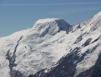
One of the easier 4000m peaks in the Alps
Ski Touring Moderate

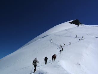
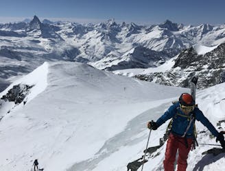
This is an ideal first day to warm up for the week. As 4000m peaks go it is relatively little effort and barely technical when in good condition. It can be a steady day out and back by the same route with amazing views of a large number of other 4000m peaks. The speedy and modern lift system at Saas Fee will take you well above 3000m to start your ski tour. Acclimatisation will play a big part in how long it will take you to get up the peak, and possibly how much you will enjoy it (!) You begin on a piste which then becomes a good skin track, taking you to the Feejoch col between your peak and the Feechopf peak. Above there you are on a broad ridge, sneaking round the back of the peak, before a gentle ridge doubles back to the summit cross. There may be quite a number of people with the same itinerary, but be vigilant as the route crosses a large number of crevasses, many of which will be invisible by mature snow bridges. Take care if venturing far from the existing tracks, especially when skiing down and carrying a bit more speed. But above all enjoy this wonderful day out with incredible views.

Moderate
Slopes become slightly steeper at around 25-30 degrees.

As well as the slope itself, there are some obstacles (such as rock outcrops) which could aggravate injury.

In the high mountains or remote conditions, all individuals must be completely autonomous in every situation.
2.7 km away
A shorter day to yet another fine summit, allowing you lighter packs as you will be returning to the same hut.
Moderate Ski Touring
3 km away
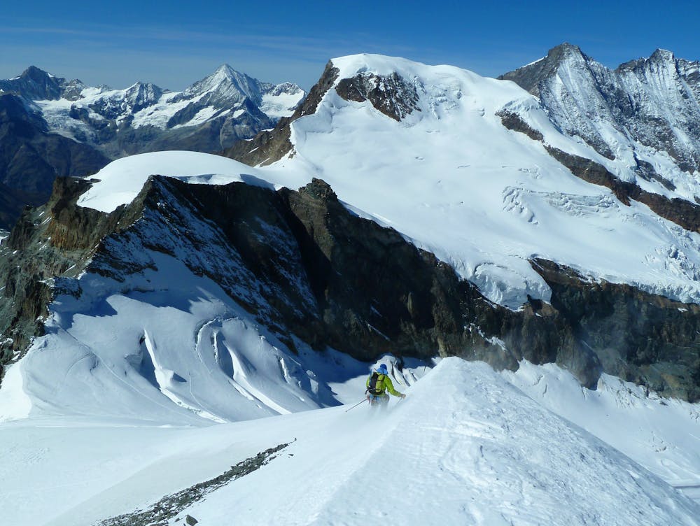
A long but relatively steady ascent up a big remote glacial peak, with great views of the giant Weisshorn nearby.
Severe Ski Touring
3.2 km away
A long journey to a watershed peak between the Saas and Zermatt valleys, with a nearly 3000m descent to finish!
Difficult Ski Touring
6.5 km away
A couple of cols and N facing descents
Difficult Ski Touring
6.8 km away
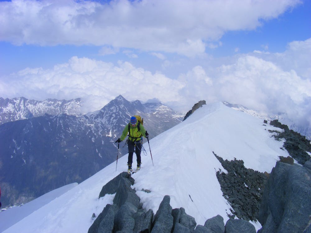
Traversing this fine and isolated mountain from a beautiful and remote, unguarded mountain hut provides an aesthetic and excellent day.
Difficult Ski Touring

50 routes · Freeride Skiing · Ski Touring

6 routes · Ski Touring
16 routes · Ski Touring