2.9 km away
Swiss 4000ers: Fluchthorn, 3795m
A shorter day to yet another fine summit, allowing you lighter packs as you will be returning to the same hut.
Moderate Ski Touring
- Distance
- 14 km
- Ascent
- 1.2 km
- Descent
- 1.2 km
A long but relatively steady ascent up a big remote glacial peak, with great views of the giant Weisshorn nearby.
Ski Touring Severe

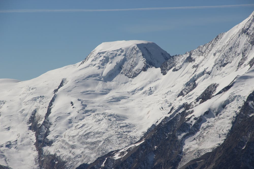
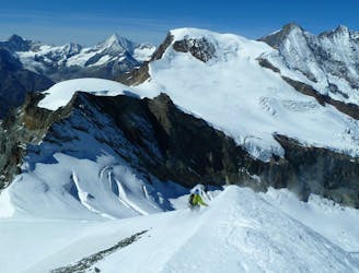
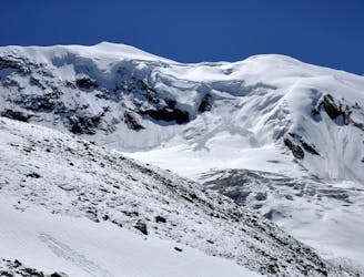
With its characteristic flat top, Alphubel, 4206m, is easily recognisable from a distance. It is slightly higher than your previous 2 summits, if you are following our Allalinhorn, Weissmies itinerary, but you should be acclimatising by now. It is a particularly fine location for a peak on the Saas/Zermatt watershed, immediately next to the bulk of the Taschhorn, with so many other enormous peaks all around too.
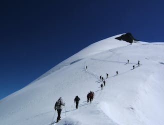
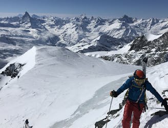
Take the lifts to Langfluh (indeed you could even stay at the Langfluh Hotel if you were feeling the need for some expensive acclimatisation). The route up takes a reasonably obvious line, up the N facing glacier, though the exact line varies from season to season, and there are a few variations. On the upper section of the route you take a wide arc out to the L to avoid the worst of the crevasses, before heading back R to the steepening below the summit plateau. Descent is the same in reverse. It is particularly crevassed in summer, so bear this in mind when you ski down, keeping a good control of your speed and keeping your eye out for any tell tale depressions n the snowpack, which might indicate a weak snow bridge.
At the end of the day, to continue to the Britannia Hut, you need to get the Felskinn lift then follow the obvious track to the hut in 45 mins, to continue the following itineraries of the Fluchthorn and the Strahlhorn.
Severe
Steep skiing at 38-45 degrees. This requires very good technique and the risk of falling has serious consequences.

As well as the slope itself, there are some obstacles (such as rock outcrops) which could aggravate injury.

In the high mountains or remote conditions, all individuals must be completely autonomous in every situation.
2.9 km away
A shorter day to yet another fine summit, allowing you lighter packs as you will be returning to the same hut.
Moderate Ski Touring
3 km away
One of the easier 4000m peaks in the Alps
Moderate Ski Touring
4 km away
A long journey to a watershed peak between the Saas and Zermatt valleys, with a nearly 3000m descent to finish!
Difficult Ski Touring
5 km away
A couple of cols and N facing descents
Difficult Ski Touring
5.1 km away
Traversing this fine and isolated mountain from a beautiful and remote, unguarded mountain hut provides an aesthetic and excellent day.
Difficult Ski Touring
9.8 km away
A complicated and isolated glacial peak with amazing views.
Severe Ski Touring

50 routes · Freeride Skiing · Ski Touring

6 routes · Ski Touring
16 routes · Ski Touring