13 m away
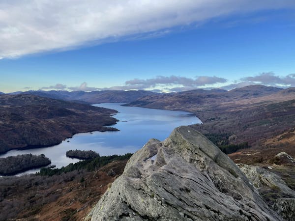
Ben Vorlich (943m) - Loch Lomond
A relentless ascent but well worth it for this Loch Lomond classic!
Difficult Hiking
- Distance
- 13 km
- Ascent
- 977 m
- Descent
- 977 m
Short and stubborn, a great hike nonetheless
Hiking Difficult

Ben Vane (Scottish Gaelic – A' Bheinn Mheadhain) is a Scottish Munro (by 3 metres) situated between Beinn Ìme (1,011m) and Ben Vorlich (943m) to stand firm as stubborn, rocky mountain that can put up a fight on the ascent. As with Ben Vane’s neighbours, it belongs to the Arrochar Alps, which are a group of mountain near the villages of Arrochar and Lochgoilhead on the Cowal Peninsula in Argyll and Bute.
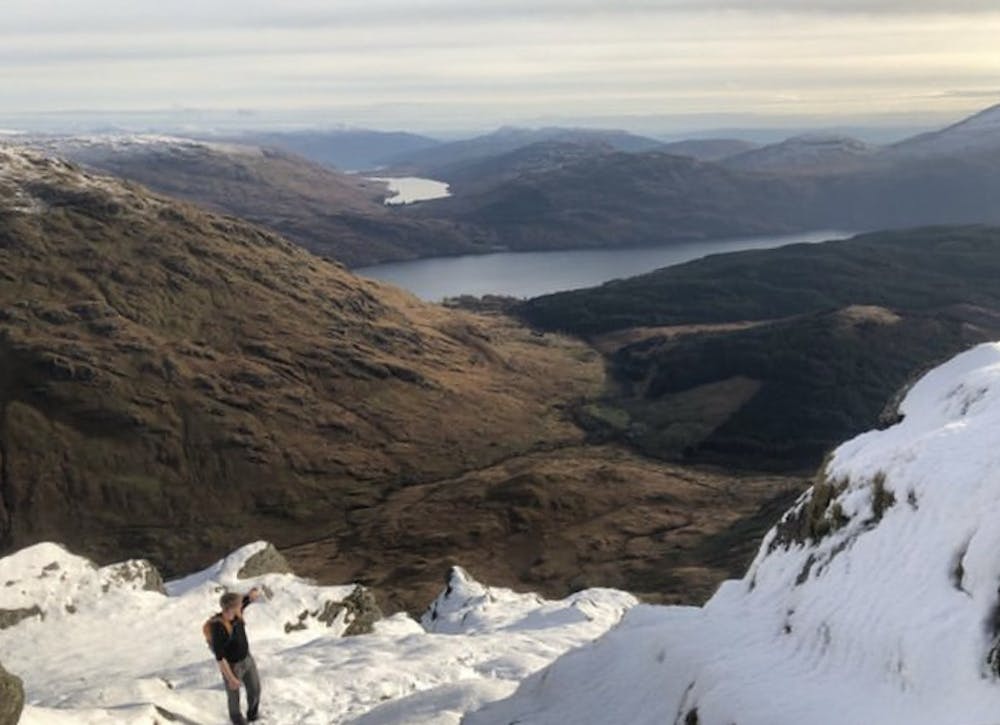
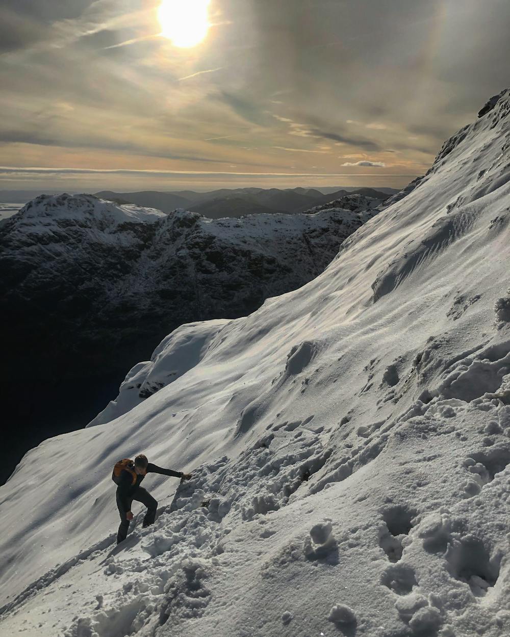
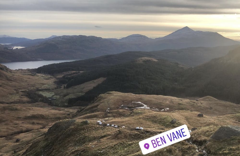
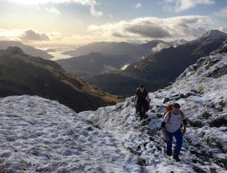
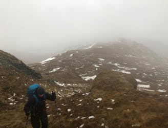
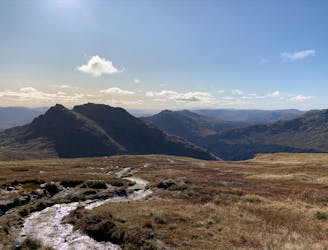
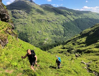
As of the publishing of this guide, the authorities have put up many signs regarding parking issues at the start point of this hike, be aware. If concerned, park at Inveruglas visitor centre just a little further north down the A82. The walk starts off following the road that runs parallel to Inveruglas water. Pass some rural farms before the hike starts bending to the right. Follow the GPX file to where it turns a sharp left and over a bridge. As you cross the bridge look slightly to the right of you and up. This is Ben Vane. A couple hundred metres passed the bridge the path splits in two with the left taking you up the Glen and the right taking you up Ben Vane. Be prepared for a sustained climb and numerous false summits. It’s taxing on both mind and body but see it as good training for tackling the bigger mountains in the area. At the top you’ll be provided with great views of Ben Ìme and Ben Vorlich across the valley. Make sure to pick up a nearby rock of whatever size and place it on the cairn. This pleases the mountain Gods.
After a selfie and sandwich, you have two options. You can retrace your steps back down the route you took up (as the GPX file shows), or you can drop off the eastern side of Ben Vane to ascend Ben Ìme from its western flank. Bear in mind this will add some considerable time onto the hike and be conscious of daylight hours.
This hike and guide were completed during spring weather conditions. This is just one opinion of this route. Make sure to do your own research by consulting local internet resources, mountain guides or guidebooks to evaluate other opinions so you can be best prepared for the terrain.
A Guide by Red
Difficult
Hiking trails where obstacles such as rocks or roots are prevalent. Some obstacles can require care to step over or around. At times, the trail can be worn and eroded. The grade of the trail is generally quite steep, and can often lead to strenuous hiking.

The trail contains some obstacles such as outcroppings and rock which could cause injury.

Little chance of being seen or helped in case of an accident.
13 m away
A relentless ascent but well worth it for this Loch Lomond classic!
Difficult Hiking
3.1 km away
A wild, rugged, and isolated landscape. Be prepared for a grind.
Difficult Hiking
4.9 km away
A big day, a big car park fee and a big load of tourists, but beat that and you'll have fantastic hike on three local area classics!
Difficult Hiking
5 km away
A justly popular up one of Scotland's most recognisable mountains
Difficult Hiking
7.4 km away
Simple and effective, without sacrificing the view!
Difficult Hiking
12 routes · Hiking