2.7 km away
Bowscale Fell via Bowscale Tarn
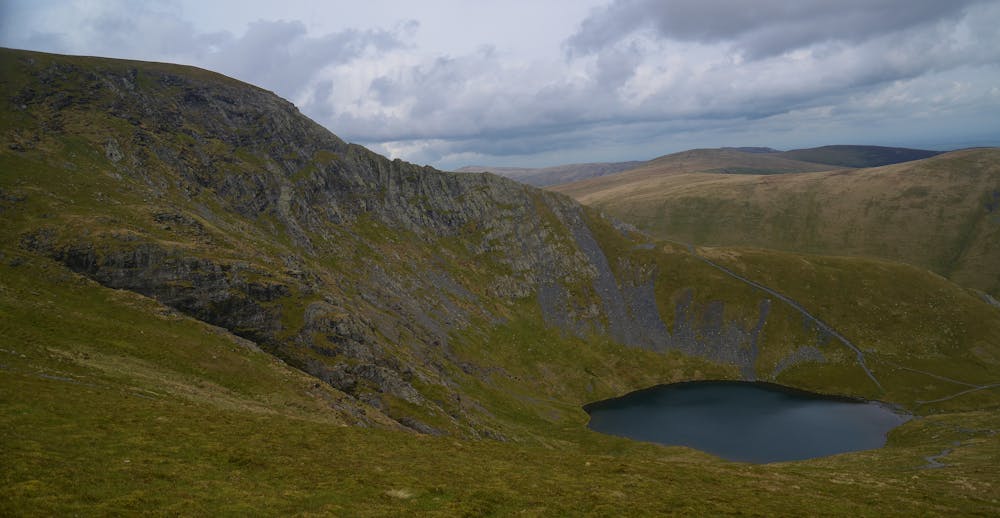
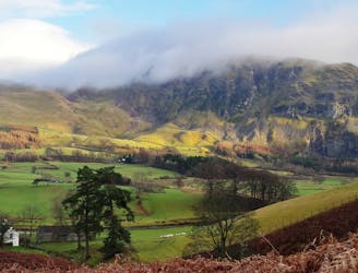
This northernmost summit of the Blencathra range has a hidden scenic corner, the high glacial bowl of Bowscale Tarn.
Moderate Hiking
- Distance
- 4.7 km
- Ascent
- 289 m
- Descent
- 461 m
A less-trodden ascent to Blencathra.
Hiking Severe

Blencathra's classic Sharp Edge is most often done in a short circuit from the A66. To add distance and novelty to your day, not to mention a whole extra bonus ridge, why not come instead from Mungrisdale in the uncrowded east? Start via the scrambly east ridge of Bannerdale Crags - it's no nail-biter, but serves as a great intro to the day's scrambling, and it's relatively untrodden too. A quick moorland stride then brings you to Sharp Edge from an unusual angle. And after Blencathra, the little peak of Souther Fell is a scenic place to end.
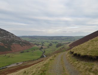
Follow the track up bucolic Bannerdale, along the north bank of the River Glenderamackin. Cross a footbridge and then when a path splits left from the track, take this trail to stay close to the riverbank. Continue up-valley between the steep flanks of Souther Fell and The Tongue. Cross a side stream and look out for a less-trodden path on the right.
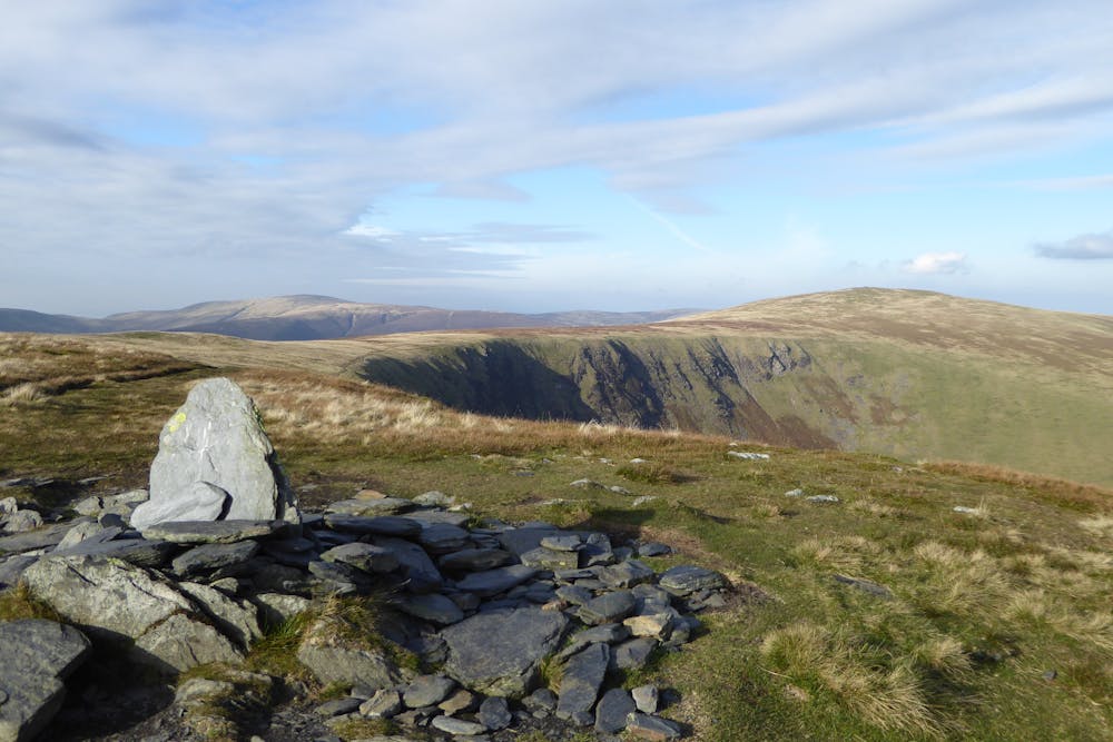
This leads uphill, quite a slog for a bit, onto the more level grassy crest at the bottom of Bannerdale Crags' east ridge. The upper ridge rises steeply ahead. Sticking directly with the crest gives some nice-but-scrappy scrambling on heather and little rock steps; a path just to the left avoids it all, winding up a scree of little slate chips (this bit of the hill was once quarried). The grassy summit plateau is soon reached, with a great view east to Eden, and west to Blencathra.
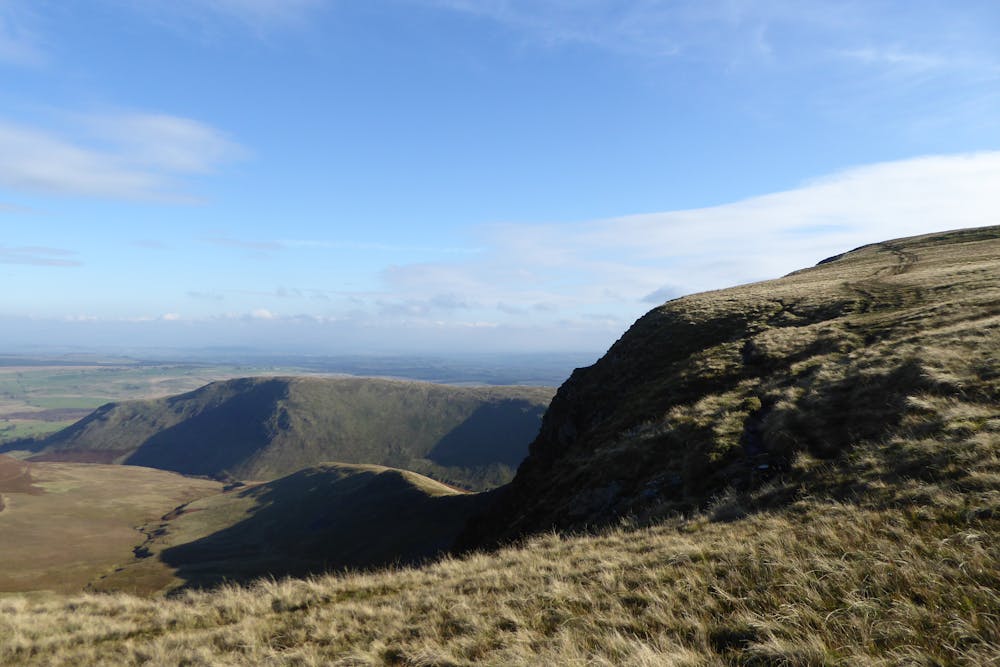
Follow an obvious path on a gentle descent west to the col at the top of the Glenderamackin valley. Begin the steep ascent of Blencathra's northern spur, and look out after a few minutes for a path that cuts off left down into the cove under Foule Crag. The start of this trail is not 100% obvious (small cairn) but it soon gets easier to trace as it crosses the floor of the cove heading directly towards the craggy flank of Sharp Edge. On approaching this, work up left to outflank the worst scree and outcrops, climbing the toe of the ridge (pathless briefly) to join the popular trail on the ridge crest.
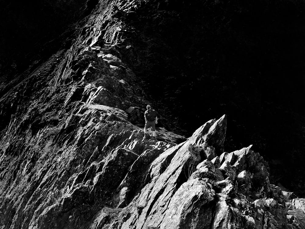
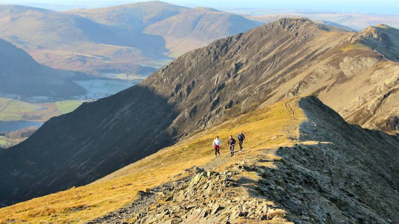
Much of Sharp Edge can be bypassed via flanking paths on the right (north) side - this is a waste of a good scramble. Staying on the crest, the scrambling starts straight away with an optional slabby groove. Easy angled rocks then lead to a more or less level crest, airy but not difficult. The ridge soon narrows into a slate knife-edge leading up to a little pinnacle. This can be dodged via a sloping shelf on the right (polished, nasty in wet or ice) or climbed direct with a tricky step down at the far side (very exposed). That's the crux over with. From the gap beyond the pinnacle scramble over easier rocks to a second little notch, where the ridge joins the bulk of Blencathra. There's a choice here: a slabby wall or an obvious groove just to its right. Both are nice. The ground now gets steadily easier and soon you're up on the plateau above. Turn left along the corrie rim for the short stroll onto Blencathra's summit.
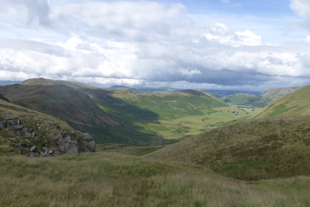
Descend the east ridge on a very well-used path, unfortunately over-manicured in the style of an urban park (there's a regrettable fashion for this in the Lakes). At least there are great views over the mountain's steep southern slopes and across to the crest of Halls Fell Ridge. Where the main path heads valley-wards stay left to reach the wide col and trail junction above Mousthwaite Comb.
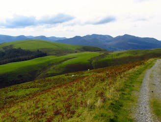
Go northeast for a steady climb up the grassy flank of Souther Fell. Follow the broad ridge crest, with lovely edge-of-the-Lakes views out over the Eden valley, and back to Bannerdale Crags and Sharp Edge. Beyond the northern top the ridge steadily descends, and there's a nice grassy path. Just above the village a sign forbids access to a key field, and the anti-social farmer sends you instead on a long indirect leg rightwards along field margins. Meet a minor road and head back left into the village, passing the pub to return to the car park.
© Dan Bailey - UKHillwalking.com, May 2014
Severe
Hiking challenging trails where simple scrambling, with the occasional use of the hands, is a distinct possibility. The trails are often filled with all manner of obstacles both small and large, and the hills are very steep. Obstacles and challenges are often unexpected and can be unpredictable.
2.7 km away
This northernmost summit of the Blencathra range has a hidden scenic corner, the high glacial bowl of Bowscale Tarn.
Moderate Hiking
4.2 km away
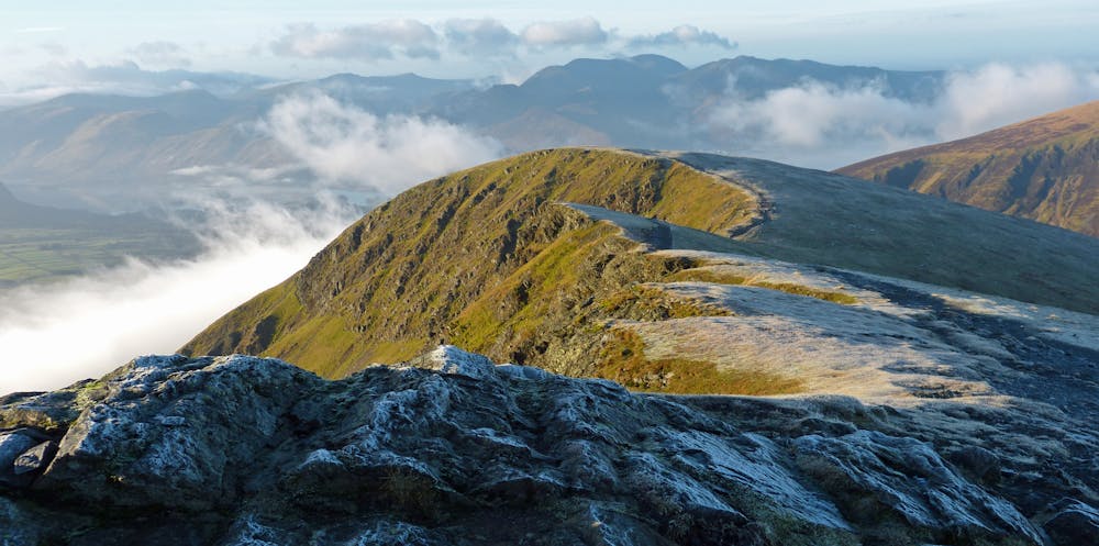
Blencathra is not only one of the oldest mountains in Lakeland, it’s one of the finest too.
Extreme Hiking
6.2 km away
A broad ridge provides easy peak bagging but with a sting of a series of big ascents and descents towards the end.
Difficult Hiking
9.2 km away
For a completely different day out head round to the hill's wilder northeastern side, where the wide open spaces of the Skiddaw Forest have plenty to offer lovers of remote country.
Moderate Hiking

9 routes · Hiking
6 routes · Hiking

5 routes · Hiking