1.3 km away
Ben Nevis Mountain Track
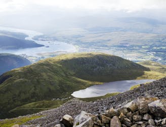
The classic route up the UK's highest mountain
Difficult Hiking
- Distance
- 16 km
- Ascent
- 1.3 km
- Descent
- 1.3 km
24 munros, 24 hours, over two marathons with an elevation gain of 28500 feet/8686.8 metres
Hiking Extreme

At only 200m off an "Everesting" in ascent and at two and a bit marathons on rugged and remote terrain this one requires extensive training, planning and experience. Preferably done on a good weather day in late May or June to avoid snow underfoot and have daylight on your side.
Starting and finishing from the Glen Nevis Youth Hostel and returning within 24 hours.
Support/drop bags best given at East side Loch Eilde Mor (on foot or bike from Mamore Hotel, Kinlochleven), the tip of Loch Treig at Fersit Dam and the Bealach between Aonach Mor and Carn Mor Dearg.
A Tranter's round cuts the distance to under 40 miles by shortening the route and traversing from Stob Ban to Sgurr Eilde Mor or vice versa depending whether you go clockwise or CCW.
Extreme
Scrambling up mountains and along technical trails with moderate fall exposure. Handholds are necessary to navigate the trail in its entirety, although they are not necessary at all times. Some obstacles can be very large and difficult to navigate, and the grades can often be near-vertical. The challenge of the trail and the steepness of the grade results in very strenuous hiking. Hikes of this difficulty blur the lines between "hiking" and "climbing".

Some trail sections are extremely exposed where falling will almost certainly result in serious injury or death.
In the high mountains or remote conditions, all individuals must be completely autonomous in every situation.
1.3 km away
The classic route up the UK's highest mountain
Difficult Hiking
2 km away
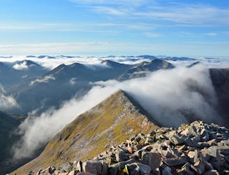
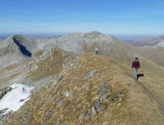
A contender for the title of grandest ridge walk in the country, the Carn Mor Dearg (CMD) Arete straddles that fine line between rambling and scrambling.
Extreme Hiking
3.9 km away
A shorter, easier alternative to the neighbouring Ring of Steall - but no less worthwhile.
Extreme Hiking
4.8 km away
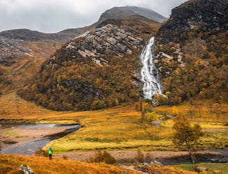
A short trip to one of the Glen Nevis natural wonders
Moderate Hiking
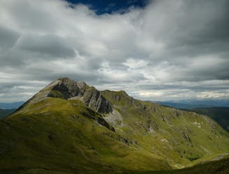
6.6 km away
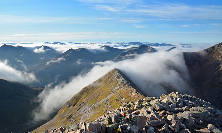
A long and challenging classic ridge walk with a feeling of remoteness.
Extreme Hiking
7.2 km away
A fine trail or hiking loop taking in some of the highest peaks the UK has to offer
Difficult Hiking
8 routes · Hiking

18 routes · Alpine Climbing · Hiking